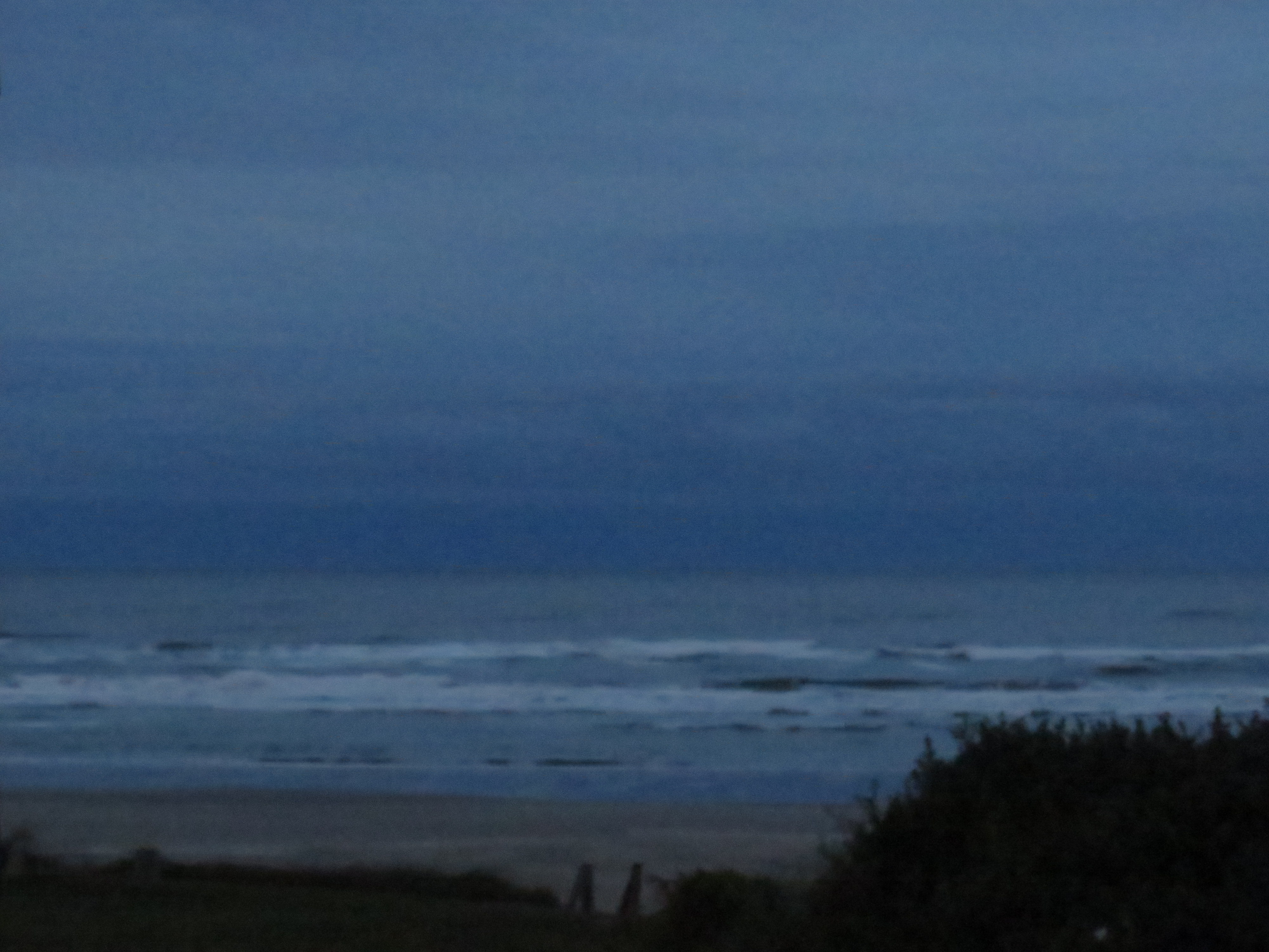
We awoke in Yachats to a gray, gray day. Amazingly, it was our first overcast day in the trip so far.
Undeterred, we had breakfast: fish tacos. Hey, why not? We then set out to roam the town.
Yachats, with only just over 700 people, has a sweet little community garden.
First up was hitting the beach.
Then we roamed the trails around town. Yachats trails are interesting in that there are a number of them that wander through town. They are (fairly) well marked and go up and down the hills as well as through the town’s streets.
On one of the Yachats trails.
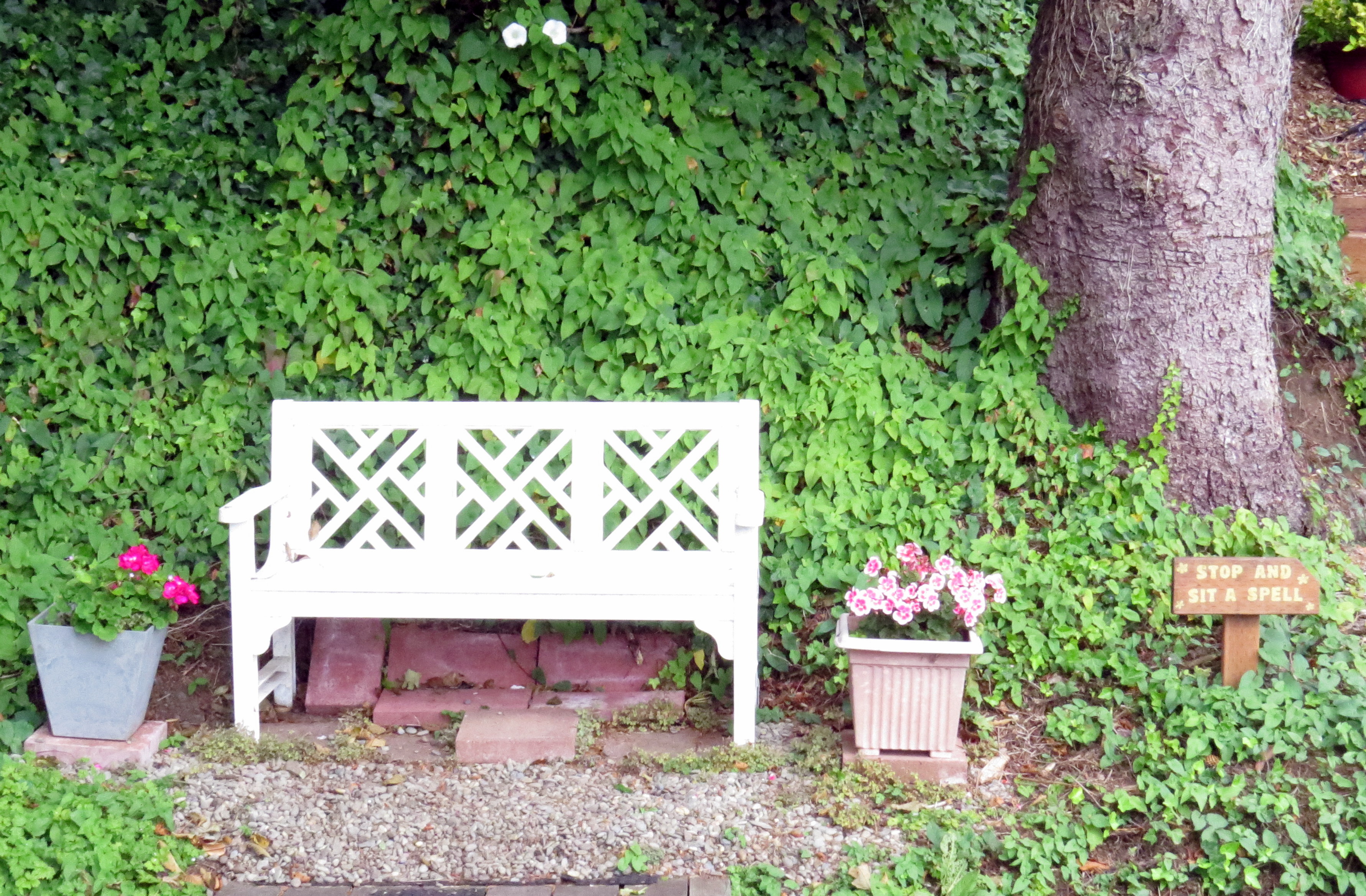
We did the hills first. Up, and up, and up some more! These trails started on the streets and then cut up the hillside between houses. Some of one trail we followed was simply a trail while other parts had been laid out as steps. Some people along the trail took great care to make the area welcoming and beautiful.
Yachats hiking trail – a welcoming place to sit awhile. Another welcoming place to sit.
We then went down, down, down into the town. Have you noticed that everything along the coast is up and down? Even our second floor room!
In town we popped into the local library and also found a small wetlands area.
Yachats wetlands.
By this time the gray day had turned into a light drizzle, but we kept on.
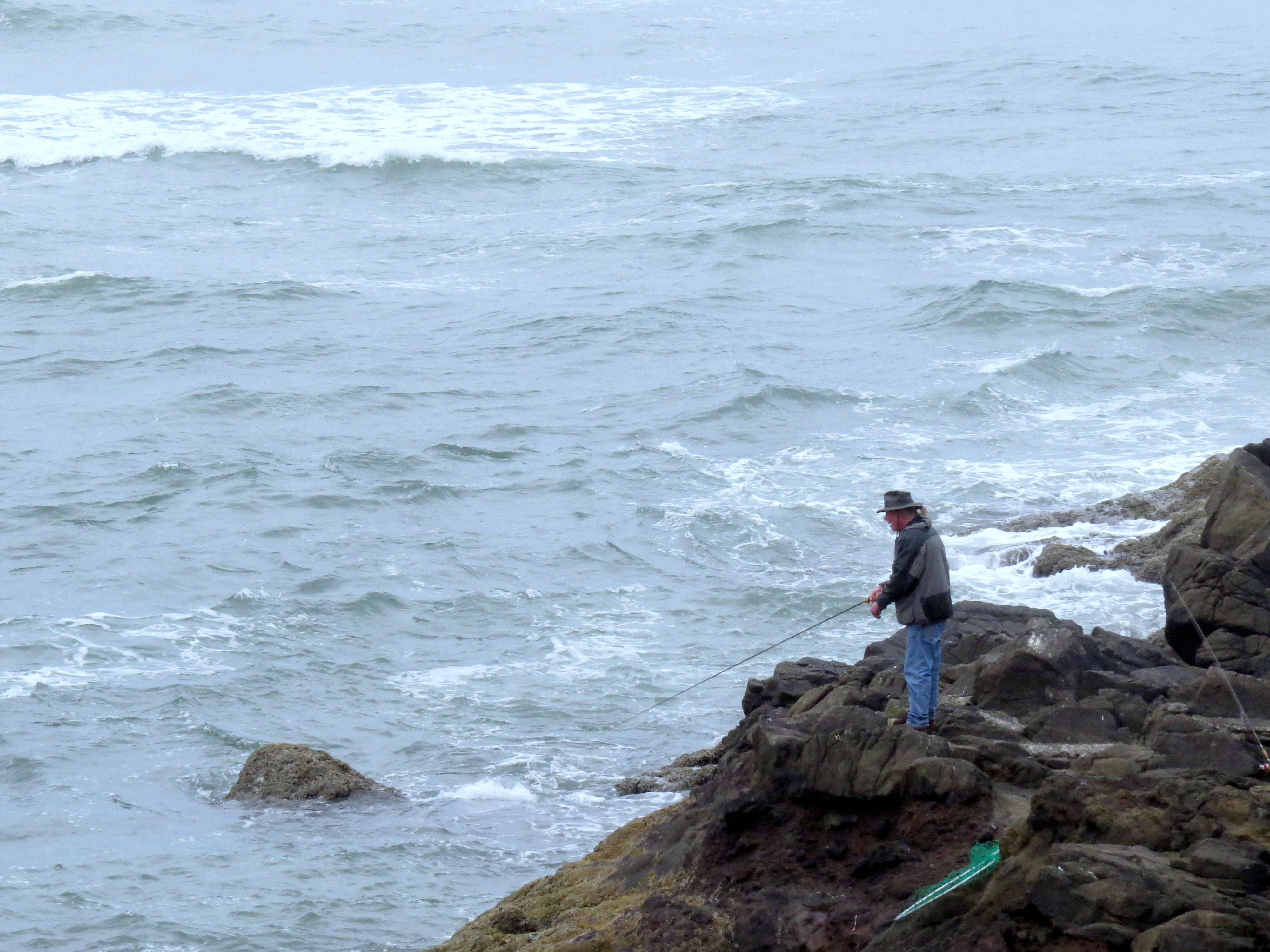
We visited the Devil’s Churn and a covered bridge.
The Devil’s Churn in Yachats.*Another octapus tree?Notice the water in the blowhole on the left!
Eventually, we wore out and got chilly and a bit too damp, so we headed back to our sweet room and watched late afternoon turn to evening and sunset.
The next morning, south again!
Yachats dawn, last day.Yachats hotel yard from our balcony.
We left Sekiu and began the more leisurely part of our trip. The four-hour drive to Astoria, Oregon, took us around nine hours due to several stops and wanders.
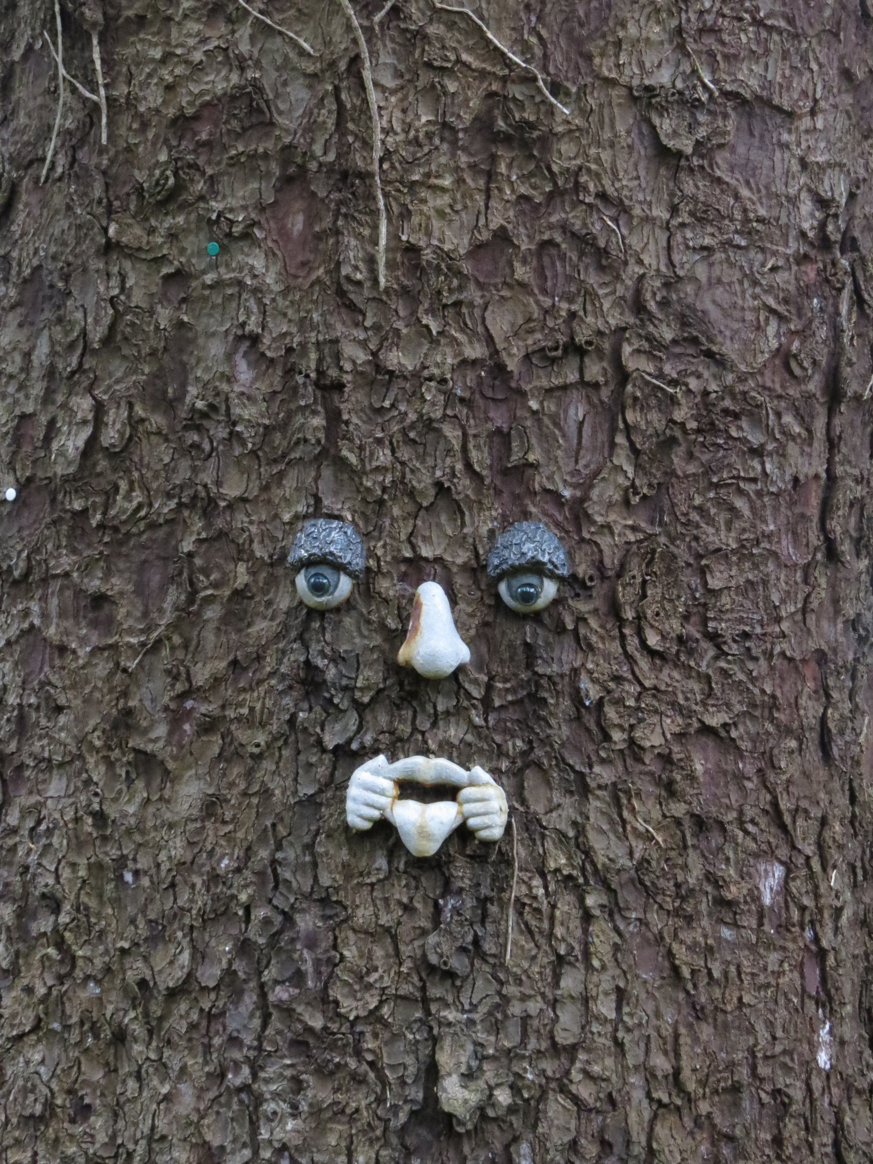
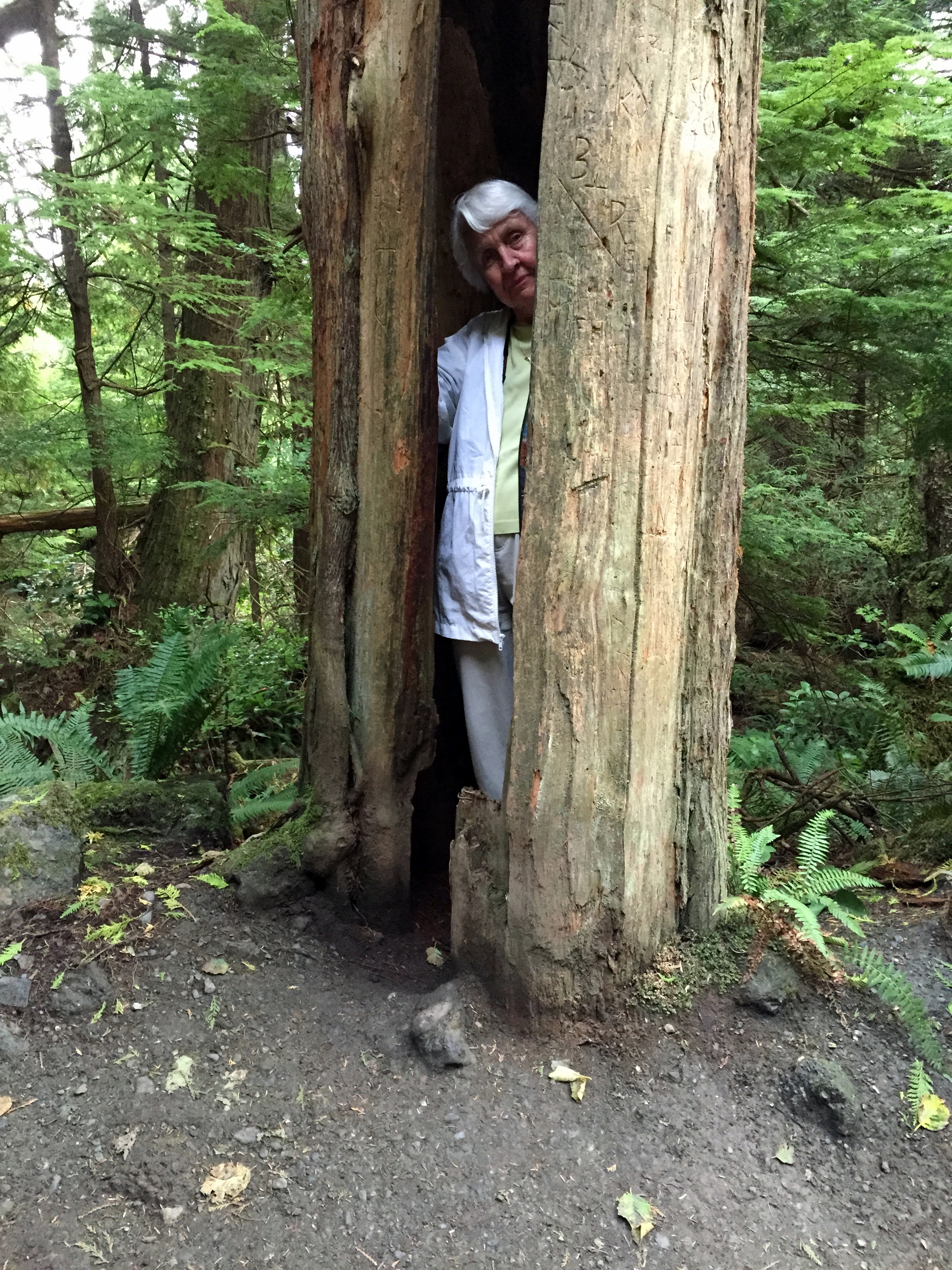
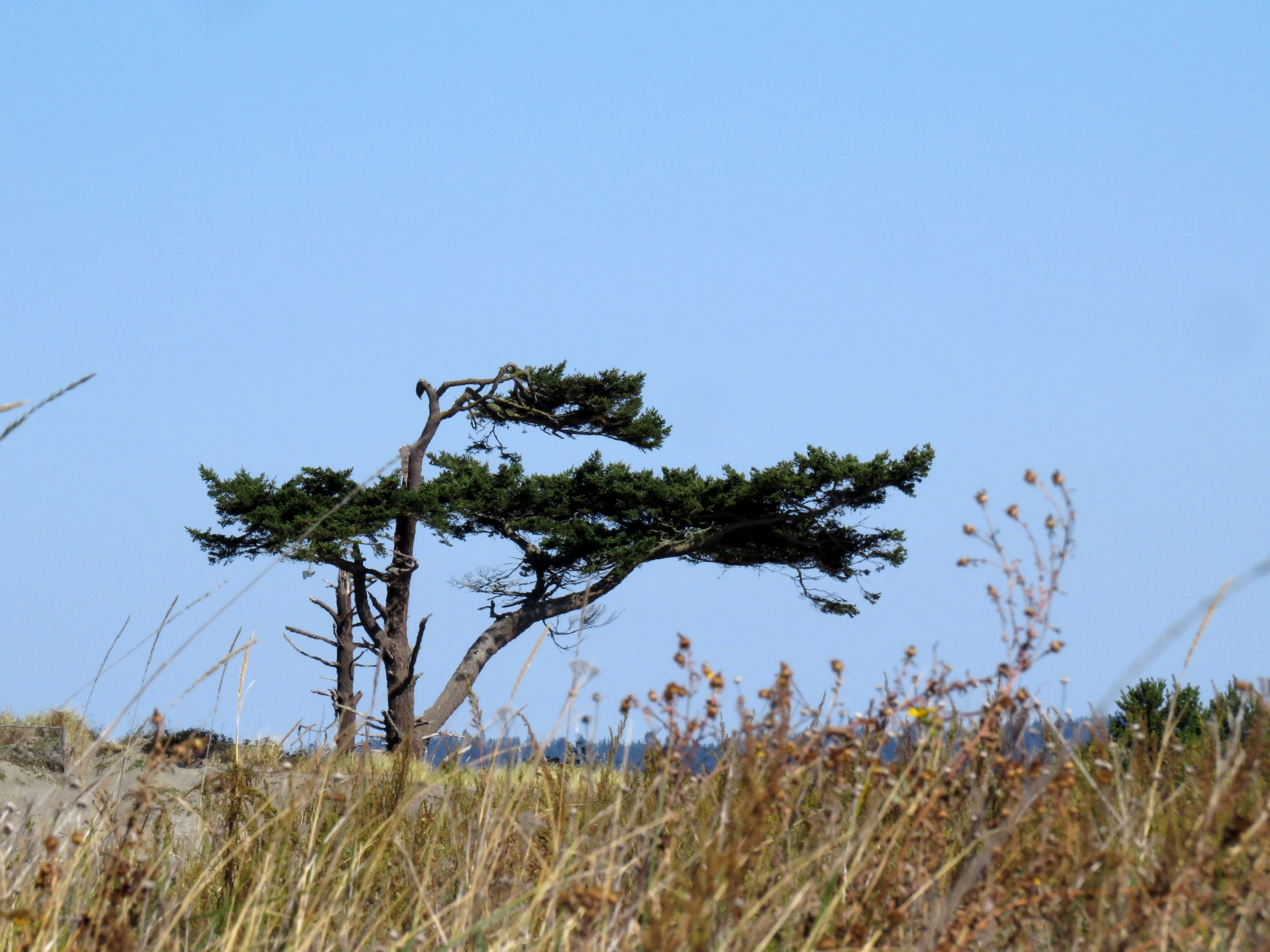
But wait. Could it be? Could this be the very monkey tree that attacked our friend Lori?
Look familiar, Lori?
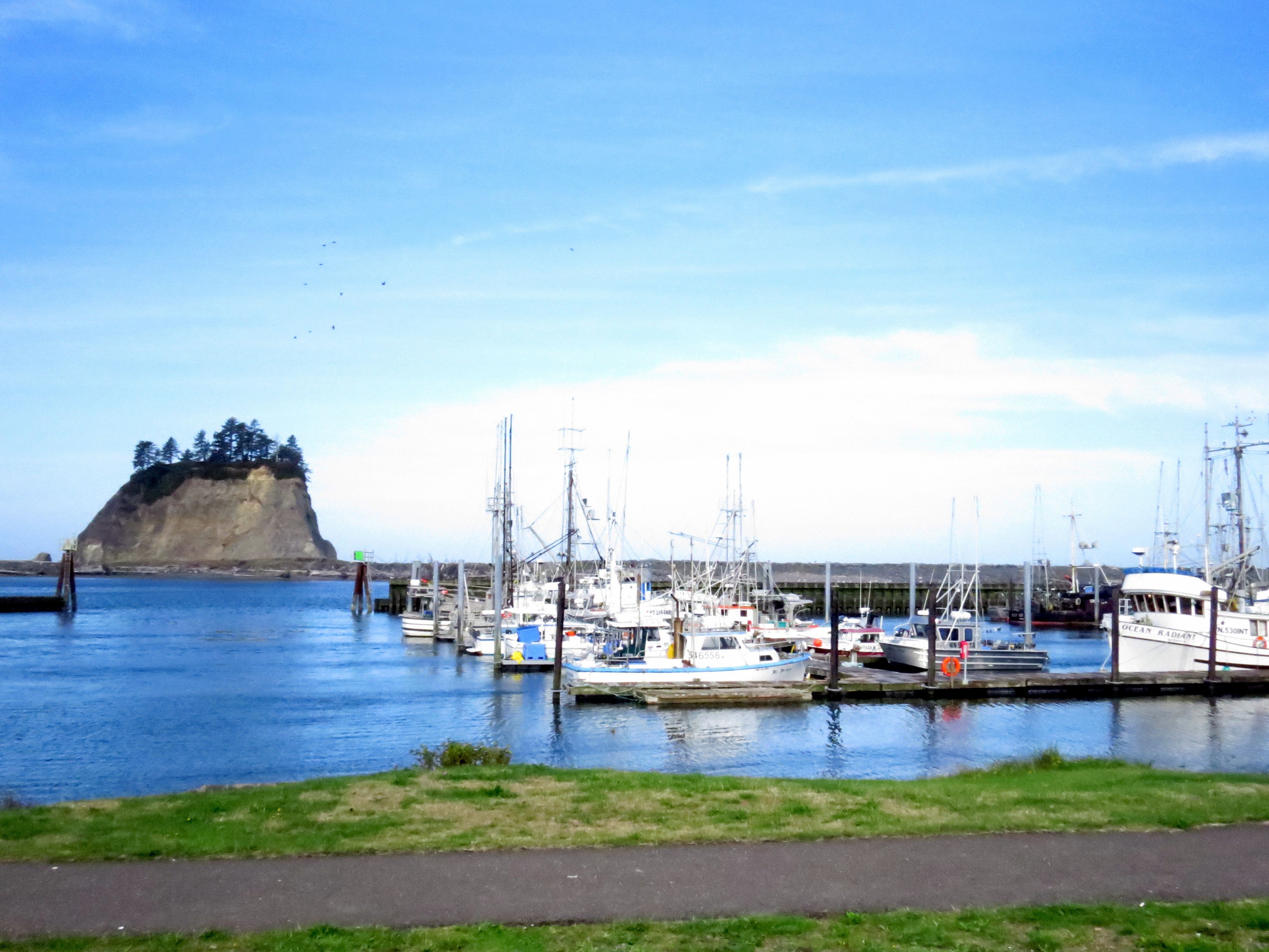
La Push, on the Quileute Nation, was our first stop.
The harbor at La Push. First Beach, La Push, where I saw my first big stacks (big rocks in the sea).
We saw a most beautiful sign there:
“Generation upon Generation the Salmon have returned to our waters offering themselves
That the Quileute people might live.
There was a time once not long ago salmon were many. Now they are few.
Generation upon Generation
The Salmon have helped the Quileute People.
Now the Quileute People must help The Salmon.”
A salmon even decorates the bus stop in La Push.
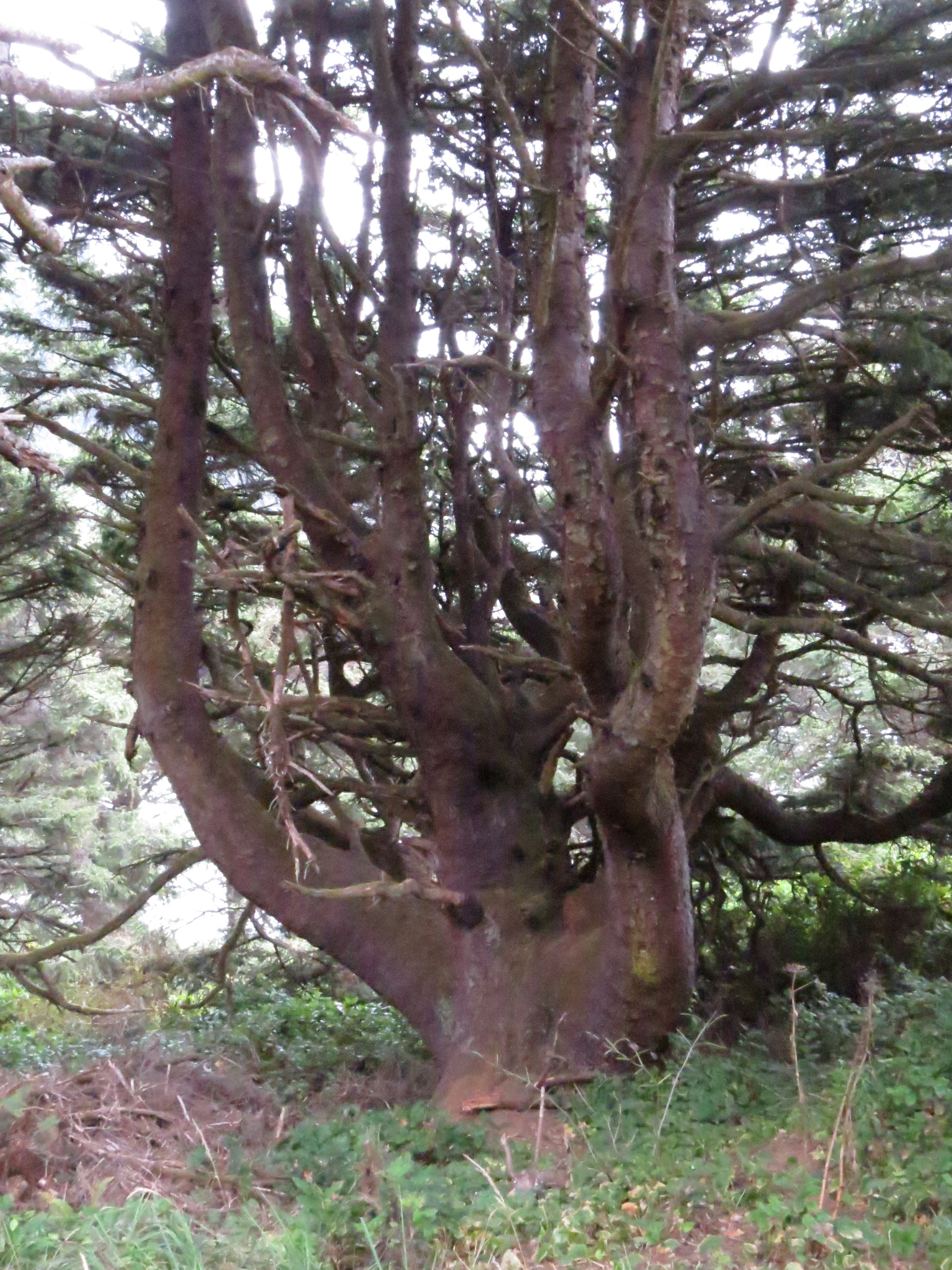
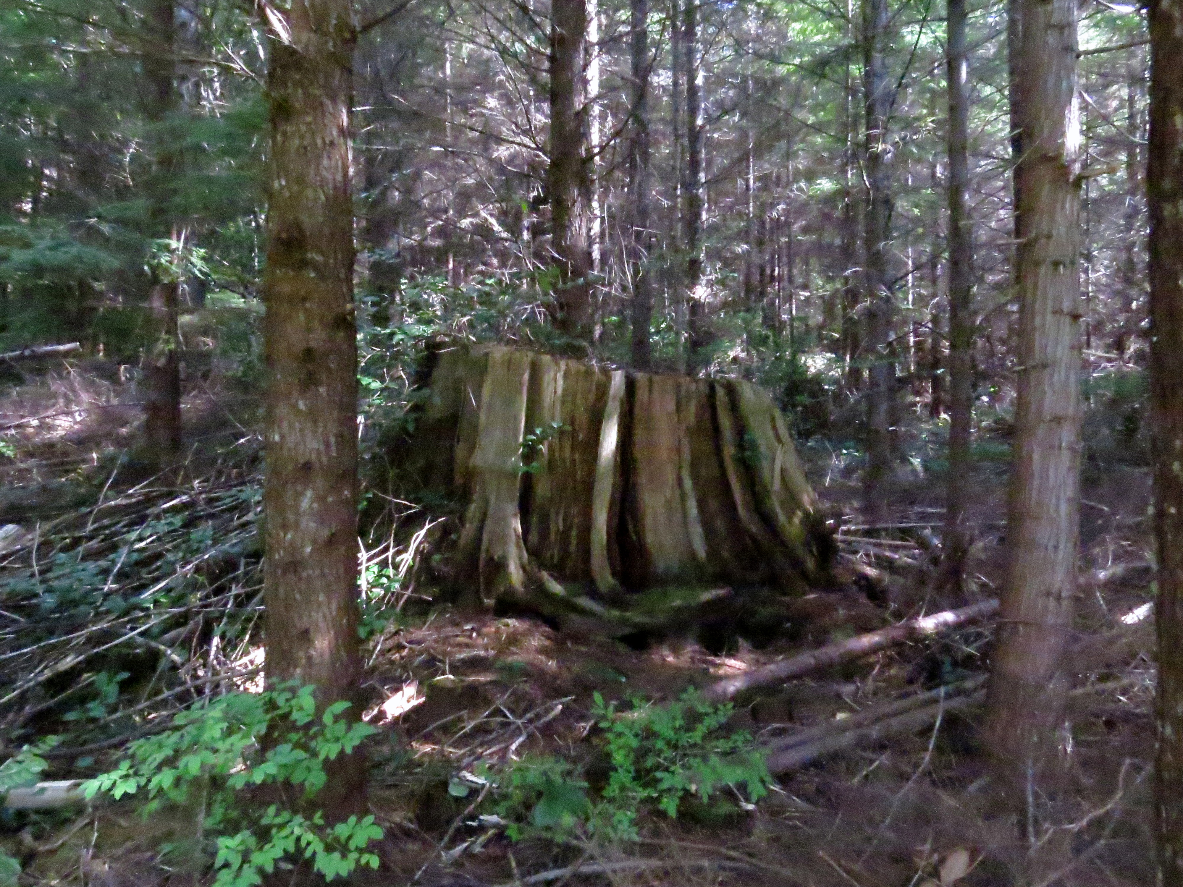
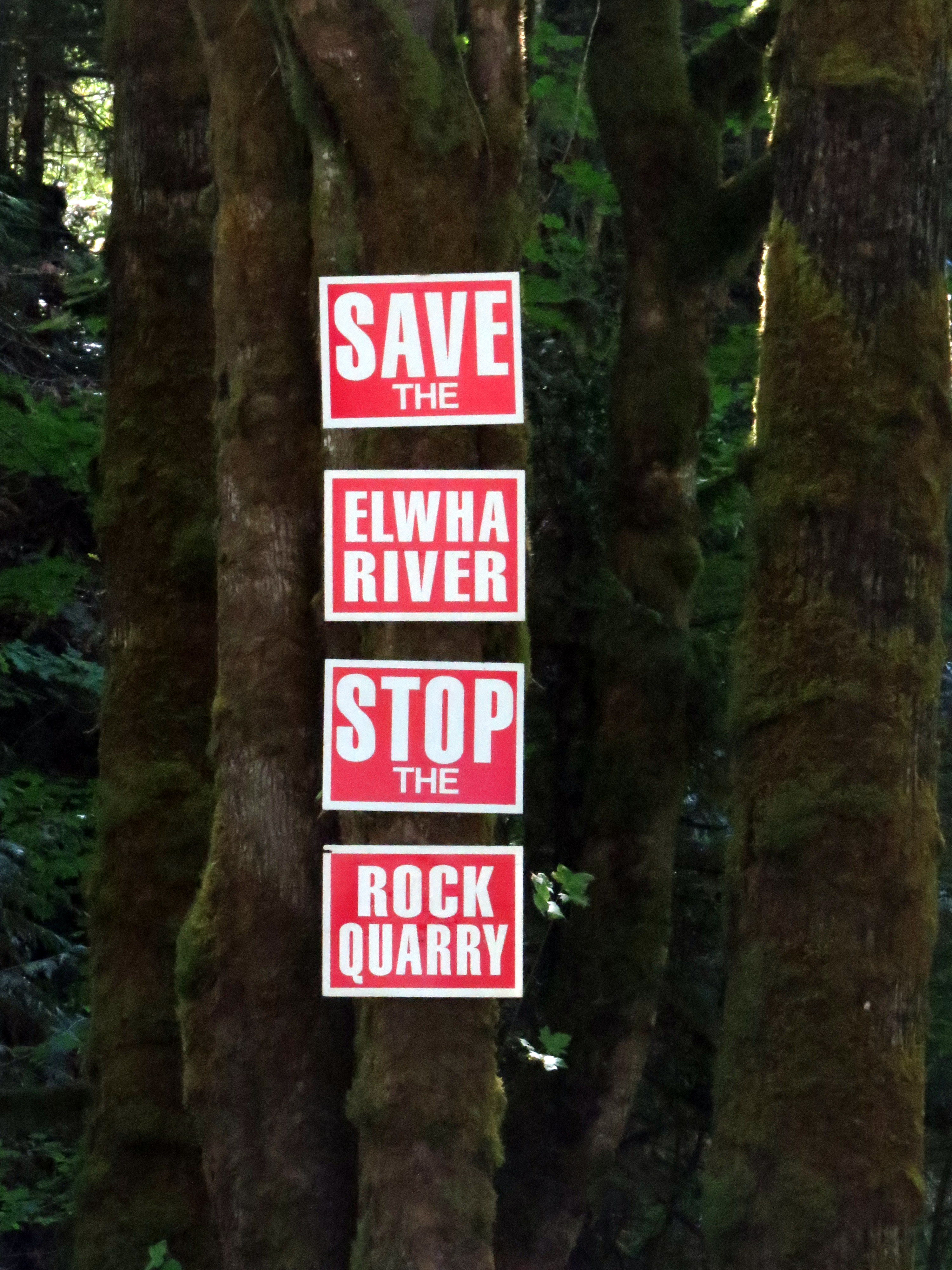
As we headed south again, Cinda noticed a sign that simply said “Big Cedar Tree” and of course we had to turn. Four miles later, we met the Grand Dame of the forest, an ancient cedar.
She is a Western Red Cedar and is 178 feet tall and nearly twenty feet in diameter.
Though she is a wonder, the visit left me a bit down. How is it all the rest of these ancient beauties were cut down? She is surrounded by forty-year-old trees that are not even a foot in diameter. How old could the Grand Dame be?
The remains of an ancient cedar.
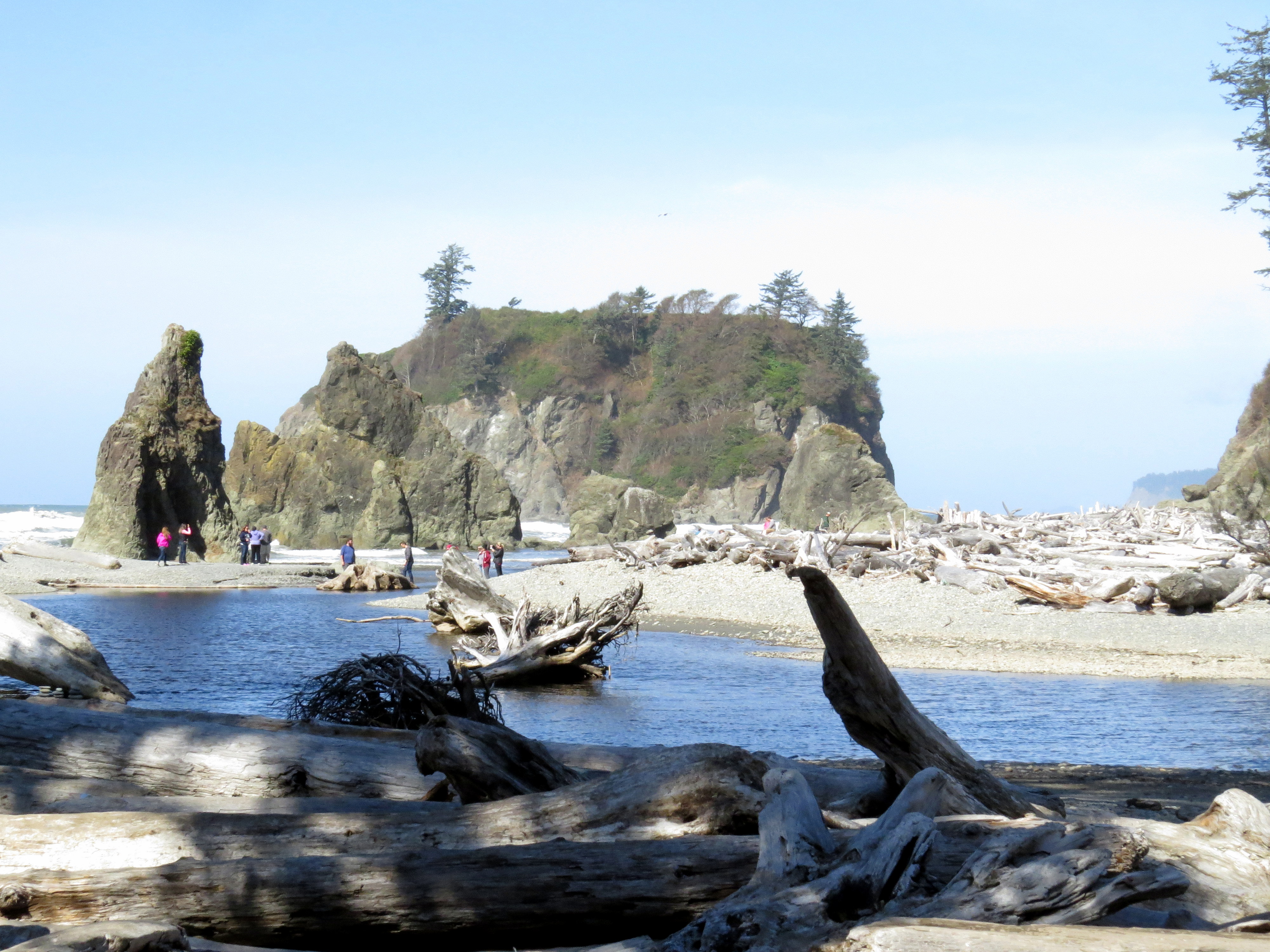
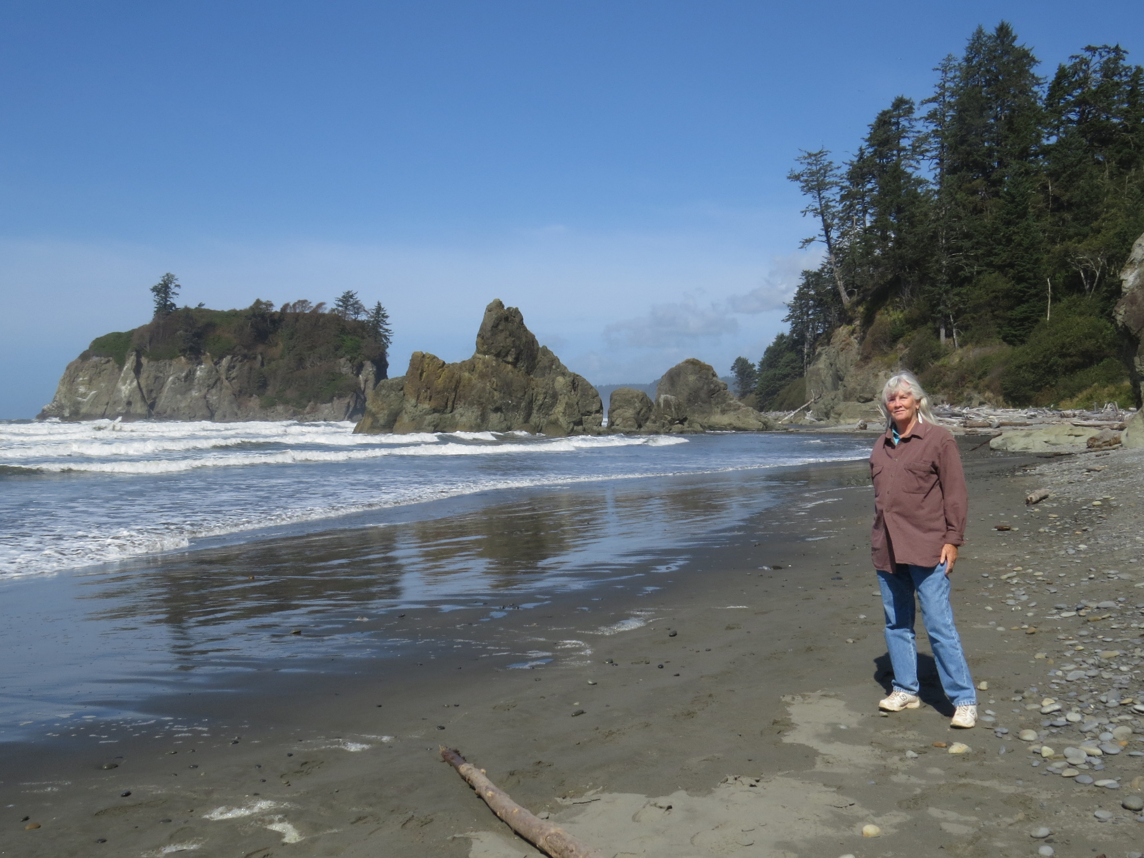
Then on to Ruby Beach. Another beautiful spot!
But there is a little bad news.
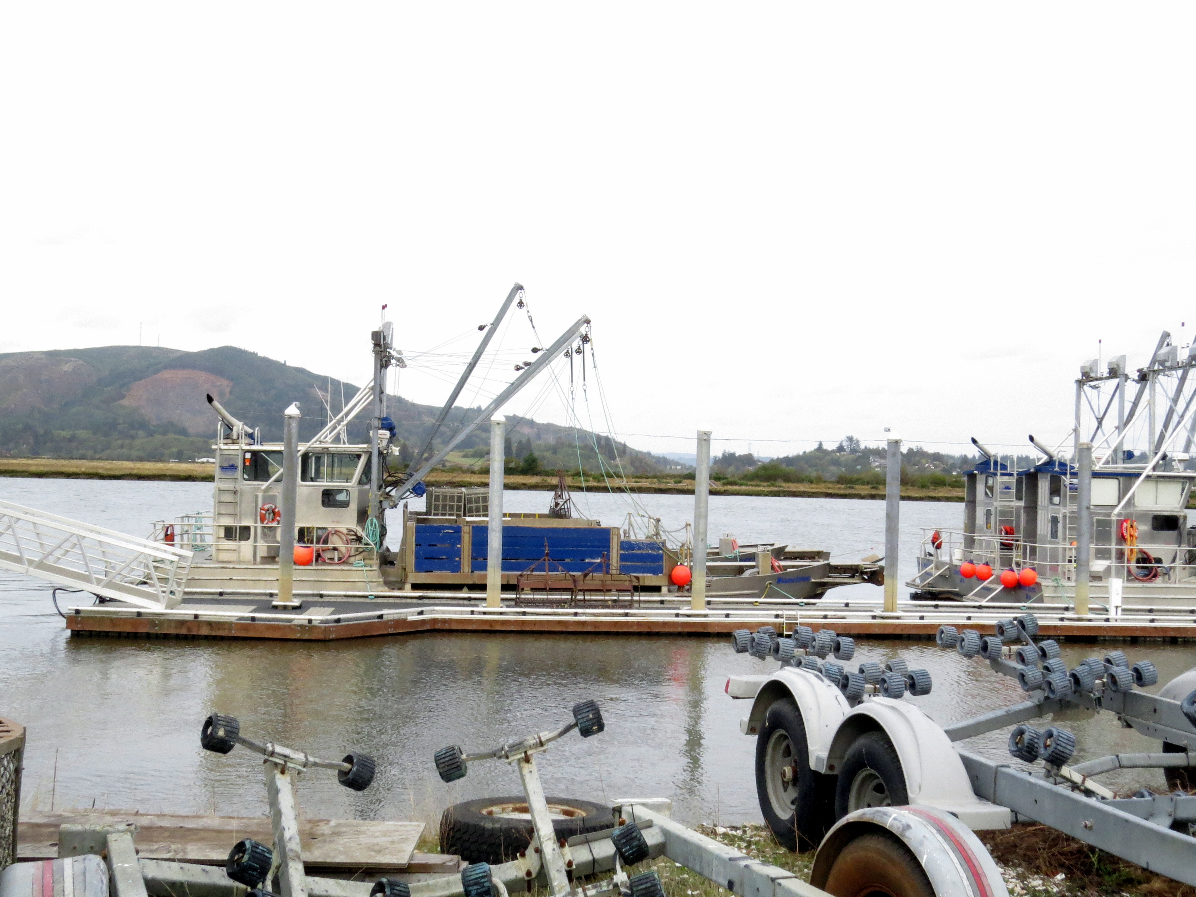
We stopped in South Bend, Washington, which proclaims itself the oyster capital of the world. Big claim, but we did see a number of boats and cages used for oystering, and there were a few processing plants.
Finally, Astoria, where we checked into our motel then dashed out to do laundry. Ooh! Clean clothes!
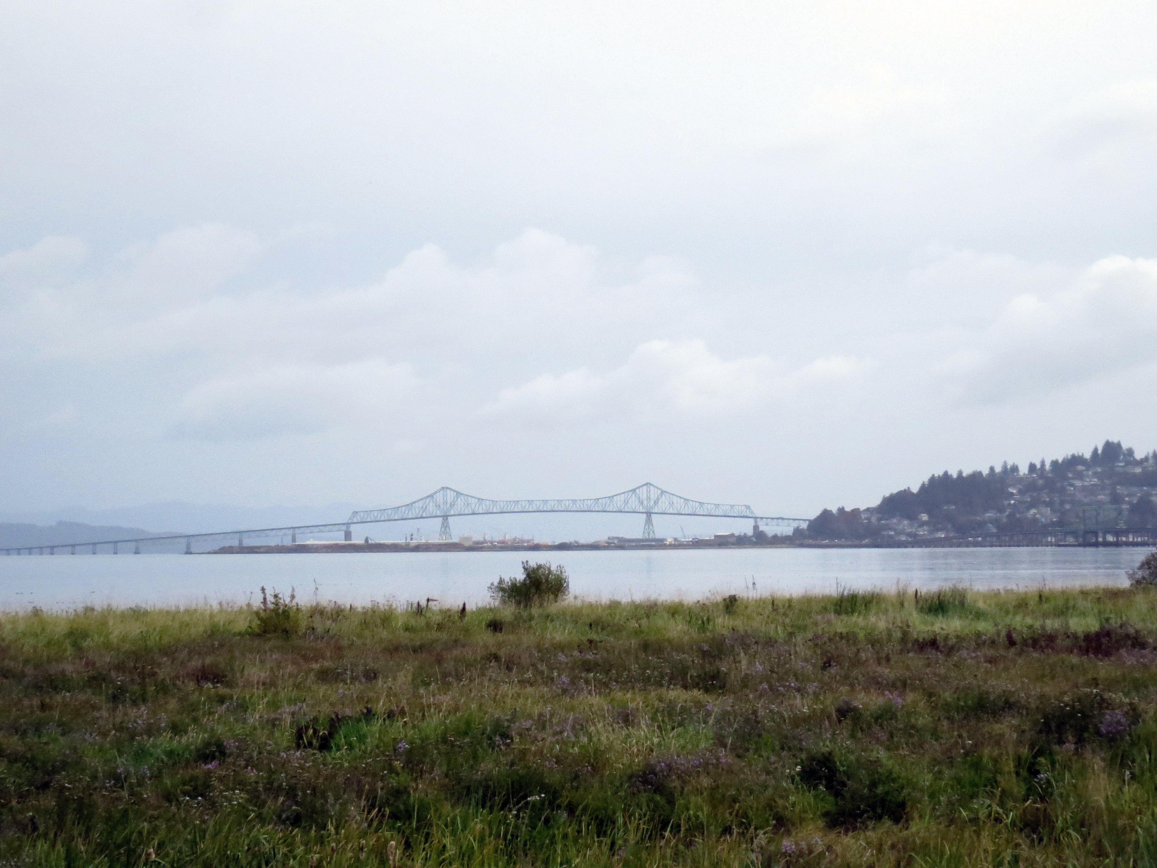
The beautiful bridge into Astoria from the north.
In the morning we each had an absolutely delicious breakfast panini at Coffee Girl, located in an old cannery building on Pier 39. The building on the pier is from the 1880s. The Coffee Girl breakfast worth the stop, and the cafe has the best view in town.
We also visited the cannery museum located there.
There was a gift shop, too. The oddest I’ve ever seen. Each item had a suggested donation rather than a price, and there was a can near the door in which to drop the donations. No staff. No closed door. Basic trust in human decency.
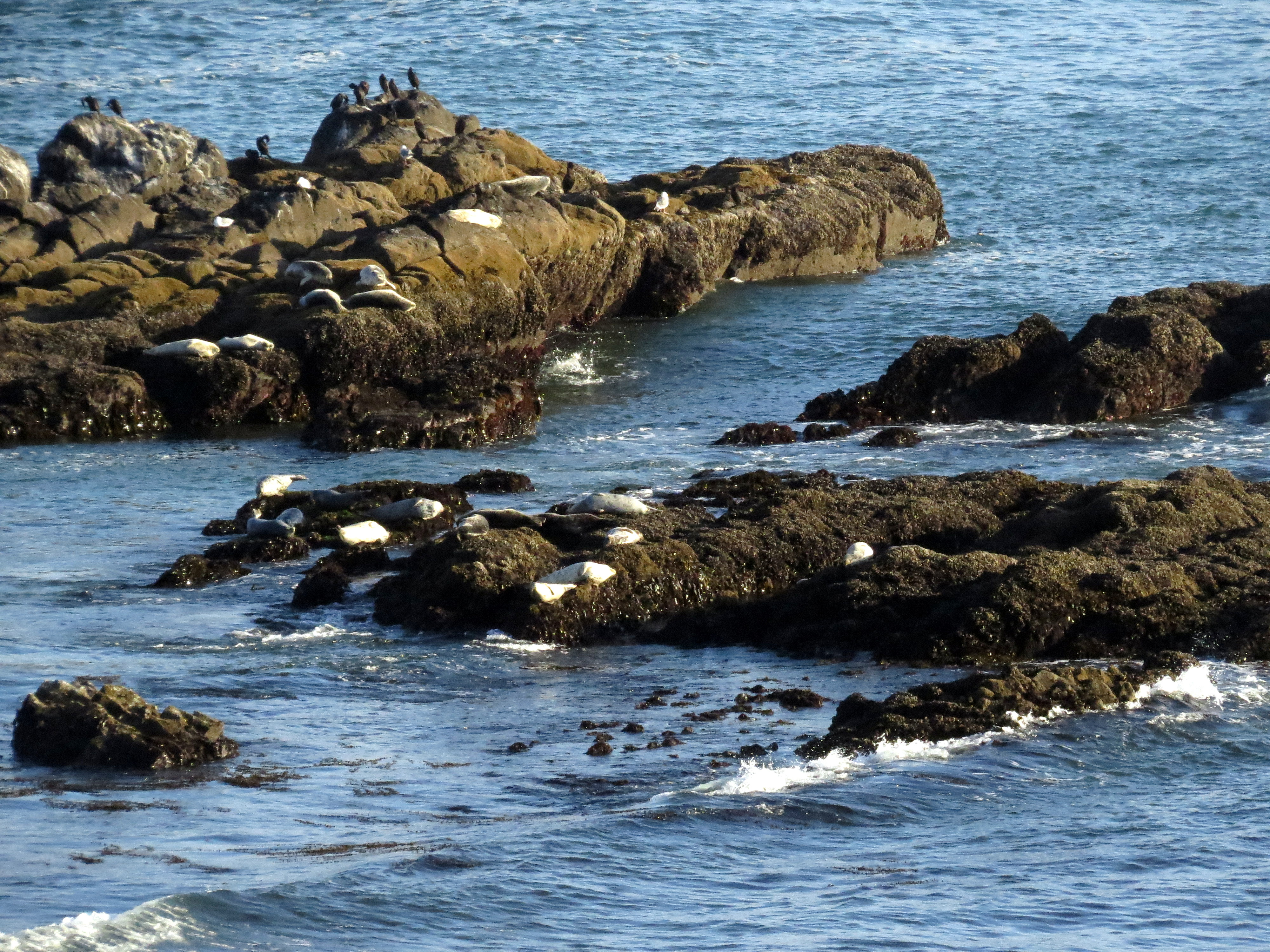
But the highlight of this stop – other than the fabulous panini – was the incredible sea lion viewing. There were sea lions everywhere! We must have seen at least a hundred, right by Coffee Girl.
We then attempted to visit the Astoria Column, a 125-foot tower commemorating those who settled the area. However, the Column was closed for a three-day minor restoration. We couldn’t even get close because there was roadwork happening, too, and the road up there was closed.
Had to settle for lovely places like this since we couldn’t see the Astoria Column.
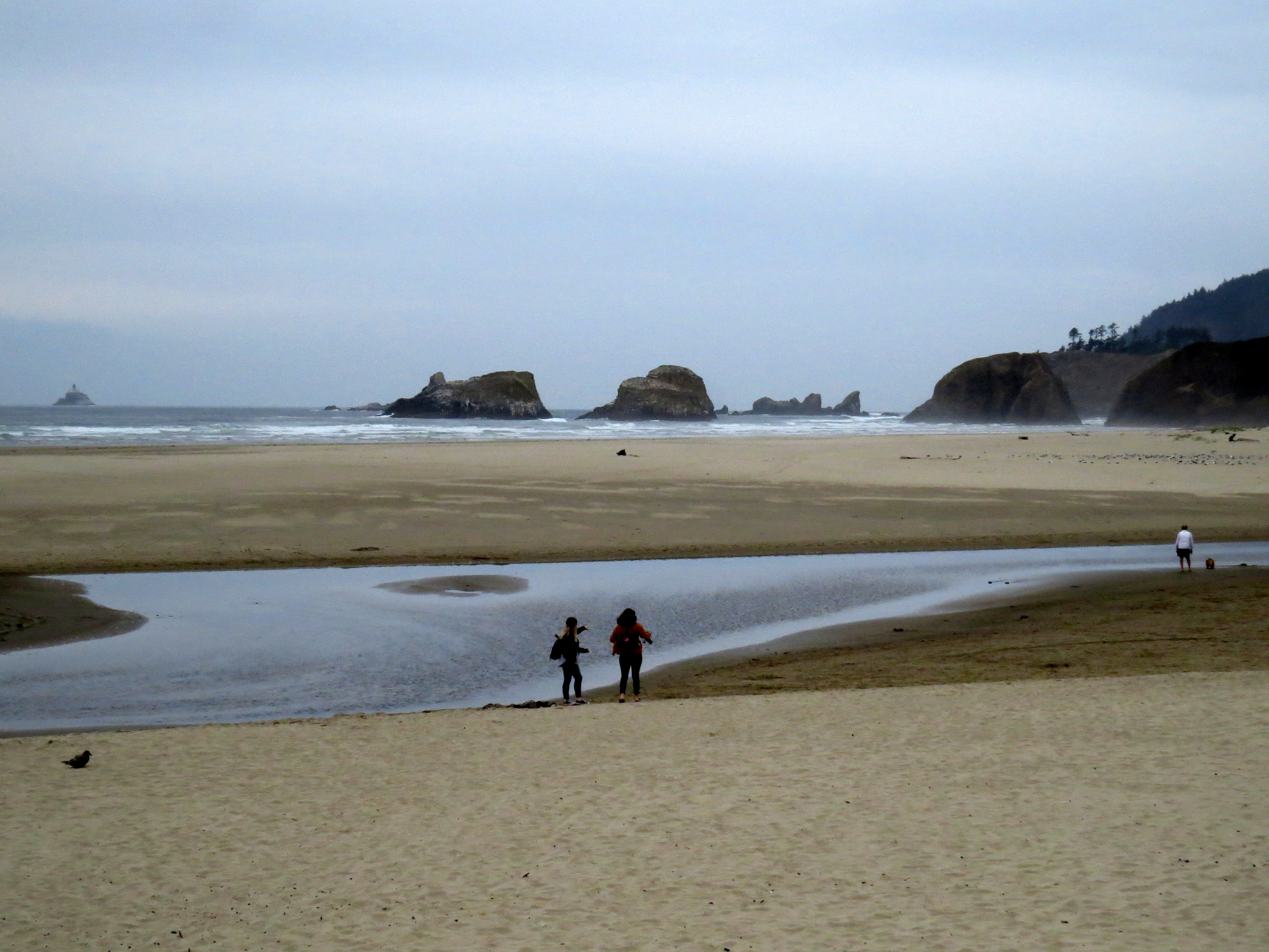
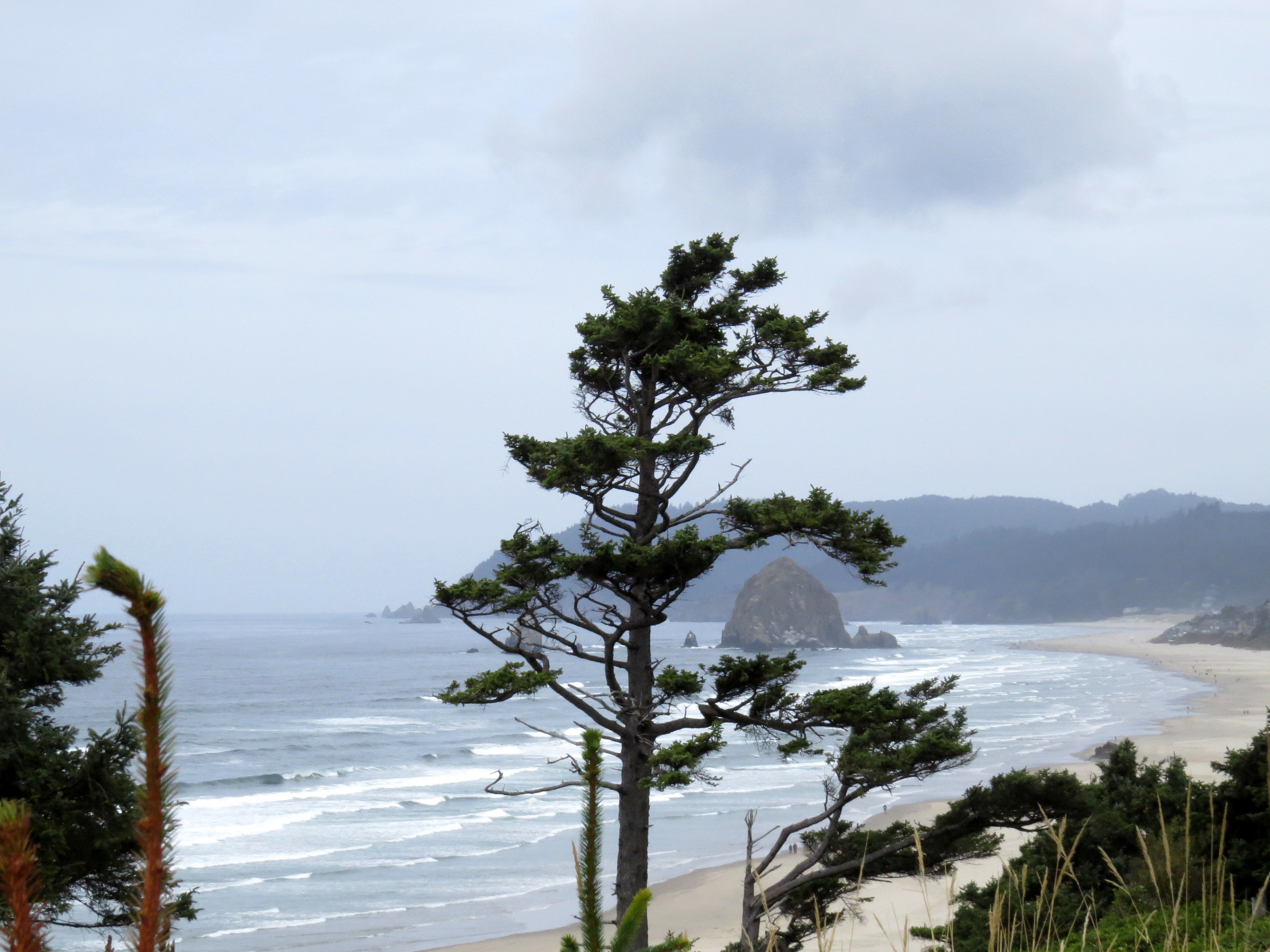
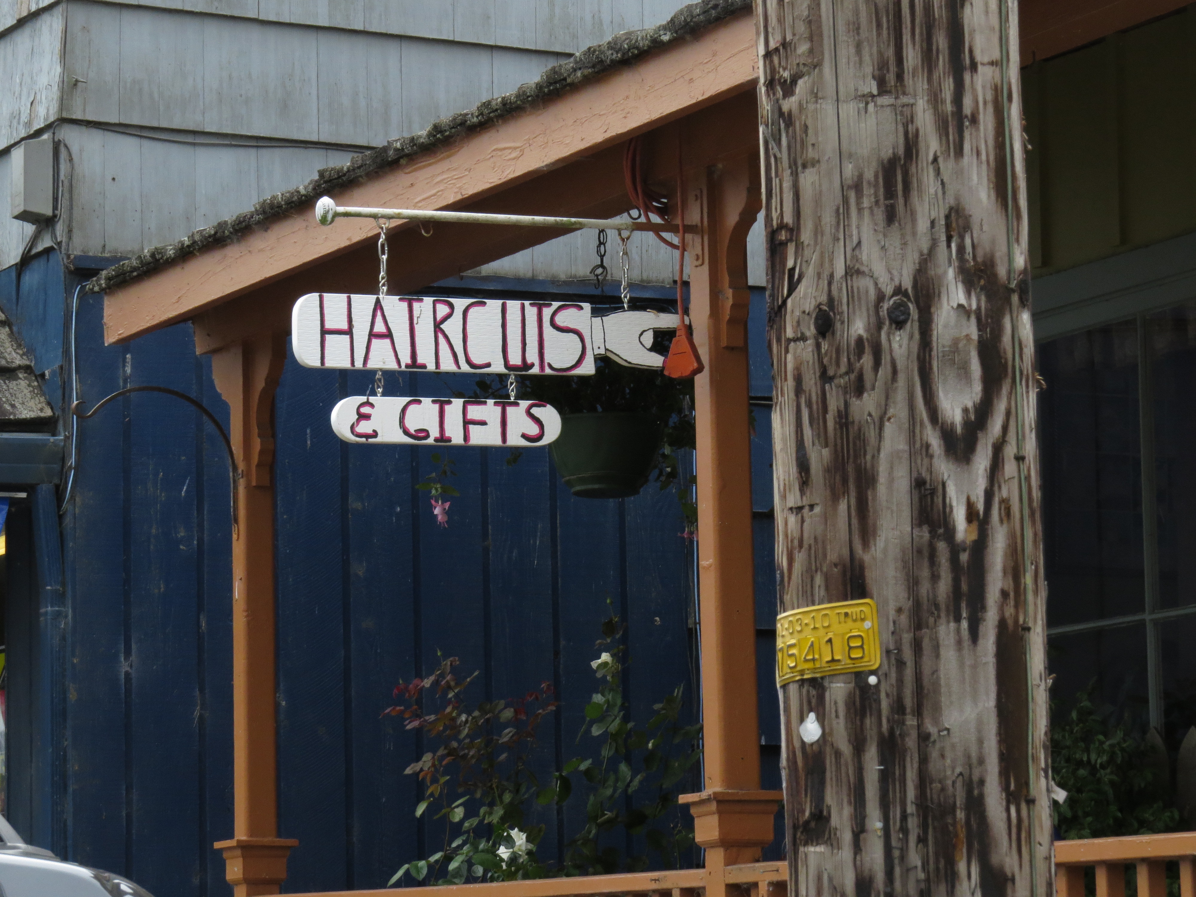
So we headed south. We visited Cannon Beach and Seaside, both sweet little beach towns.
We stopped at many an outlook and wandered several beaches, including one that simply pointed to an arch.
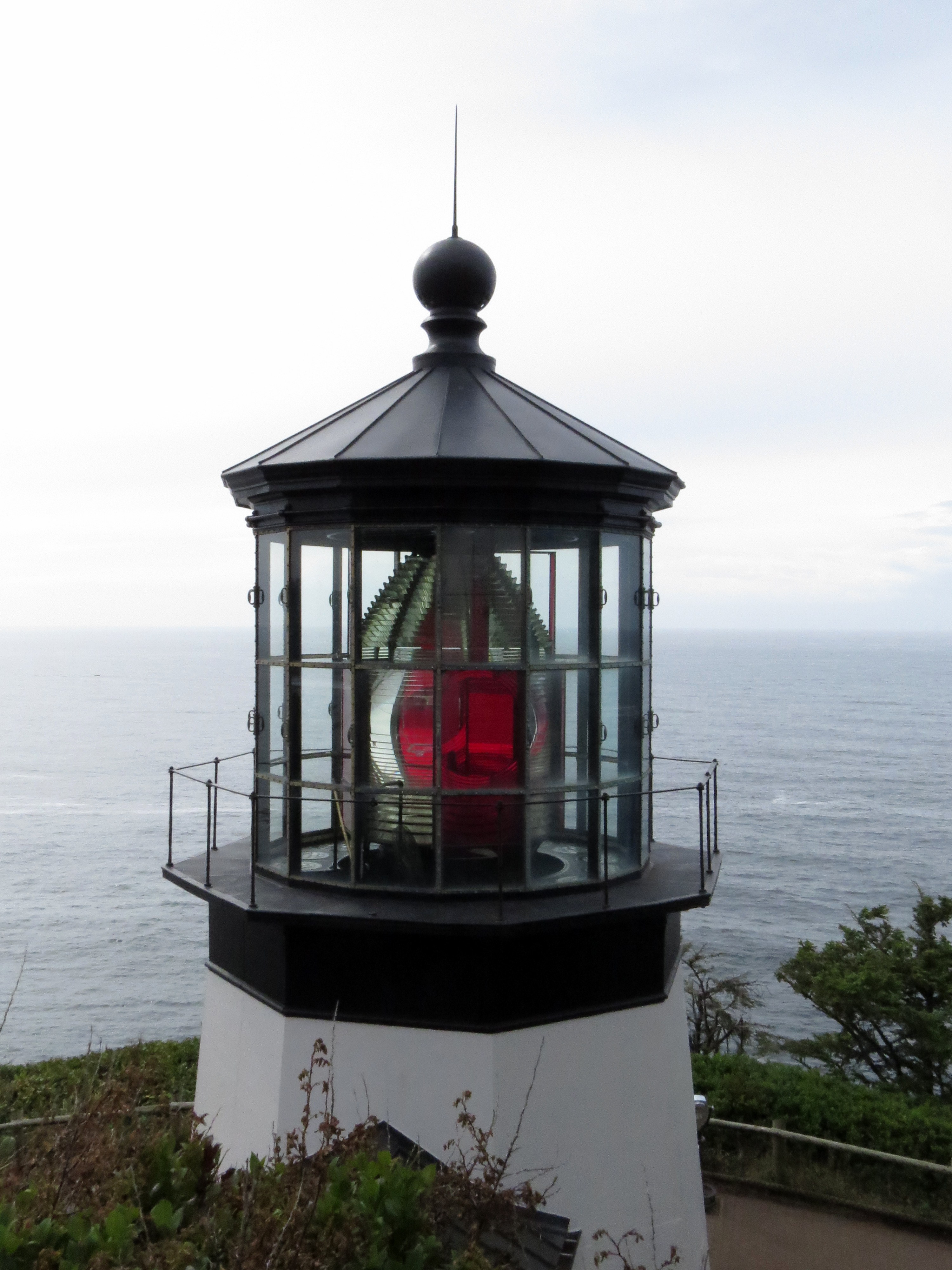
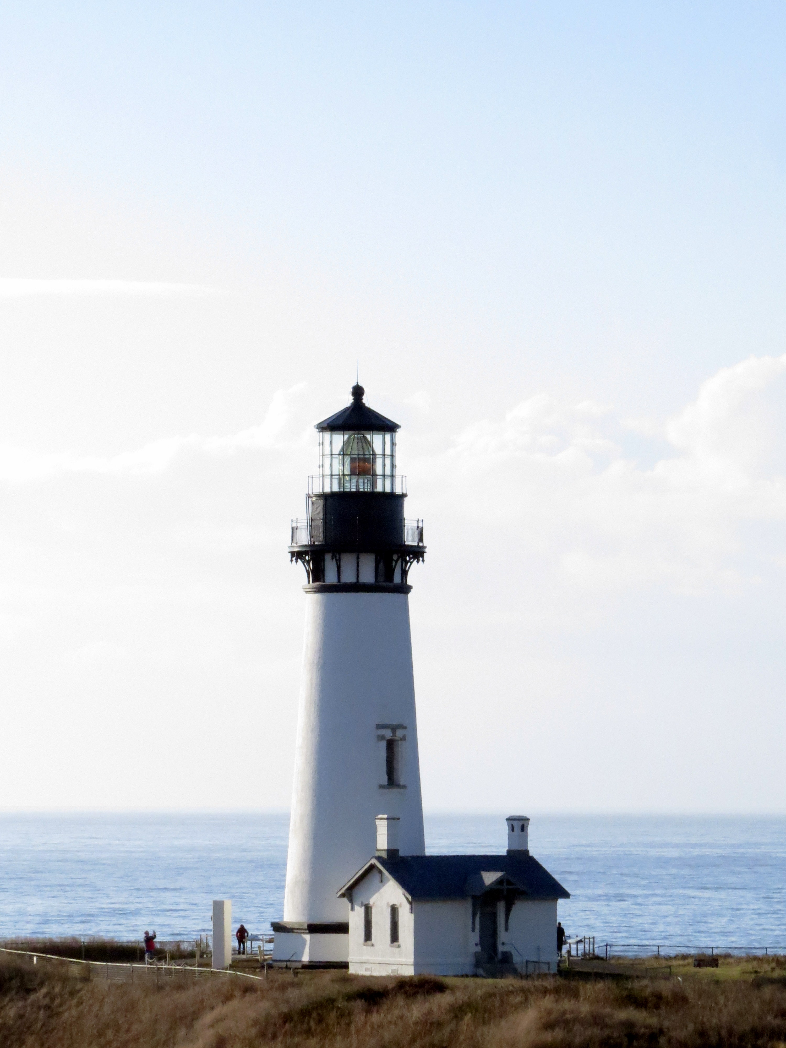
We visited a lighthouse and an octopus tree.
We saw harbor seals.
We poked around in tidepools.
The whole trip was under 160 miles, but we managed to be “on the way” for about ten hours. Almost wagon train speed.
We got to our room in Yachats (pronounced YAH hahts), tossed a few things inside, and headed to The Adobe, a lodge/resort with a restaurant on the sea. Perfect ending to a wonderfully wandery day.
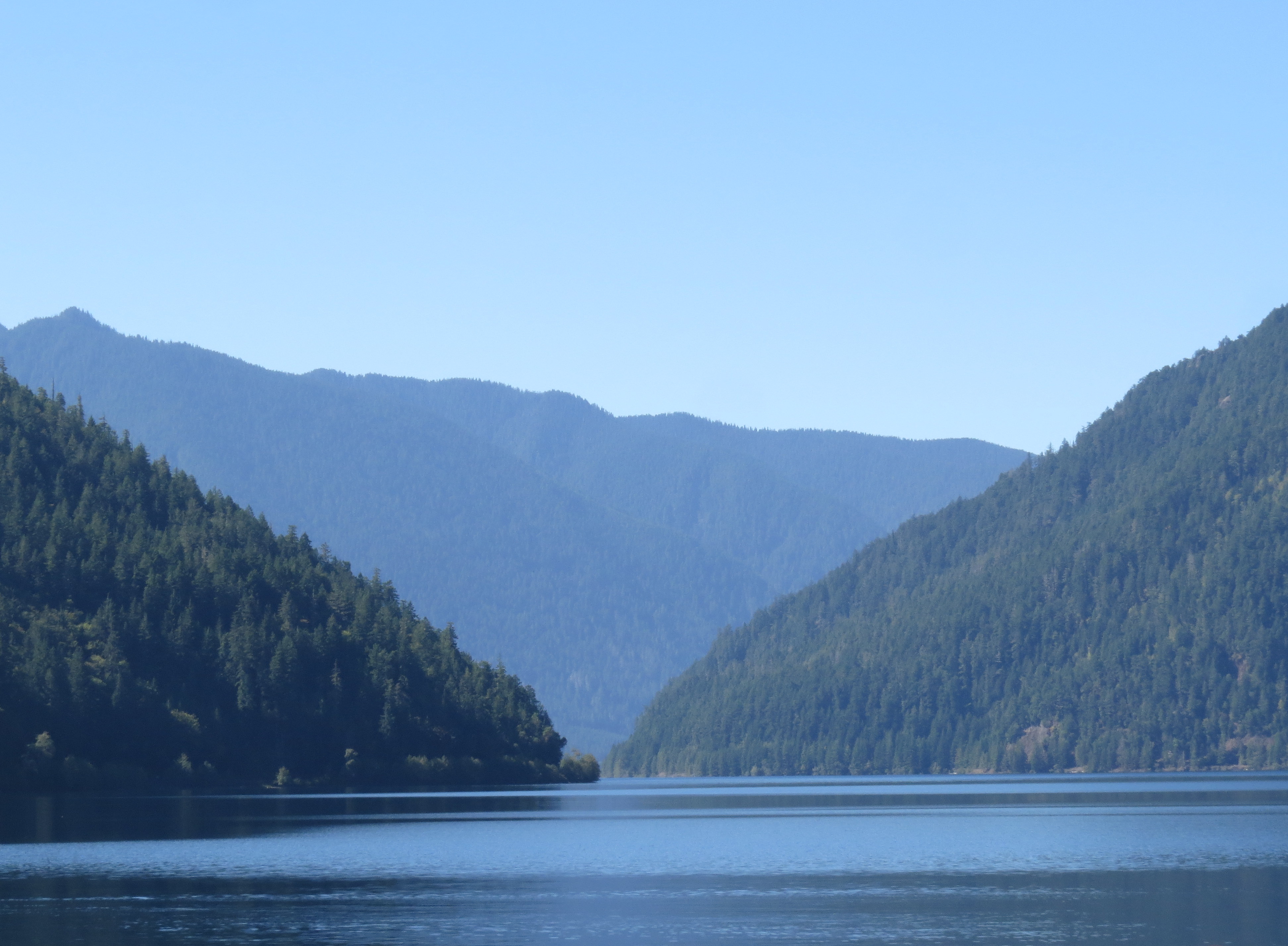
We left Port Townsend headed for Sekiu (SEE q) via Lake Crescent.
It was a day of beauty and wonder, yet there were several disappointments. Our first big stop was a ninety-foot waterfall. However, the road to the area was closed because the bridge was out, and we weren’t allowed to park and walk to the trail.
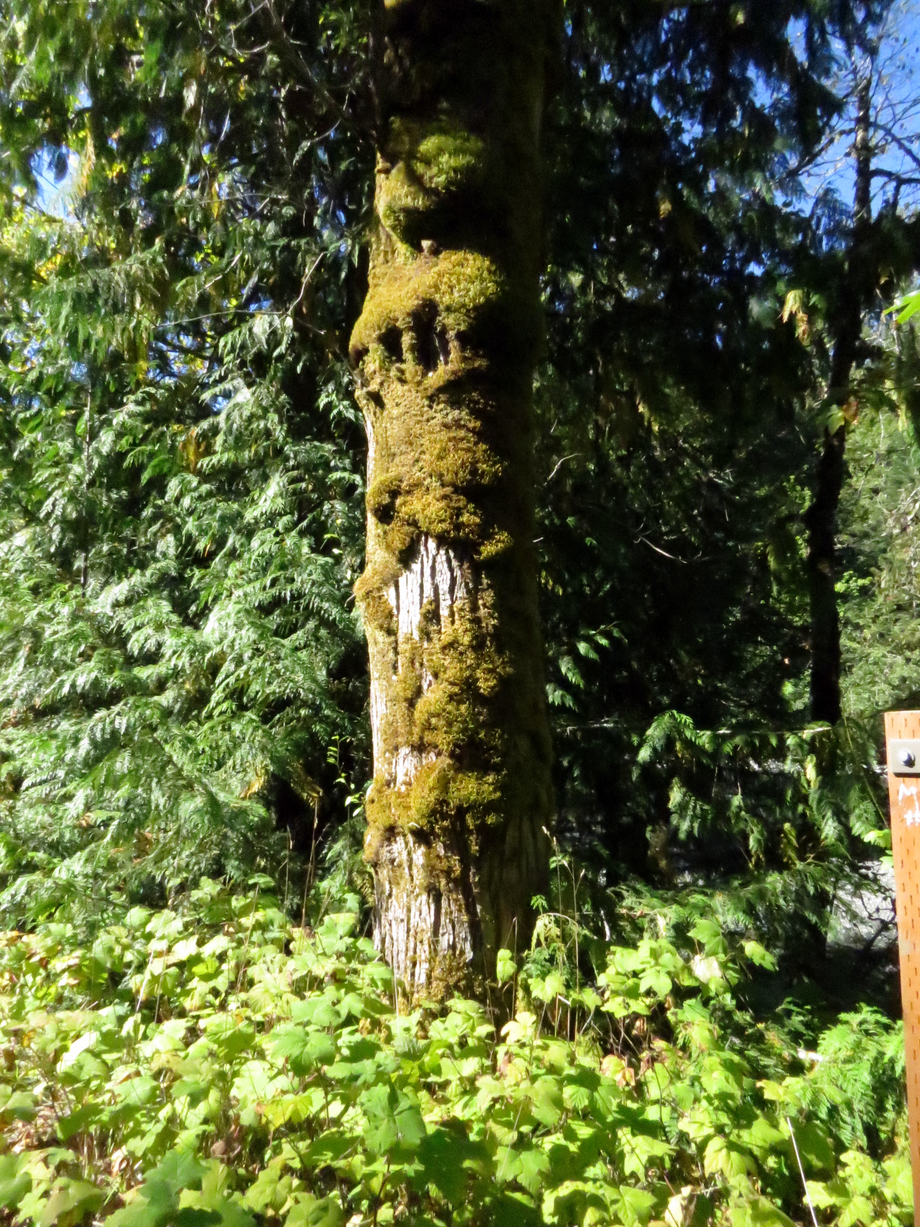
Mossy tree on the way to the waterfall we didn’t see.
Elwha River, on the way to the same elusive waterfall.
Our second big stop was another waterfall near Lake Crescent but the lady ranger said it was pretty much just a trickle this year. Not enough rain.
So we enjoyed one of the lake’s beaches and loved the beautiful drive.
We saw a lot of these signs along the way.
We stopped, too, in the campground at the west end of the lake and saw huge maple trees. Some towered above their conifer friends. I’d never seen such large maples.
On, then, to Sekiu with a few pauses for wandering and photos.
Cinda loves to skip stones, especially in the ocean. Gotta brag for her here: last year she was in Scotland and won the International Stone Skimming contest! I travel with winners.
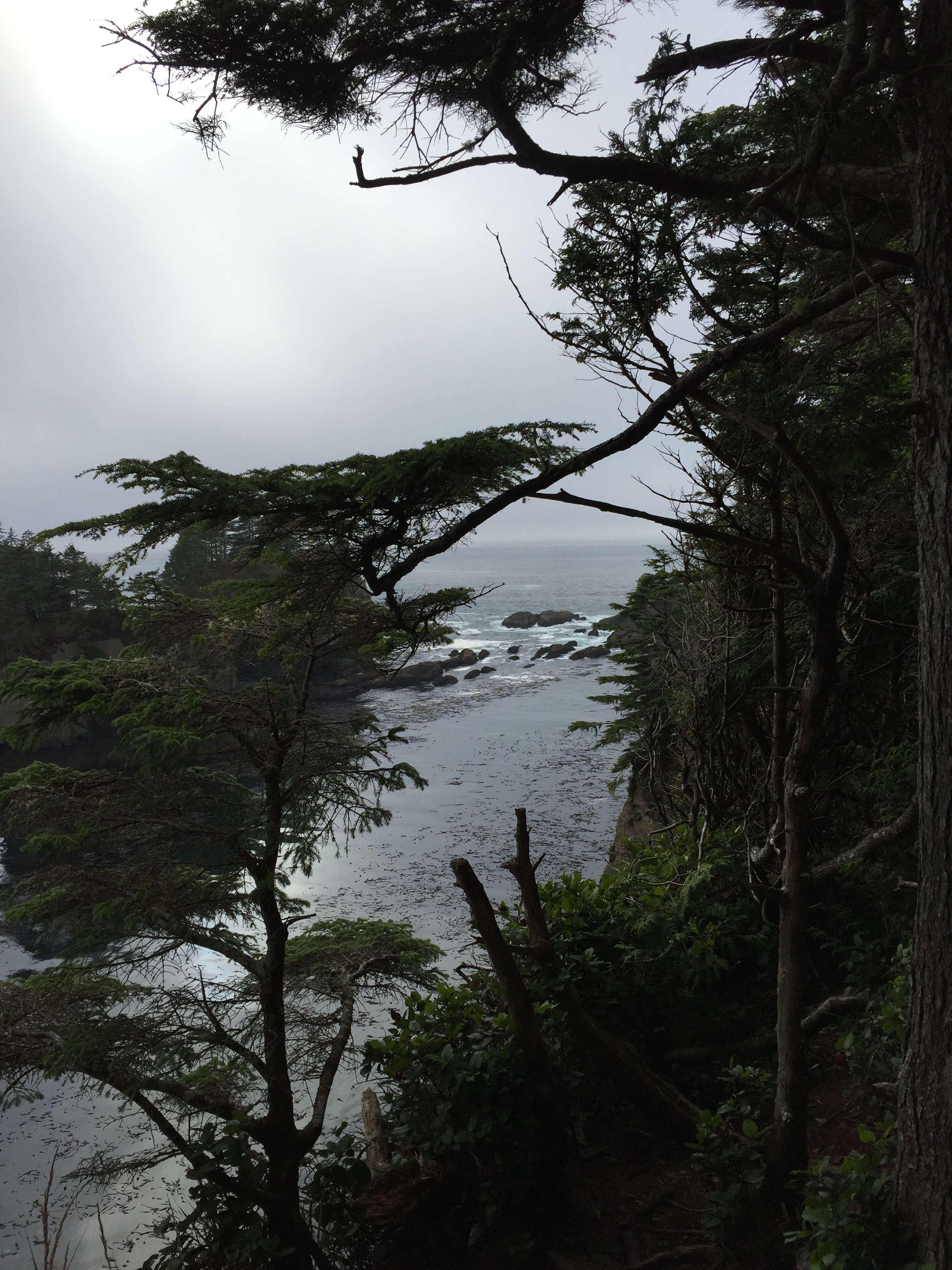
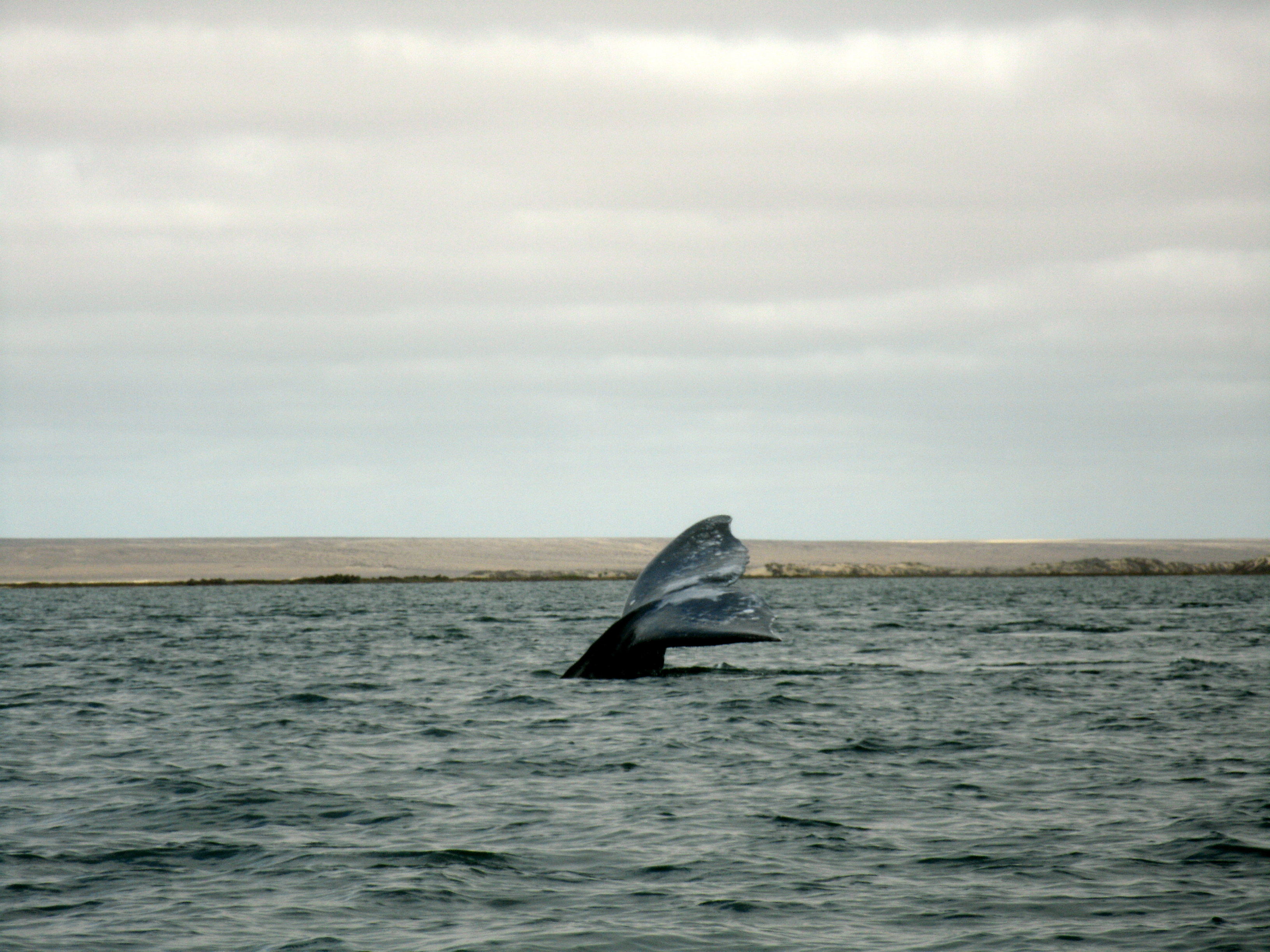
When we got to our friends’ cabin in Sekiu, they whisked us away to Cape Flattery. It is the westernmost point in the continental US.
It was a brisk fifteen-minute walk through rainforest to the Cape. Down, down, down. And down.
At the Cape we were treated to the views and also to a special view: a gray (we think) whale was right near water’s edge feeding on some wonderful whale dinner treat.
The place was magical.
But there was another disappointment: my camera battery died. I got one shot and then had to use my phone camera which has a crappy zoom, hence the distant shots of the whale.
Then it was time to head up, up, up. And up.
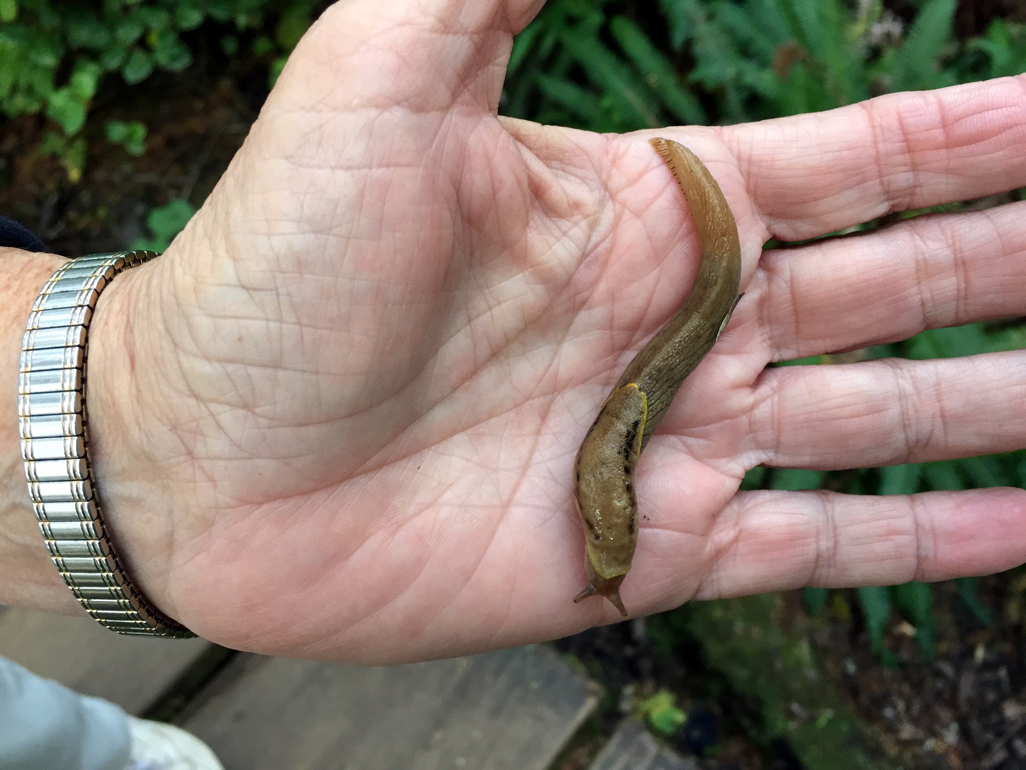
Cinda found a slug.
And tried to hide.
Soon we were heading back to the cabin.
One of the many totem poles and paintings we saw
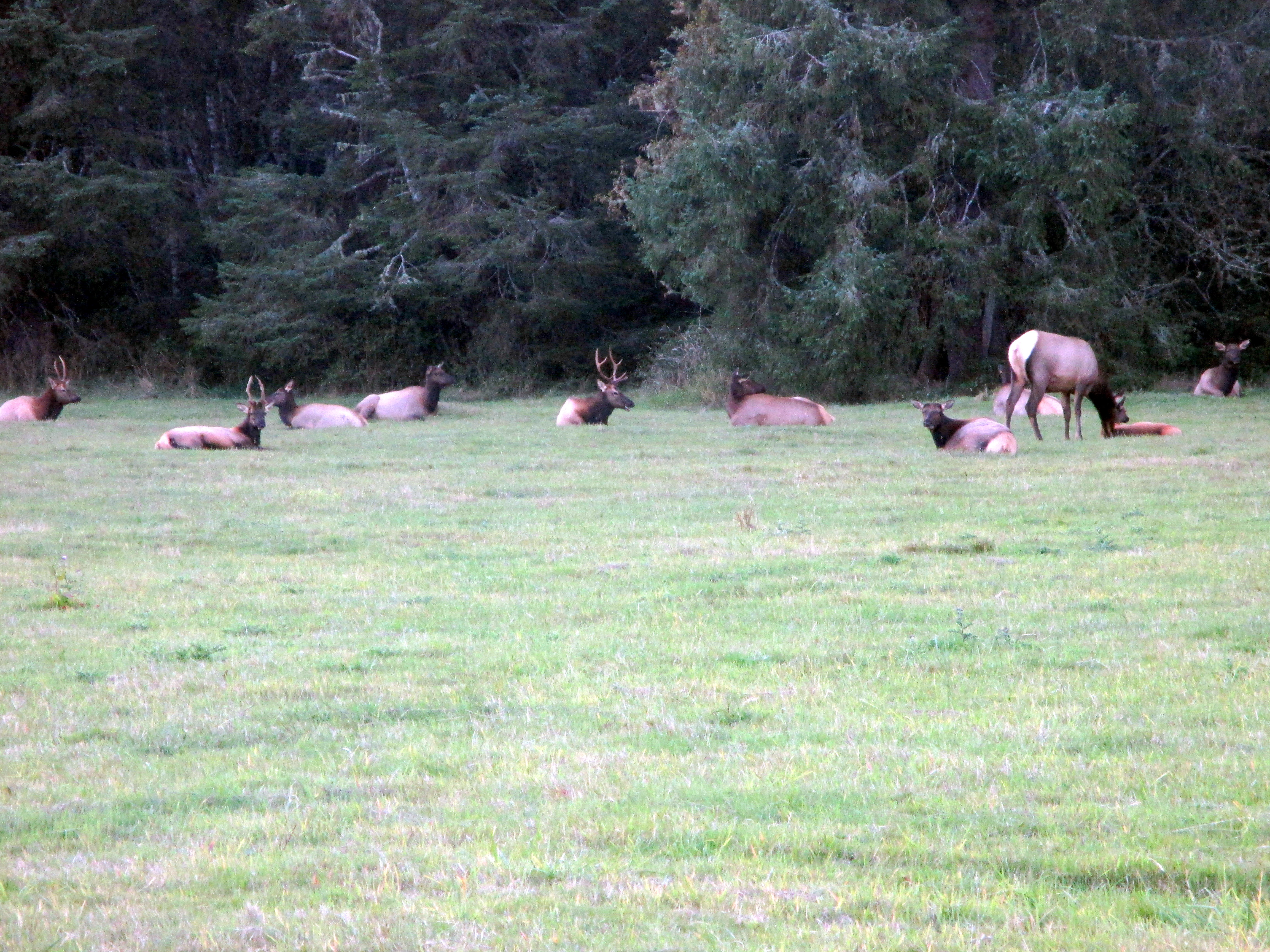
But on the way, another treat – a herd of elk!
Then a delicious dinner, lively conversation, and a great night’s sleep.
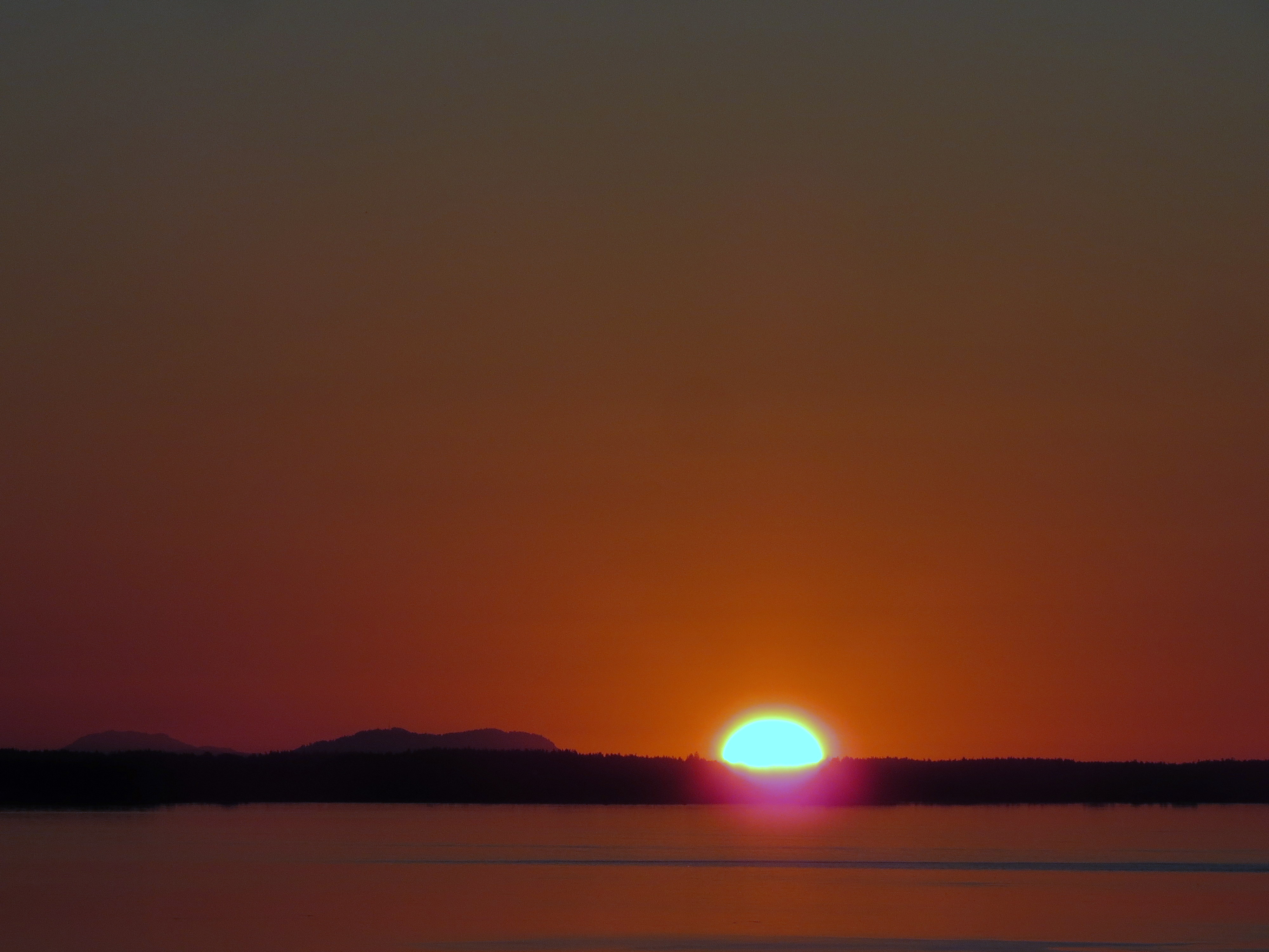
The next morning, beach time and a wonderful sunrise. More great conversation and it was time to head south.
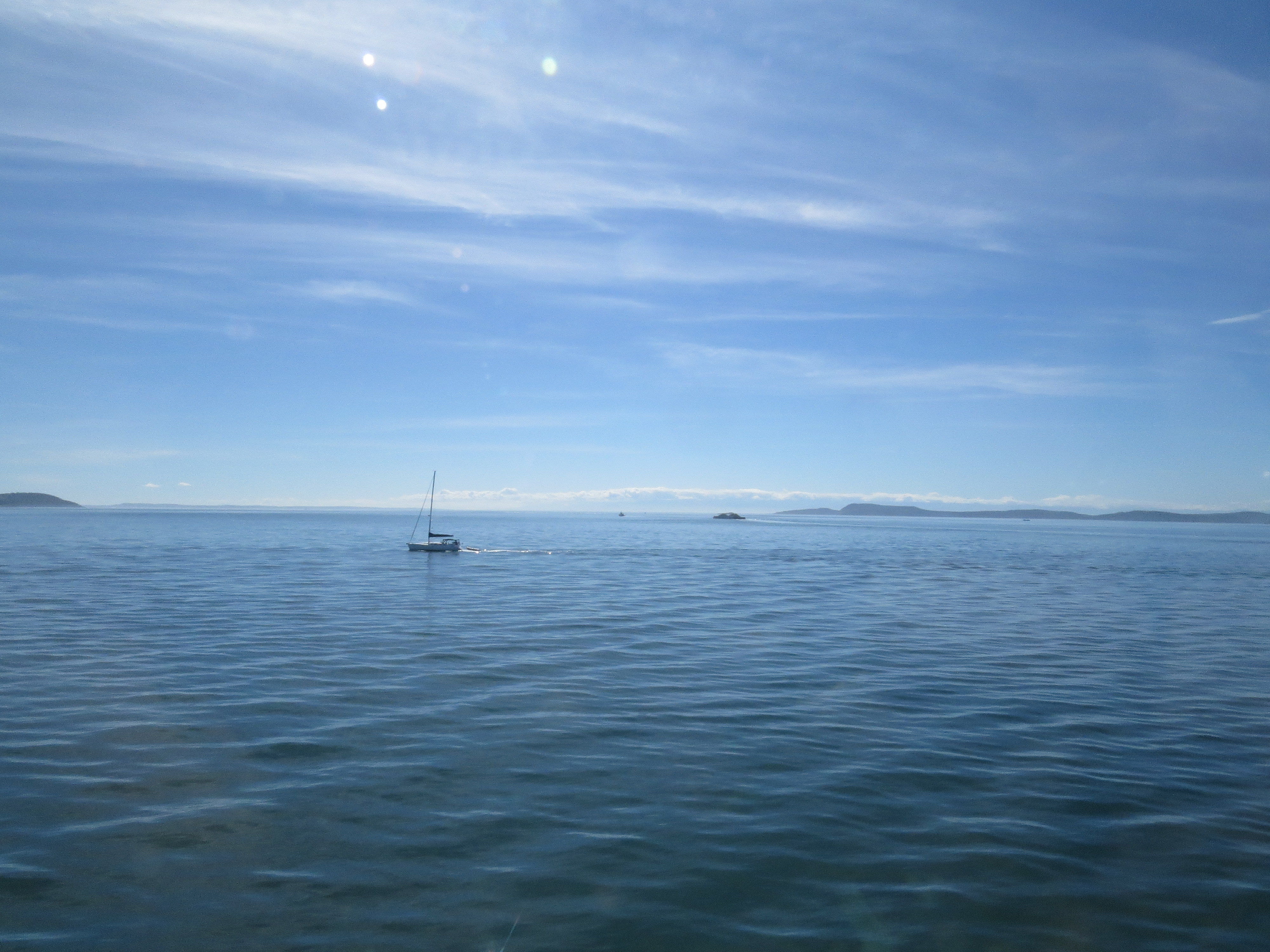
We left Orcas Island reluctantly. There is such beauty there and many trails and coves to explore. But we took the ferry back to Anacortes and visited briefly in the town, then on to Whidbey Island via Deception Pass.
Leaving Orcas Island
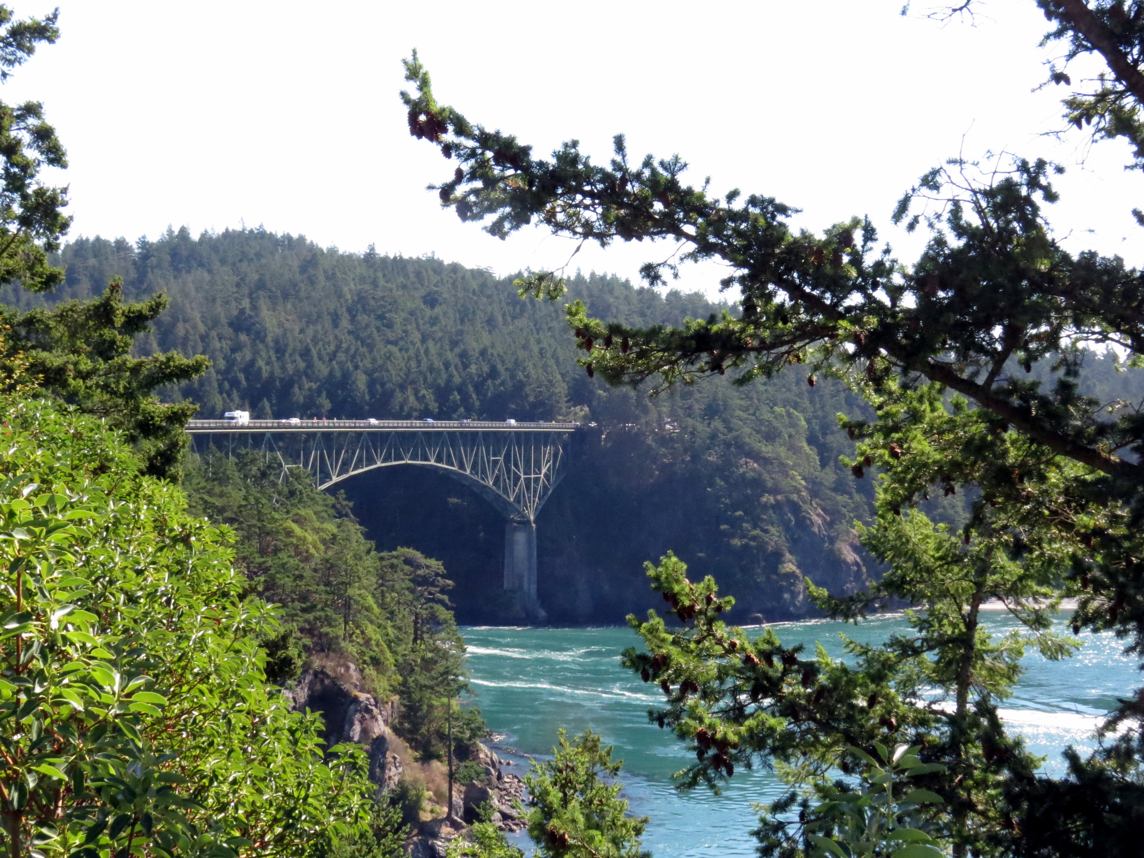
Deception Pass is a small channel separating Whidbey from Fidalgo Islands.
It is quite narrow, less than a quarter mile, so when tides are moving in or out, the water can be quite rapid, resulting in whirlpools and standing waves, both of which can be extremely dangerous to swimmers and kayakers.
What names up here! Skull Island. Victim Island. Deception Pass. History in names.
We headed south down Whidbey Island and were shocked by the noise of fighter jets repeatedly flying above us. Once we passed the naval air station at the north end of the island, the jets and noise disappeared. But following the absolute silence on Orcas, the jet noise had been especially disgusting.
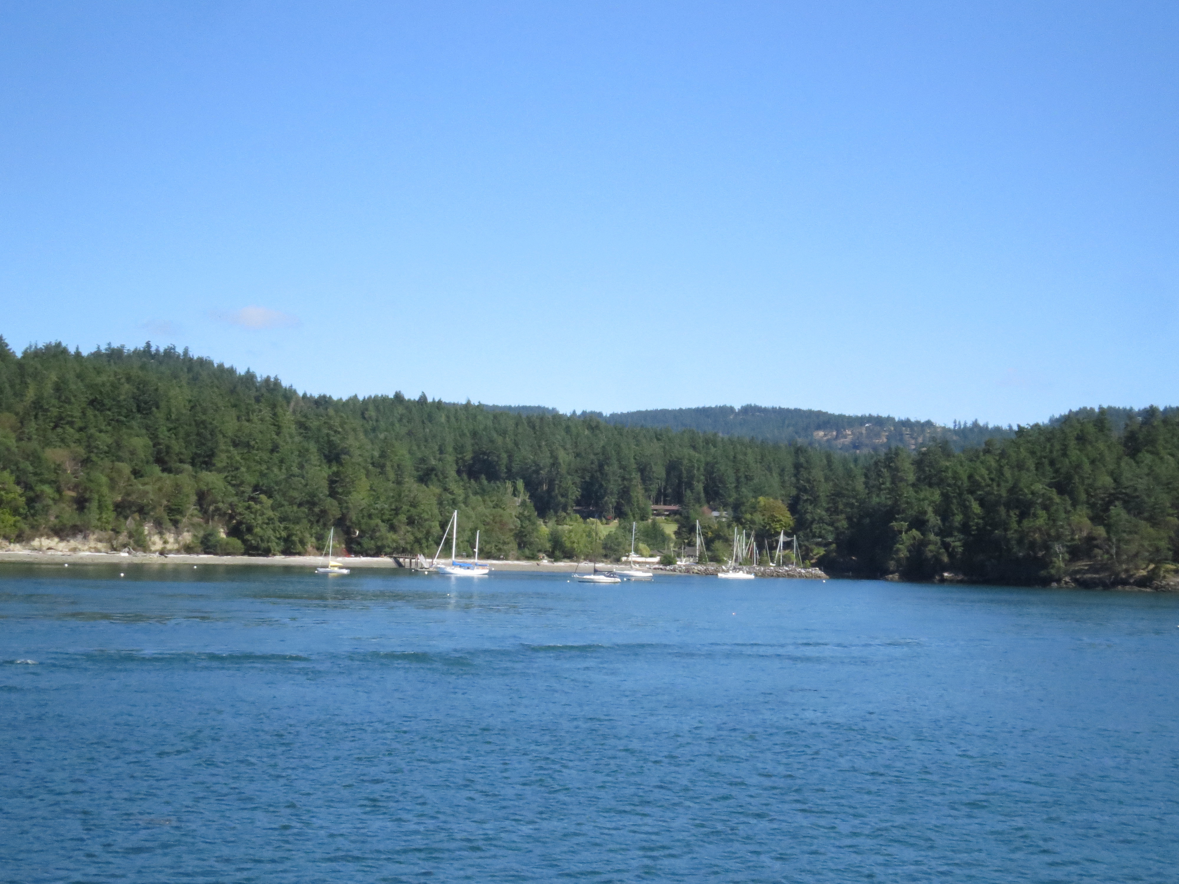
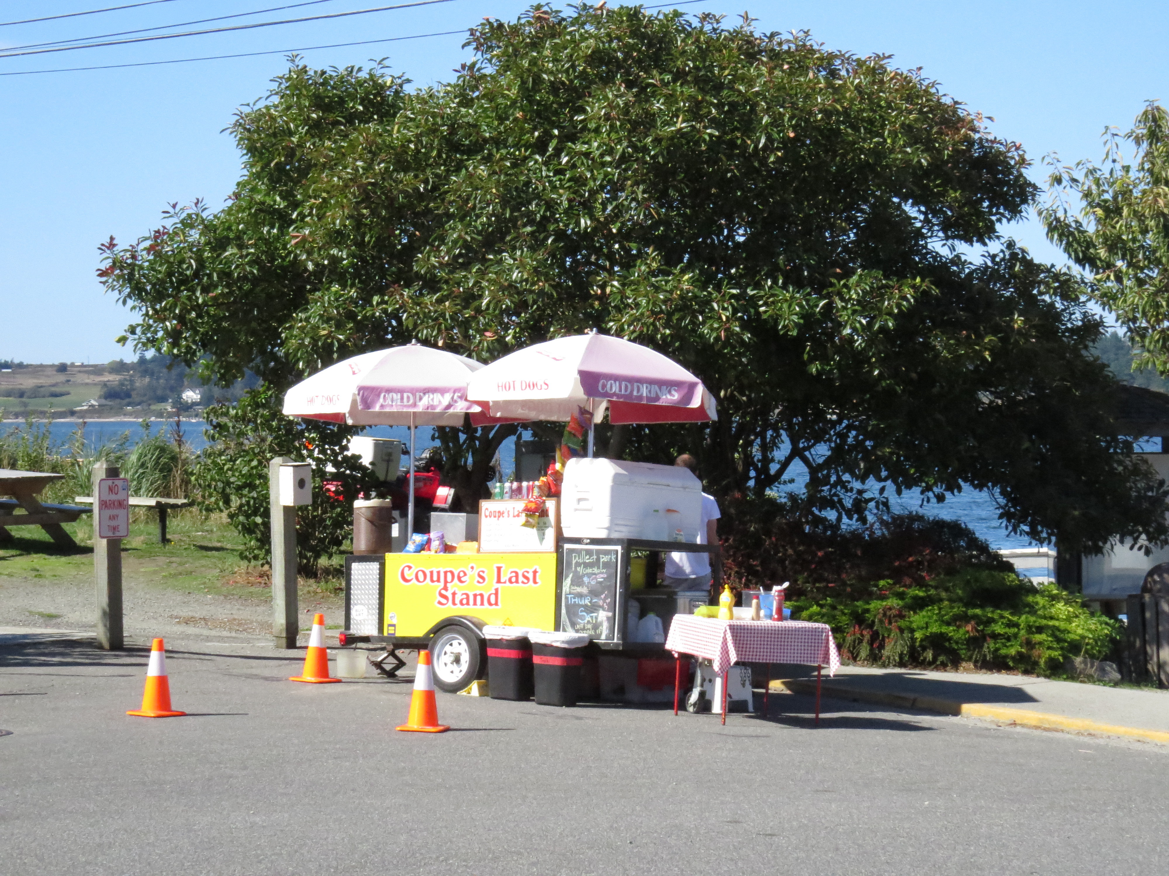
South through Oak Harbor to Coupeville where we took time to wander the streets
A little food cart in Coupsville
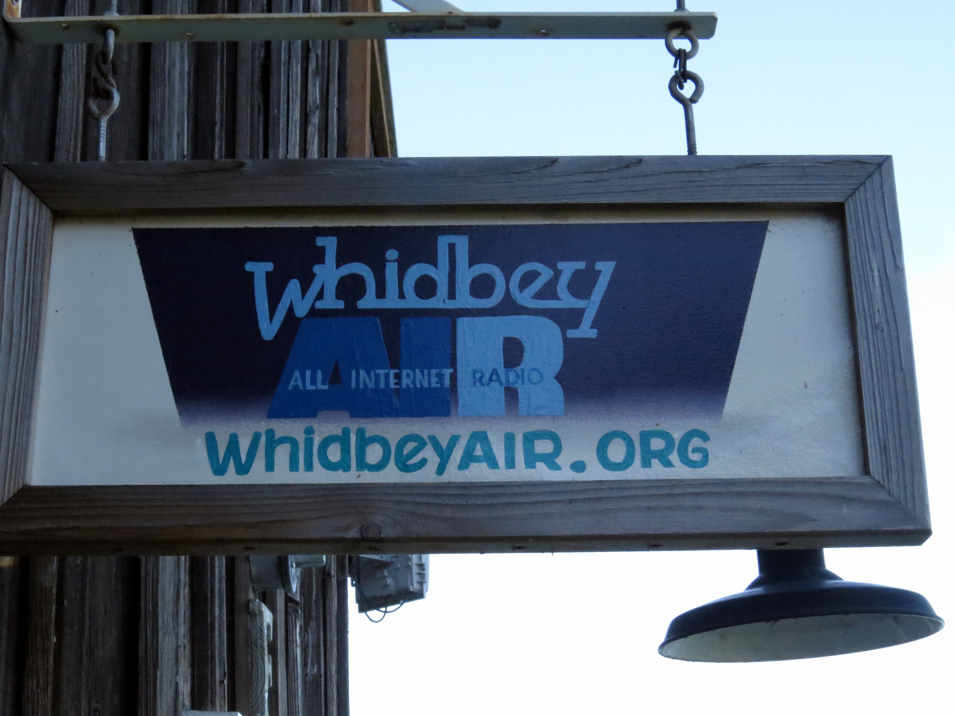
and drop in on the local community radio station, an on-line only station.
Then we moved west to catch the ferry to Port Townsend. When we got there we found we could be delayed because two morning ferries had been cancelled due to fog, but we were able to board just about on time because we had a reservation. Some of those who hadn’t reserved were left behind.
Arriving at Port Townsend
The friends we were staying with met us at the terminal and guided us to their wonderful home with views of the Strait of Juan de Fuca.
All the mailboxes for the whole community are in one place.
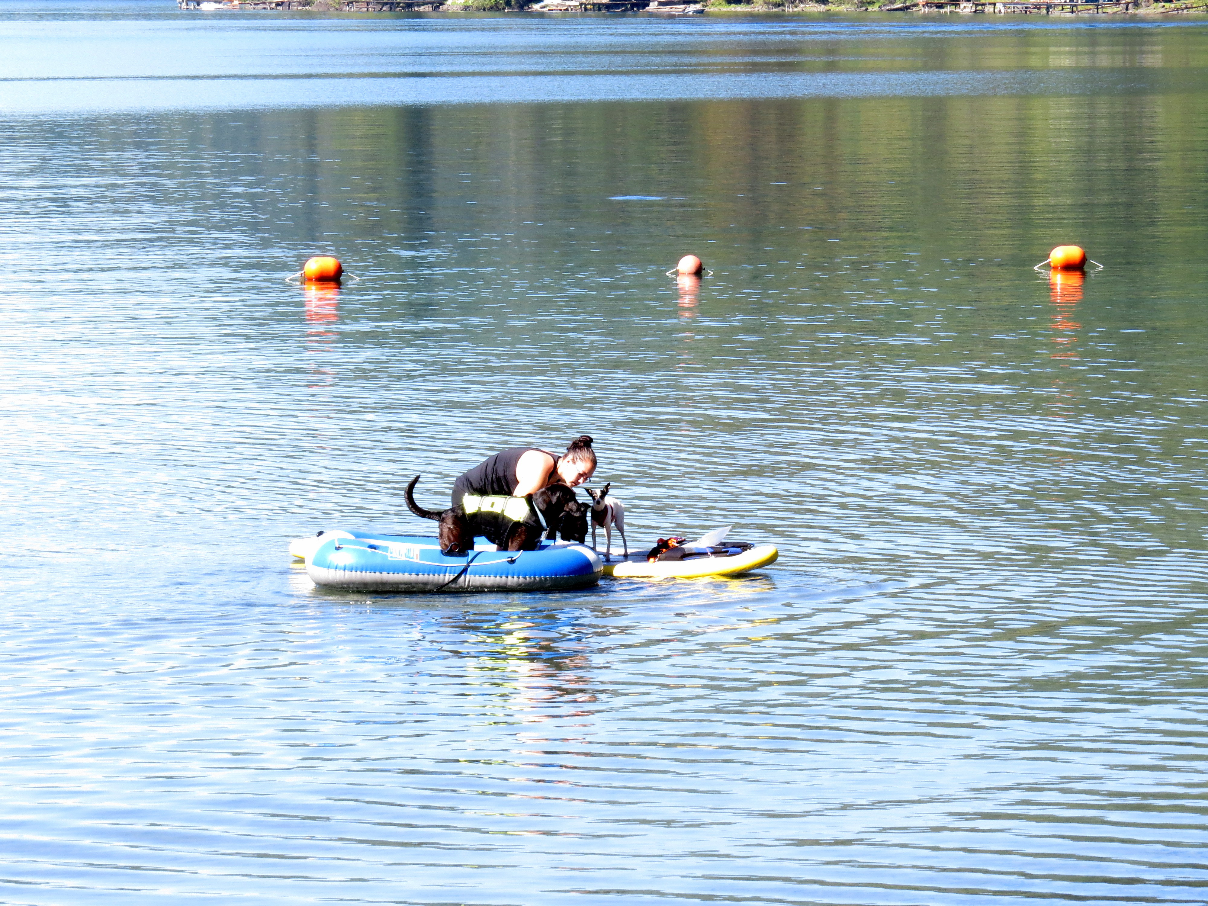
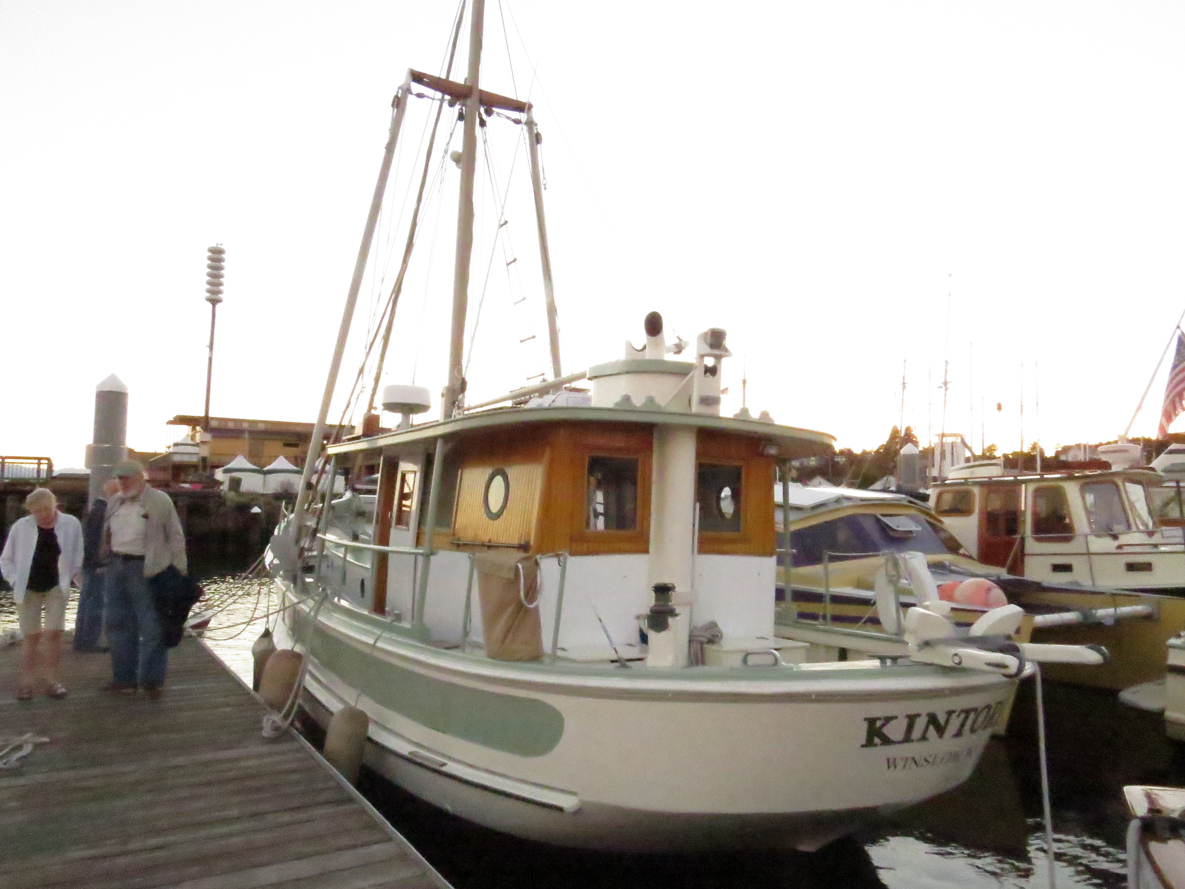
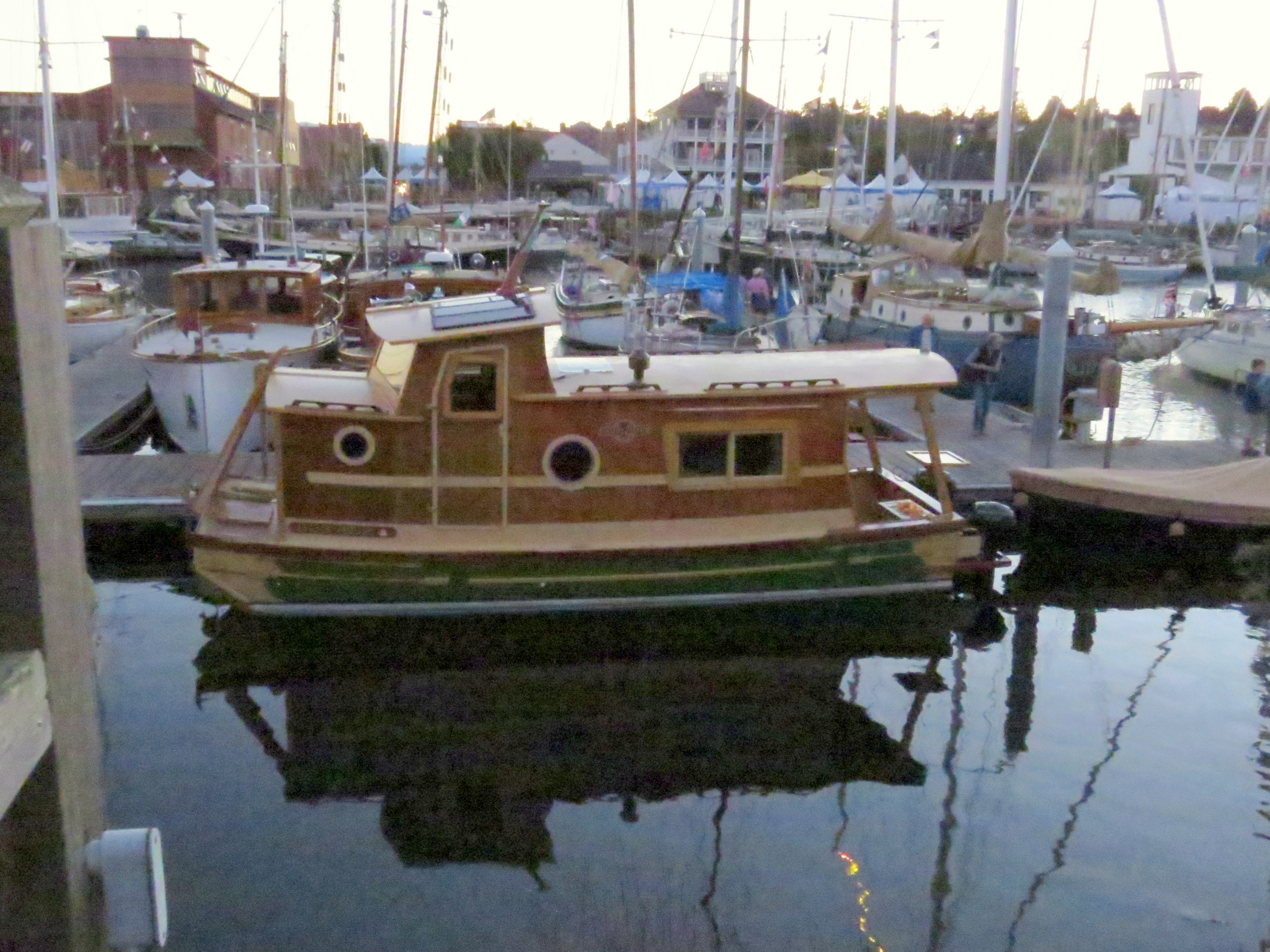
After settling in, we headed immediately for the Wooden Boat Festival. All I can say is, WOW! Port Townsend is all about boats. Well, boats and beach. And more boats. There are several boat building companies and many people build their own boats. There is also a major boat repair and restoration company.
We downed some yummy clam chowder then began roaming the many docks, each one full of boats.
I think this little one was my favorite
Our host, Rod, built his own boat with a friend this past year, and it, too, was at the Festival.
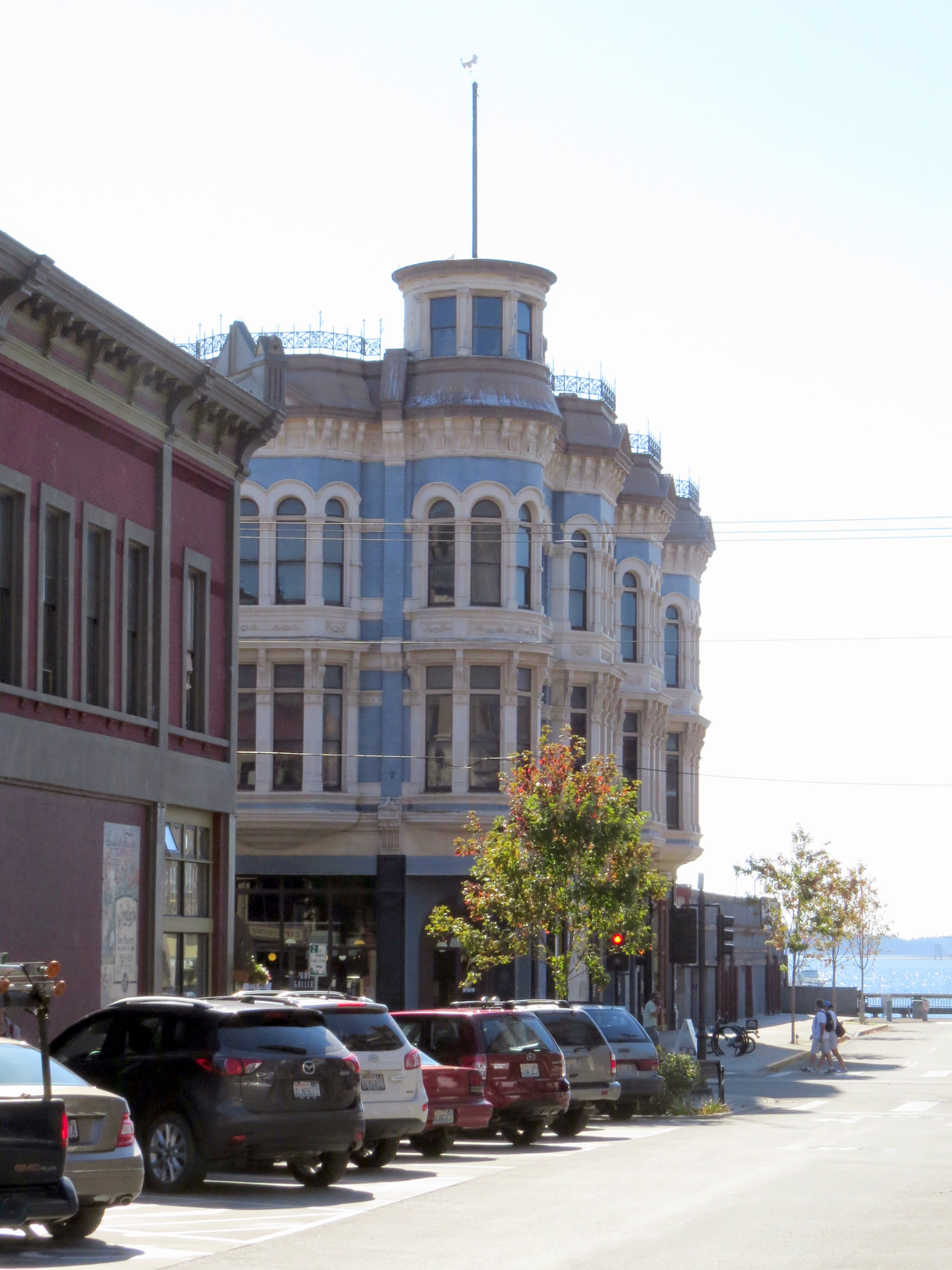
We settled in for the night then spent part of the following morning strolling downtown.
Great street music!
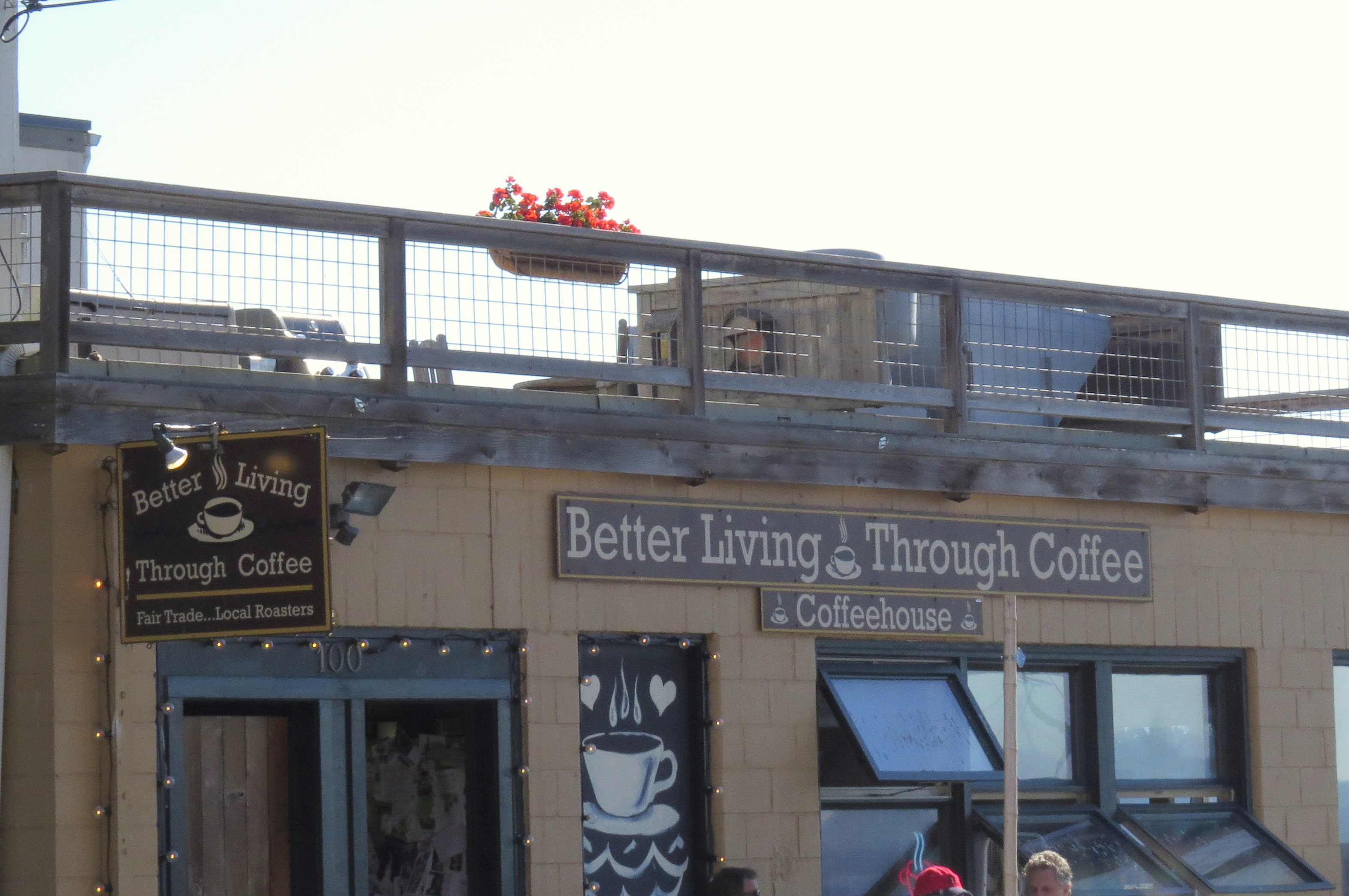
Coffee, coffee, coffee – it’s everywhere!
Port Townsend has an extremely vibrant downtown, full of shops, restaurants, pubs, and museums. All were bustling. I absolutely loved the town. Beautiful historical buildings, a waterfront and friendly people.
After roaming the town we headed to the beach and two marine museums.
This beauty was in a tank in the marine museum.
Back to the house for fresh salmon and a beautiful sunset.
The next day we headed to Sekiu in search of Lori’s infamous monkey tree.
Our tip so far can be summed up in one word: beautiful!
Day One
We left Tucson in the pre-dawn dark for a drive to Sky Harbor Airport in Phoenix and flew to San Francisco. San Francisco is huge, has atrocious traffic, and is gorgeous.
Cinda wanders one of the galleries at Sky Harbor Airport
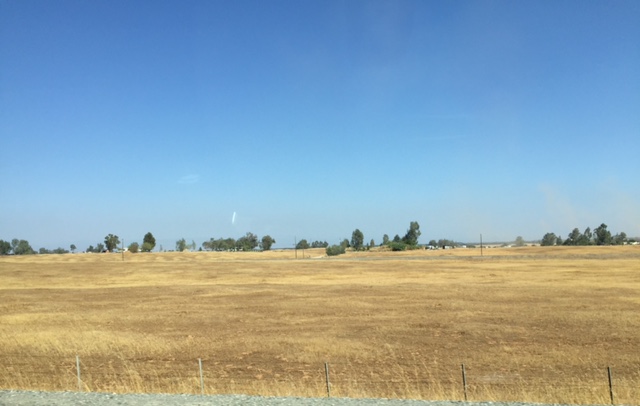
We blasted right out in our little rental (a silver Toyots Yaris I named Pearl) and across the parched landscape of northern California.
We crossed Lake Shasta which is fed by snowmelt from a number of streams, Including Doney Creek, below. Likely, all the rivers and streams are much like Doney – nearly no water. We saw far too many that were bone dry, and trees along their banks were dead or dying.
The old sign on the bridge over Doney Creek just added insult to its trickle.
In the middle of all this drought, we passed by fifty miles – fifty miles! – of cropland, all planted. Much was in trees, and most of those were almonds, at a cost of one gallon per almond. No wonder the state is running out of water!
Mount Shasta was gorgeous! We caught glimpses of her along the route to Yreka where we spent the night.
The drive left me certain of two things. First, California’s drought is very real. Second, I need to plan a two-week visit to this gorgeous area. Highway 5 is not the way to see Northern California.
Best sign of the day: Guided Goose Hunting.
Day Two
Cinda and I awoke early to the sound of geese passing by. We did not tell them of the sign we’d seen the previous day.
We were off again before dawn to missed seeing the gorgeous mountains we passed through, but this was compensated by the brilliant star-filled sky and a sweet quarter moon.
Past Ashland, Eugene, and Grants Pass. For so long they have been words on a map, and finally I was able to place them in my mind. We stopped for gas in Grants Pass where the 58-degree temperature bothered our desert-warm bones, but locals were out and about in shorts.
We did a bit of noodling so I could catch some photos.
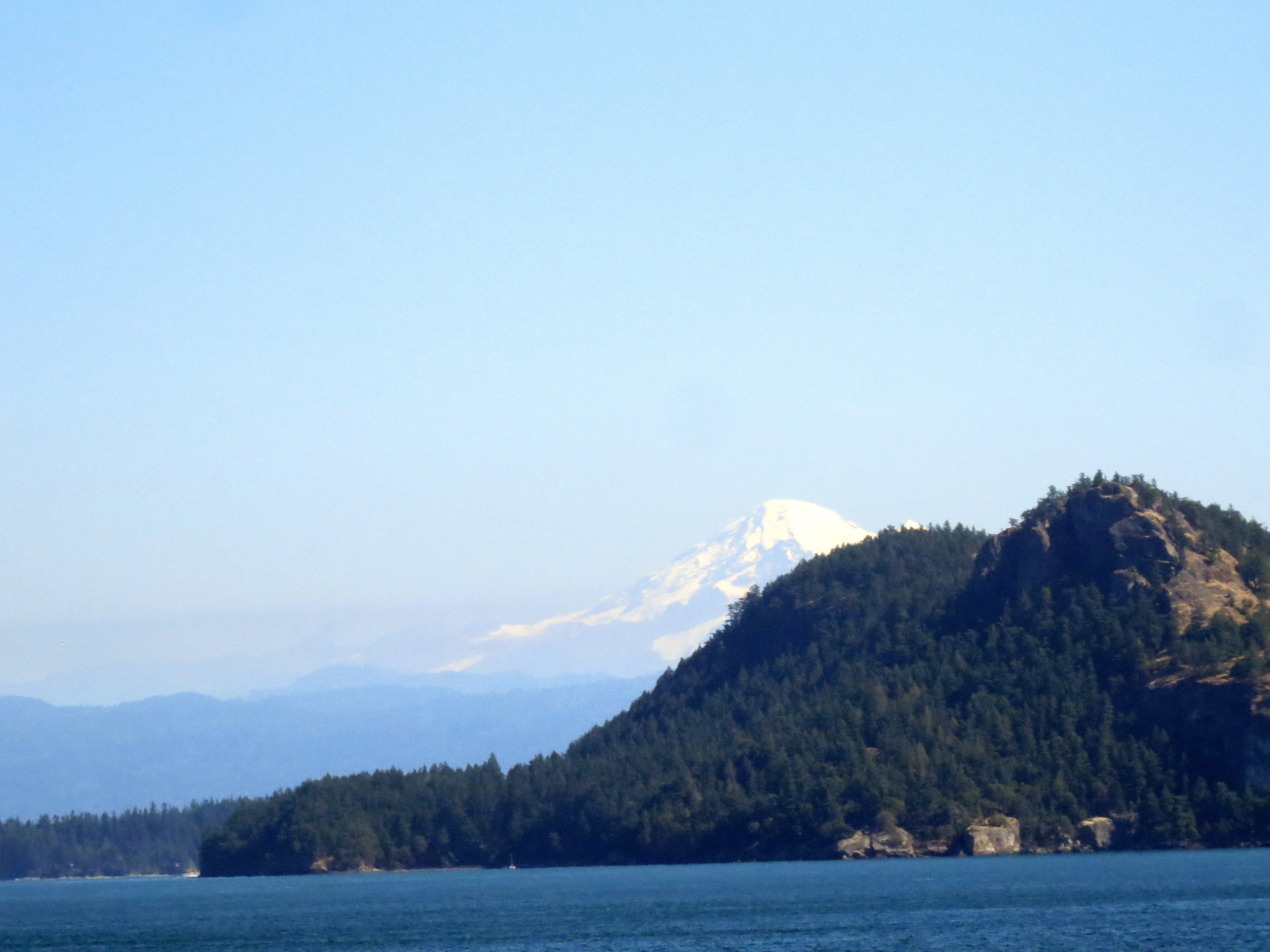
Then on through Portland and were in Washington State for lunch. Mount Rainier was buried in clouds, but we did see Mount St. Helen, her flat top exposed due to her last eruption.
We were in Edmonds, north of Seattle, in time for a lovely afternoon on the deck of Cinda’s friend, a fab dinner on the deck and a relaxing night’s sleep.
Day two left me certain that I needed much time up in the Northwest. Portland alone could take a week.
Day Three
And now the real fun began! A quick trip to Trader Joe’s and we were on our way to Anacortes, on Fidalgo Island. We hit a little drive-through coffee stand where I got a great espresso and a marionberry scone.
What is a marionberry? I have no idea, but it was fab in a scone.
We arrived early for the ferry and I put the time to good use.
A forty-five minute ferry ride and we were on Orcas Island! We noodled a bit and joined up with another of Cinda’s friends for the night.
Leaving the ferry at Orcas Island
We toured the island even more with my new friend, including a drive up to Constitution. Gorgeous views from both part-way up and from the top.
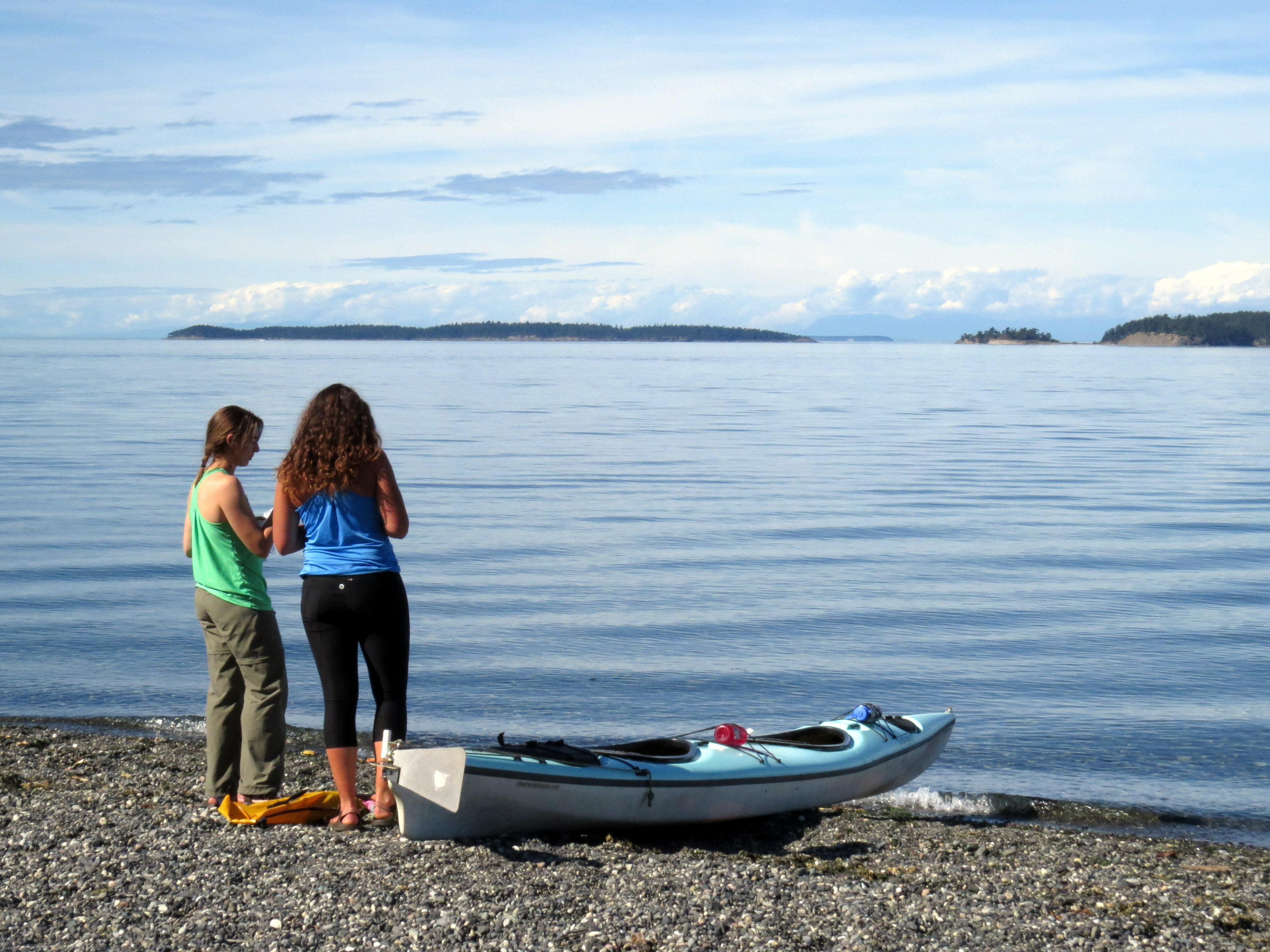
These two were headed out in their kayak
The Olgas Post Office. We spent the night in Olgas, at the far side of Orcas Island from the ferry landing.
One highlight was a trip up Mt. Constitution. The views from the top were gorgeous.
That’s Cinda at the top of the tower.
And just as we were about to walk back down, the clouds parted and we finally saw Mt. Rainier! Except it turned out to be Mt. Baker. Oh, well!
After a lovely night in absolute island silence, we did a bit more roaming
and hopped the ferry back to Anacortes to continue our journey.
I have had more than one adventure with my friend Cinda. Most have been small and somewhat tame. Not true of the road trip we took through Baja California, and hopefully this one won’t be so tame either.
When we were in Baja California, we took a panga out onto a lagoon and got to pet whales!
We’ve packed a suitcase each and also stuffed seconds with sleeping bags and some camping equipment. Think air mattress. I am not twenty anymore! And Cinda even managed to cram a tent into her second bag.
Ready to zip ’em up!
We leave tomorrow, bright and early, for San Francisco. But we will not stay. We’ll grab our rental car and blast right out and up I-5 to Yreka where a motel and swimming pool await. It should be in the 80s when we arrive and that pool’s already calling to me.
On Tuesday we continue north on I-5 to Edmonds, Washington, a little north of Seattle, where we’ll spend a night with a friend of Cinda’s. The next day, on to Orcas Island via ferry and we’ll spend a night there. Then a few days and nights in Port Townsend (two ferries to get there!) and even a night in the village of Sekiu (pronounced SEE que), population 27 according to the last census.
Friend Lori claims she fell into a monkey tree (sans monkey) in Sekiu. We will have to look for such trees.
I tried in vain to place a map here that showed Sekiu. So here’s a photo I took of my AAA map. Sekiu is south of Vancouver Island and there’s a little red tent above it to indicate camping. It’s the one furthest to the left.
From there? Down the coast! Highway 1 and Highway 101 will carry us slowly back to San Francisco. Then we’ll take brief a look around the city.
Stay tuned for our adventures and lots of great photos!
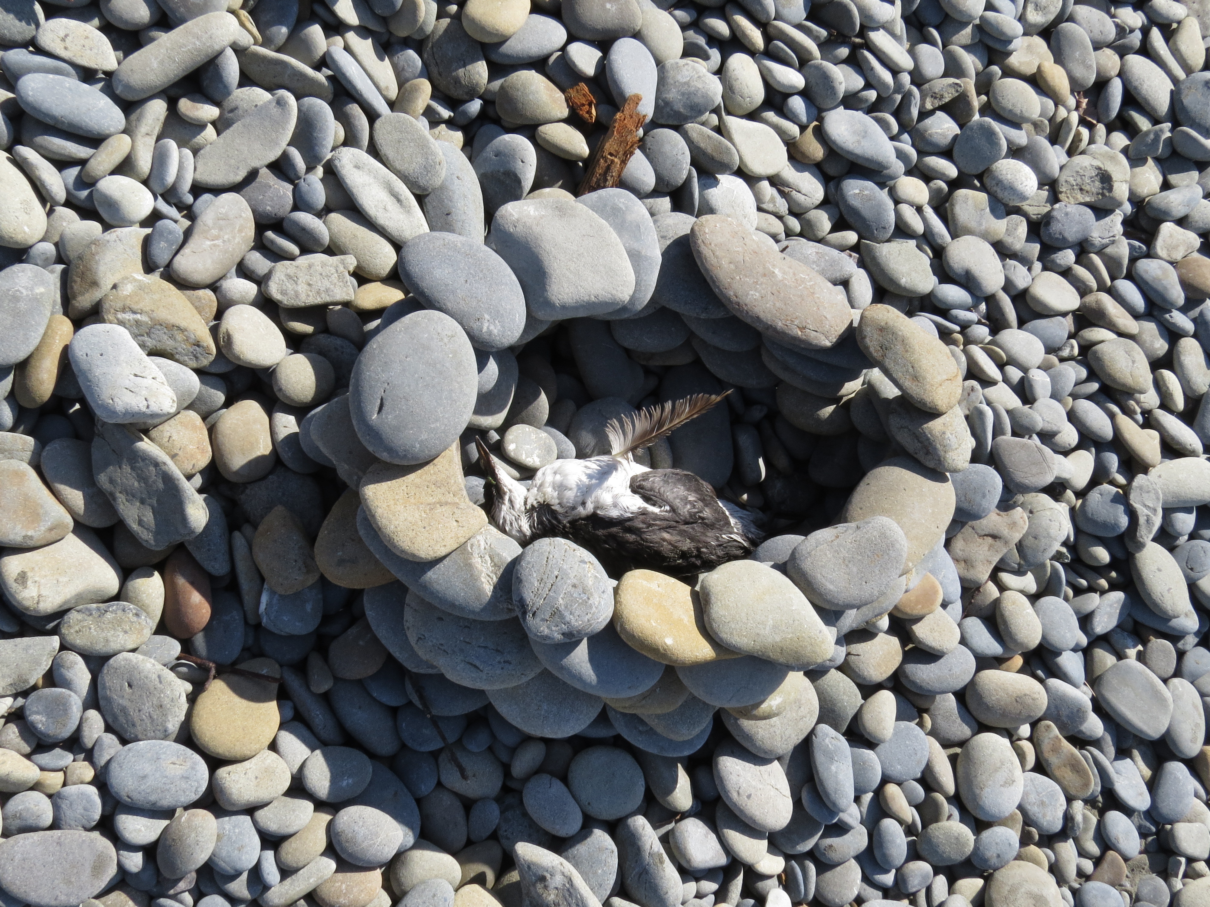
Photo by Lori Anderson, the same Lori who fell into the monkey tree.


