Sue Mani lives in Tucson in the same senior mobile home park I do. A few weeks ago, she announced she’d be having an open house, of sorts. The house she had open for us to view was a doll house.
A doll house?
A year or so ago, Sue stopped by to see a friend, and the friend was watching a TV program about miniatures. Sue became hooked on the program, and a few months later, she said, “I can do that!”
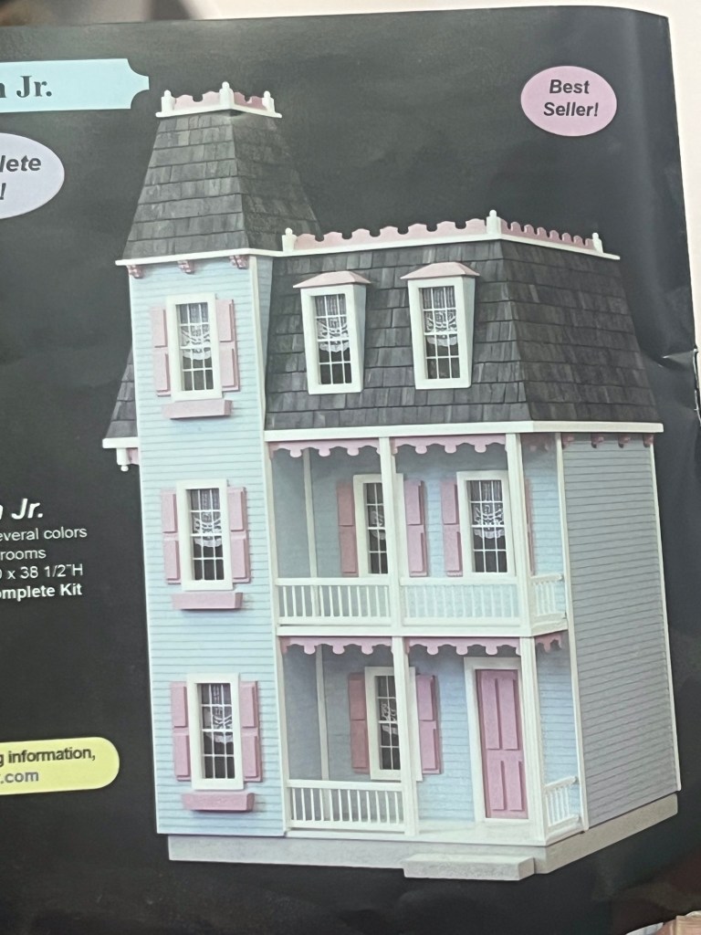
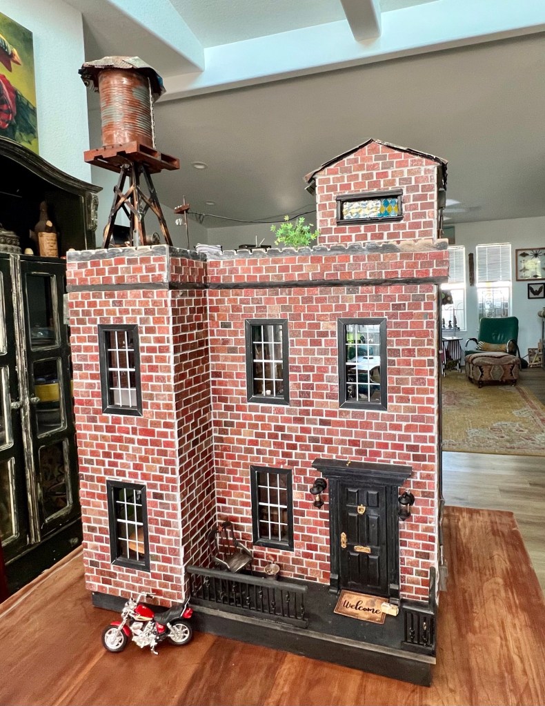
Sue started by purchasing a kit. The kit showed a charming, three-story, Victorian house. But no way Sue was going to follow the plan.
Original kitSue’s version
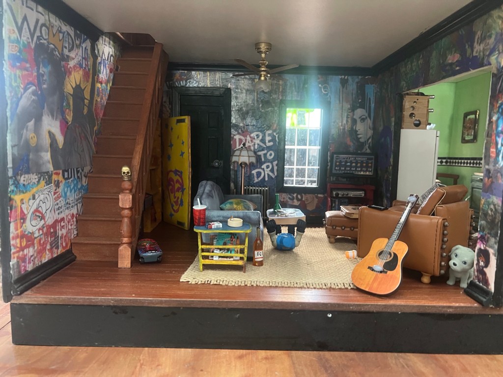
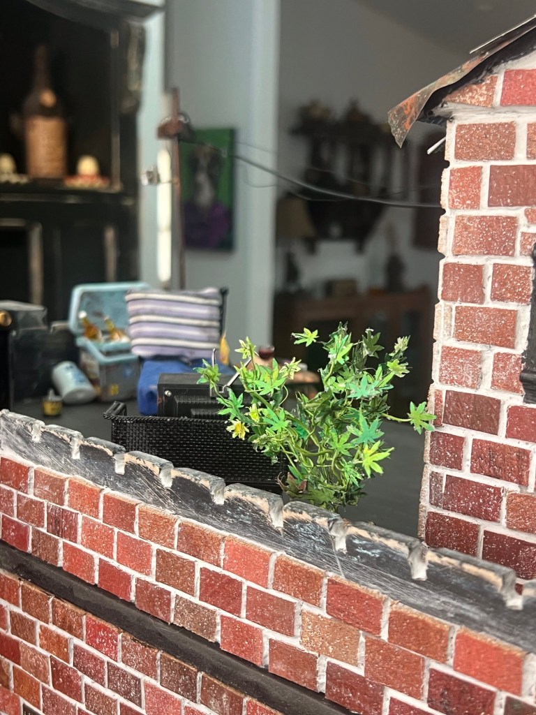
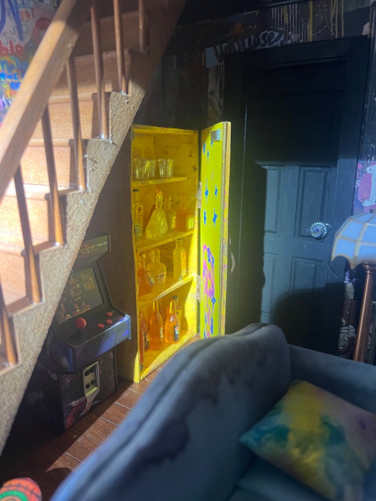
She first thought about turning the Victorian into a crack house and began painting the living room walls to reflect that. But she soon realized she wanted to put some fun and pretty things in the house, and that wouldn’t do for a crack house. She abandoned the initial plan but left the living room walls as she’d first painted them.
The crack-house walls contrast with the nice furnishings.
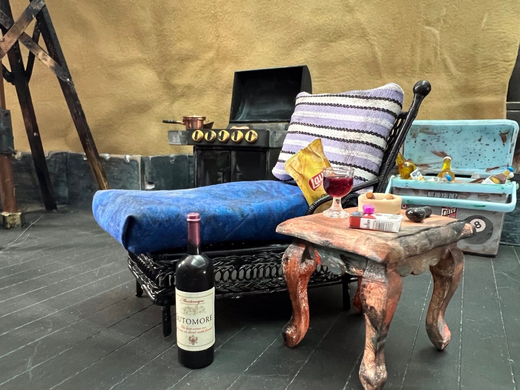
She then decided on a two-story house with a rooftop deck, so she removed the third floor and converted the new roof to a lounge area. She knew she’d need a plant on the deck, and what better than a pot plant? She said it took nearly a week to make all the little leaves and attach them to the wires that served as the plant’s stems.
Lounge area on deck.Pot plant on the deck
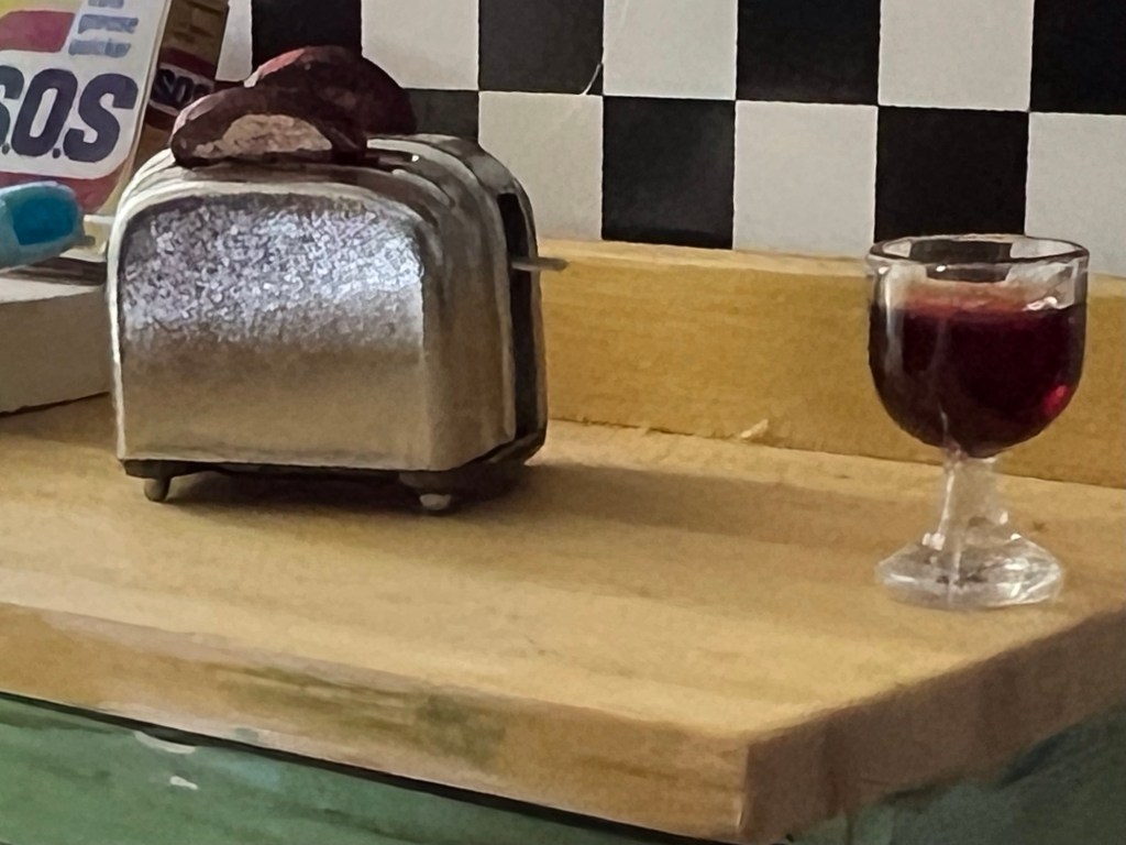
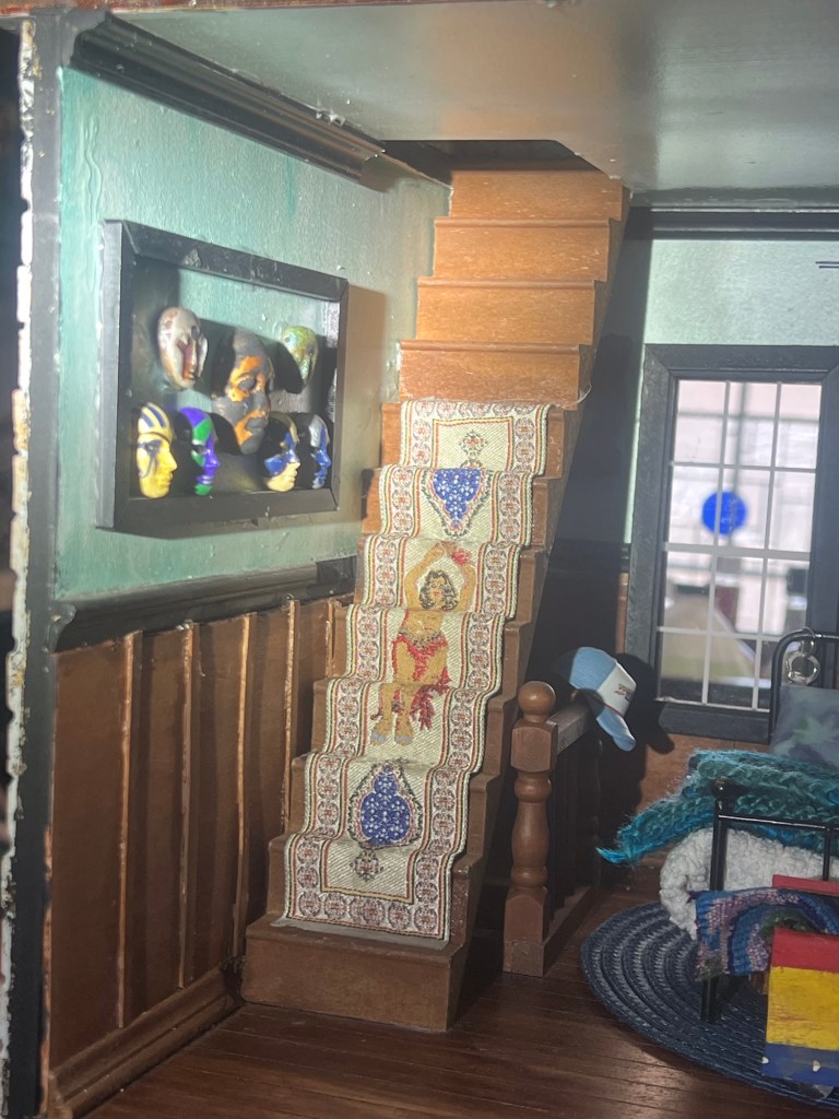
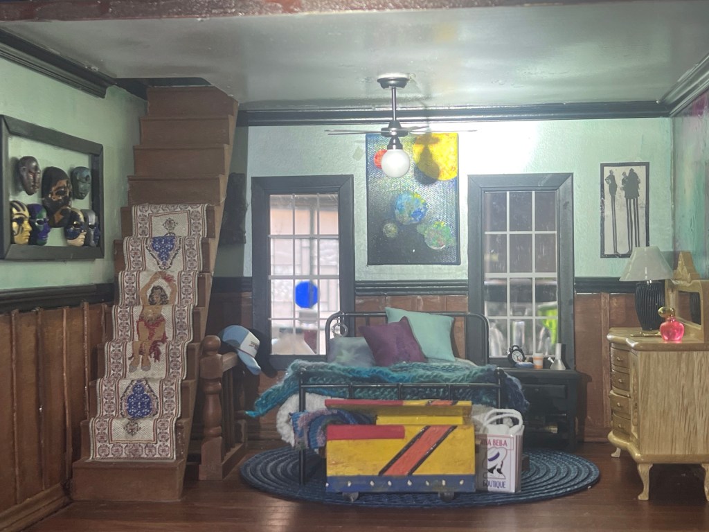
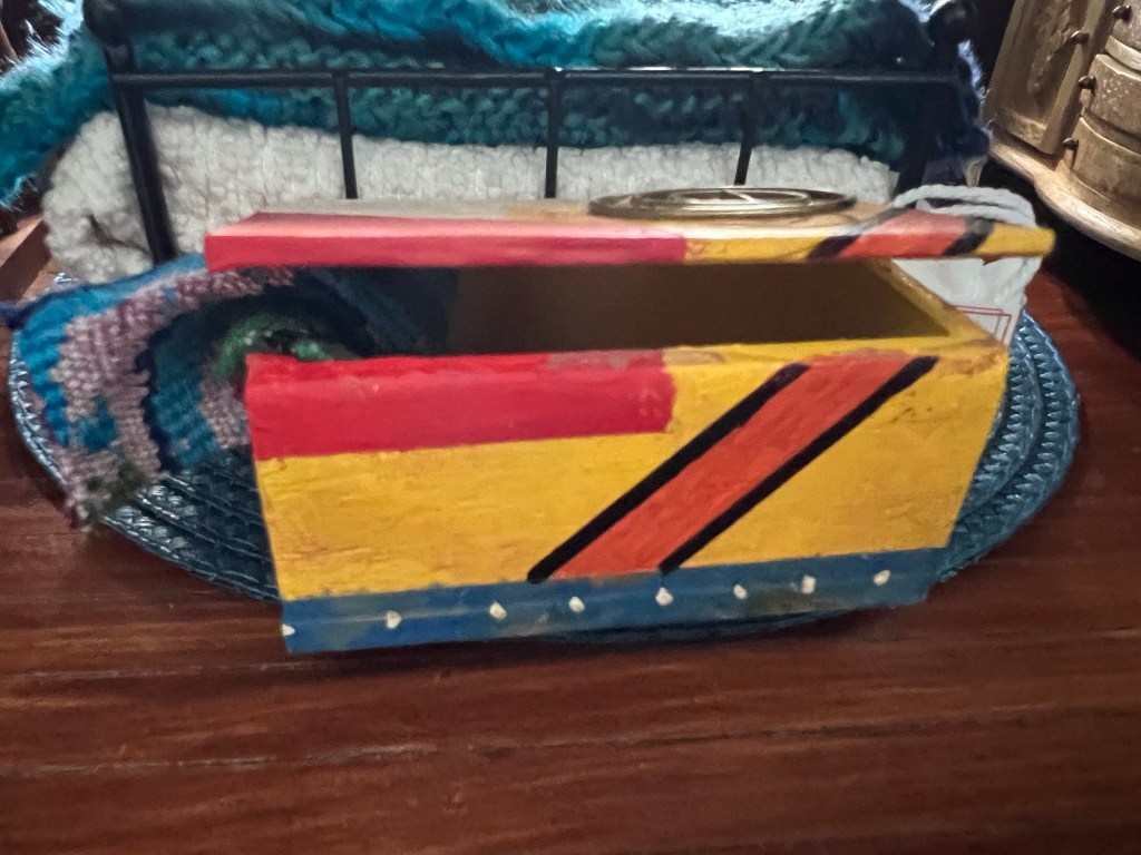
Check out the stairs. They came with the kit, but her dog decided they were chew toys. When she rescued them, the steps were OK but the railings and spindles were not, so she had to re-create those.
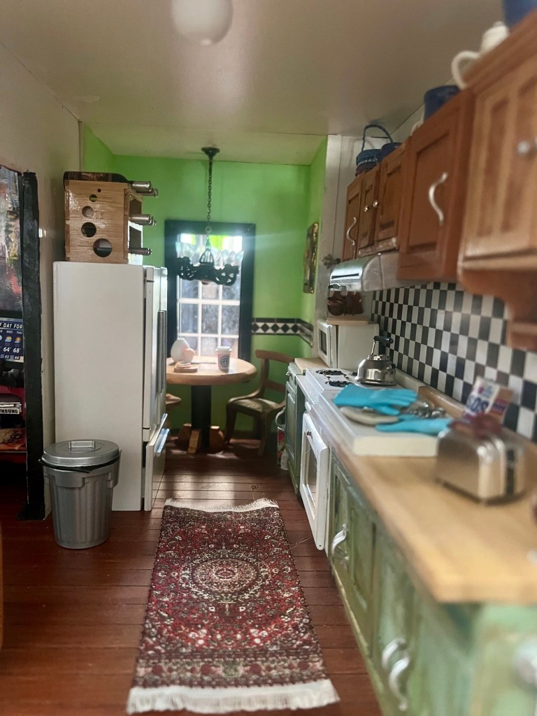
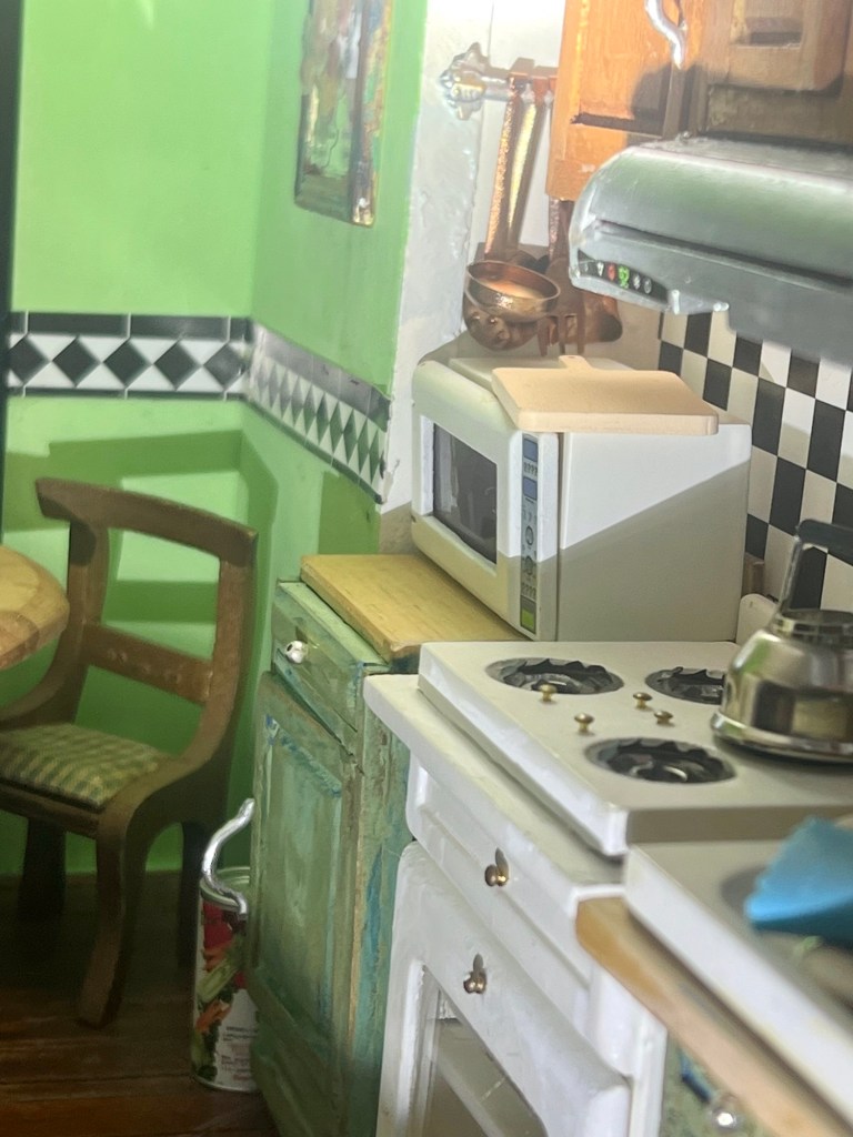
Here are photos room by room plus the deck.
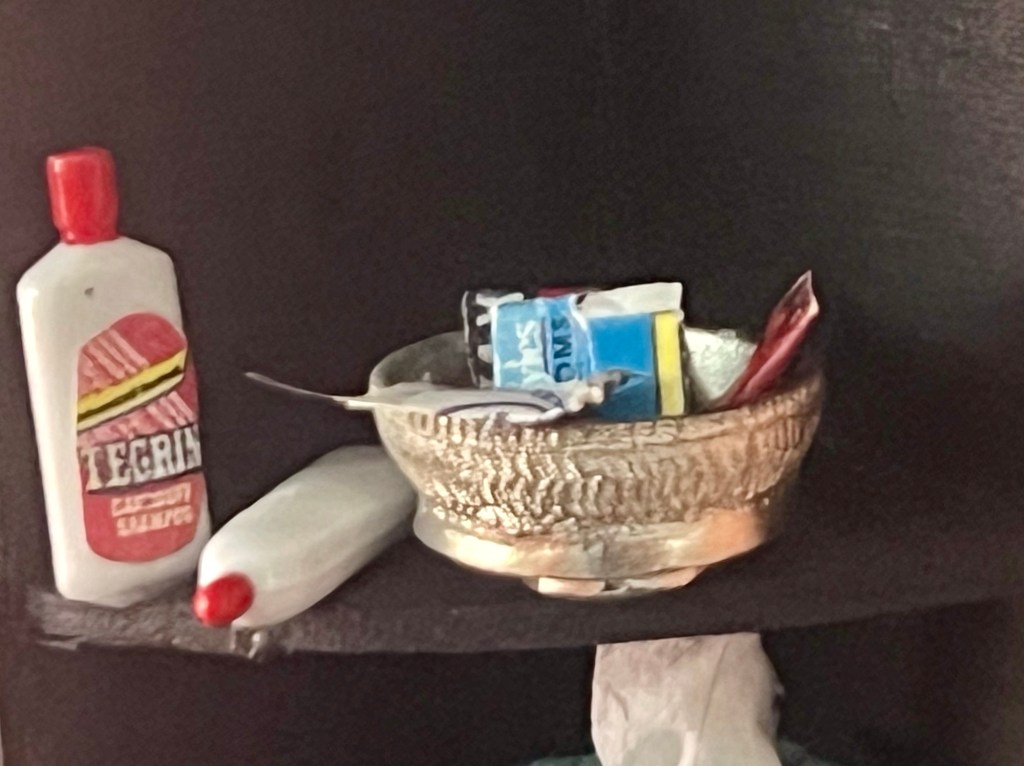
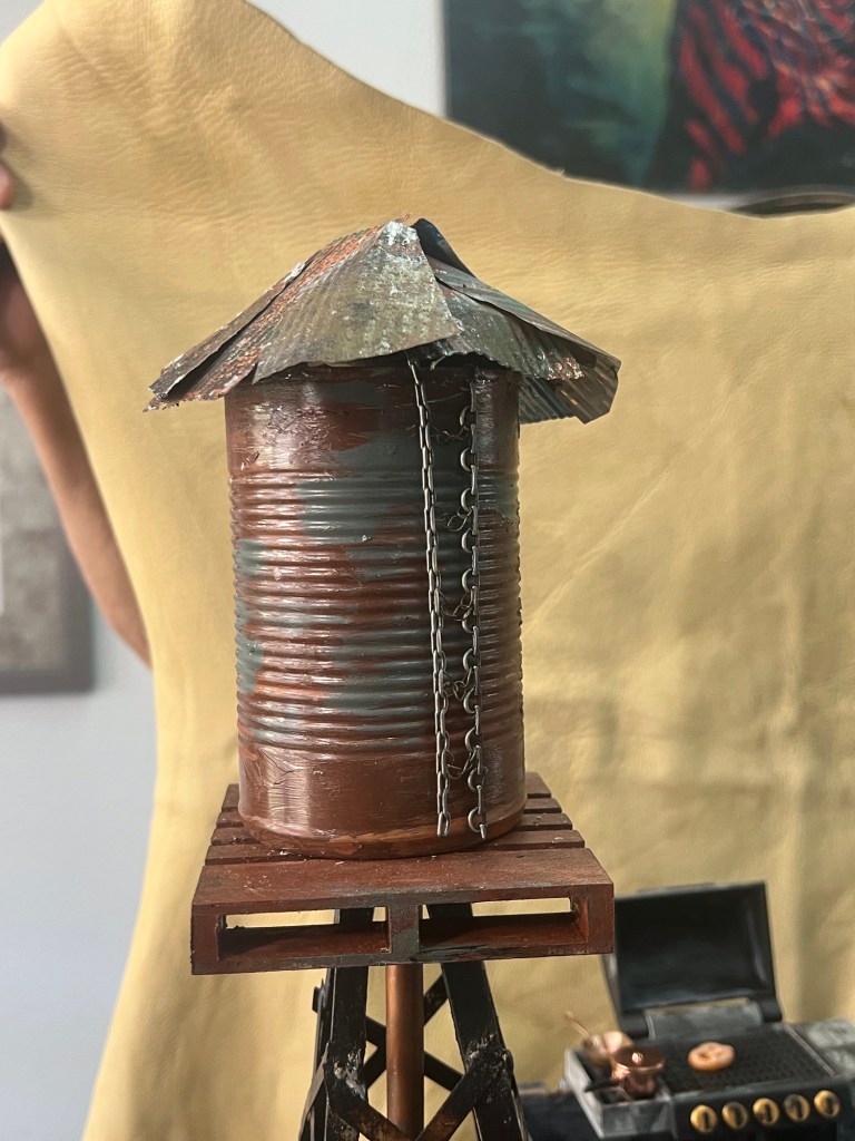
Kitchen detail Kitchen detail Stairs to second floor Living room Living room detail Coffee tableTrunk in bedroom Note that the bowl in the bathroom even has condomsOne side of the houseWater storage
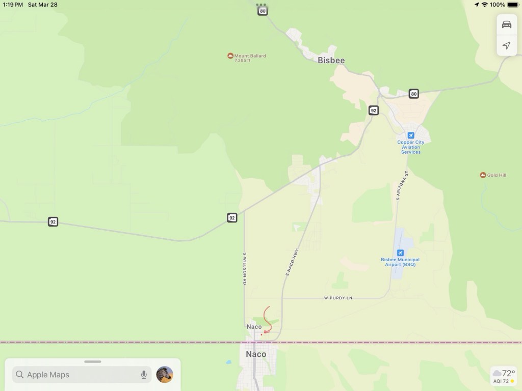
The little red arrow points to a dot where I used to live.
About two months ago, I left my home in the small town of Naco on the Mexican border. I’d lived there or in the area most of the time for 52 years, so it was more of an extraction than a simple move.
Surprising many, I left my large home on 3/4 of an acre with vistas in every direction for a city, to live in a mobile home community. A senior mobile home community.
A kind of place I swore I’d never live in, on both counts—no mobile homes, no senior communities. And yes, I’m coming to the dog part.
Not from my yard, but from very close to it.
I remember when my parents moved into a senior community. I thought it was good for them, but my father wanted to leave. “It’s only old people here.” I feared I’d have the same reaction.
But amazingly, I like it here. A lot.
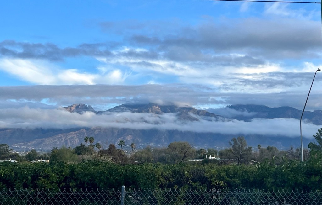
One reason I like it is I found a spot with a view.
At the bottom of the photo, you can see the fence in my back yard.
Another reason is there are interesting people and some interesting, and occasionally very interesting, activities. Like dog painting.
I get every message that goes out to community members and look at them all. When I got the one that said “dog painting”, I knew I had to go.
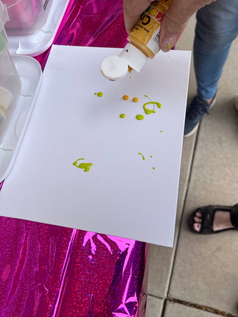
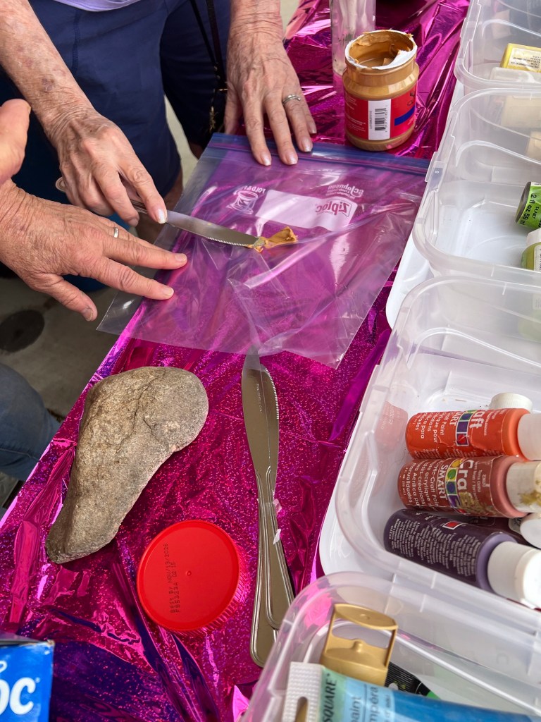
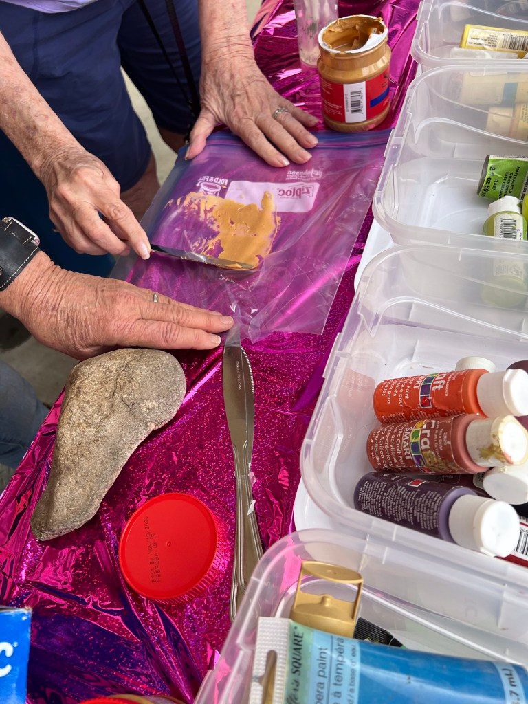
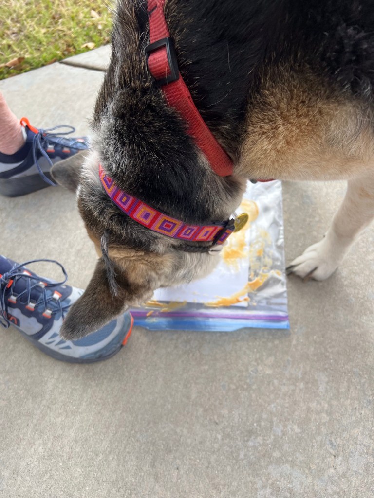
I showed up about 10 minutes before the event was to start. A woman had a table set up with small containers of acrylic paints on it. There was also poster board, a package of gallon-sized Ziplocs, and jars of peanut butter.
What did dog painting even mean? Painting dogs? Were dogs going to stand there and let us paint them, cover them in non-dogly colors? Or was it painting portraits of dogs? No, neither one. The dogs were going to do the painting.
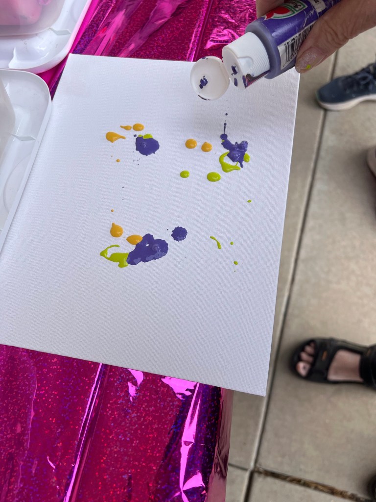
The first dog to show up was Bailey. Bailey’s human chose a few colors of paint to put on one of the pieces of poster board. She and the others were all warned not to use too many colors because the painting would turn muddy.
Then, peanut butter was plopped onto one side of a Ziploc bag and smeared around. The poster board with paint was slipped inside the prepped plastic bag and it was sealed.
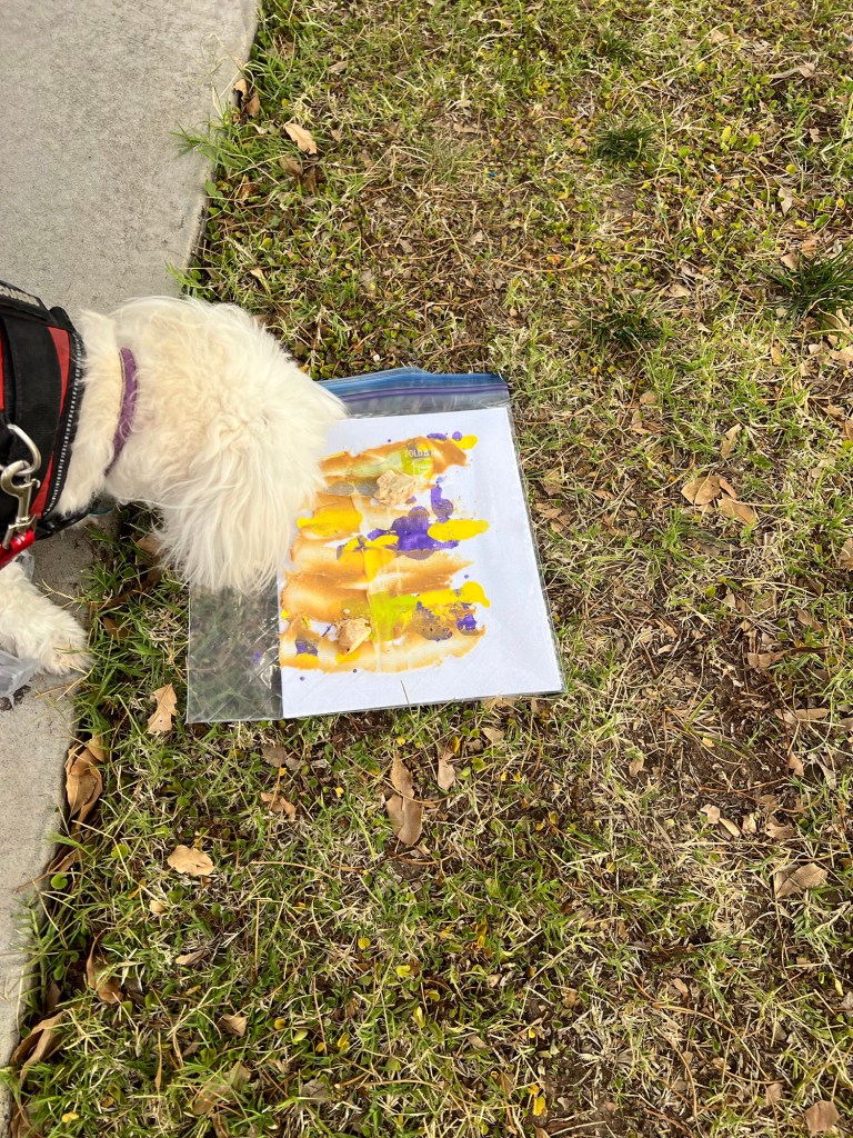
Bailey’s human set the closed Ziploc on the cement patio. The idea was Bailey would lick the peanut butter which would spread the colors inside the bag around on the poster board as the dog licked up the treat.
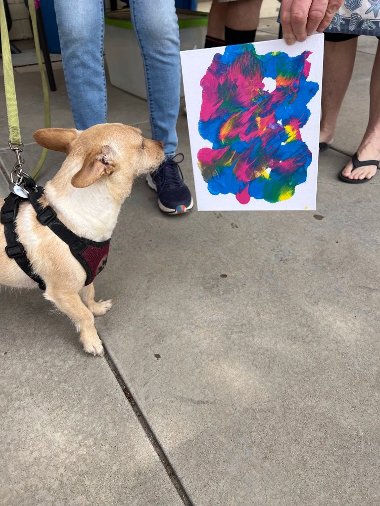
But it turned out Bailey didn’t seem to like peanut butter very much. She basically ignored the art project.
But her human mom was prepared. She knew Bailey hadn’t had peanut butter before and wasn’t sure if the doggie would like it. Mom had a little baggie of cubed chicken with her. She sprinkled chicken pieces on top of the peanut butter, and Bailey went at it.
Bailey at work
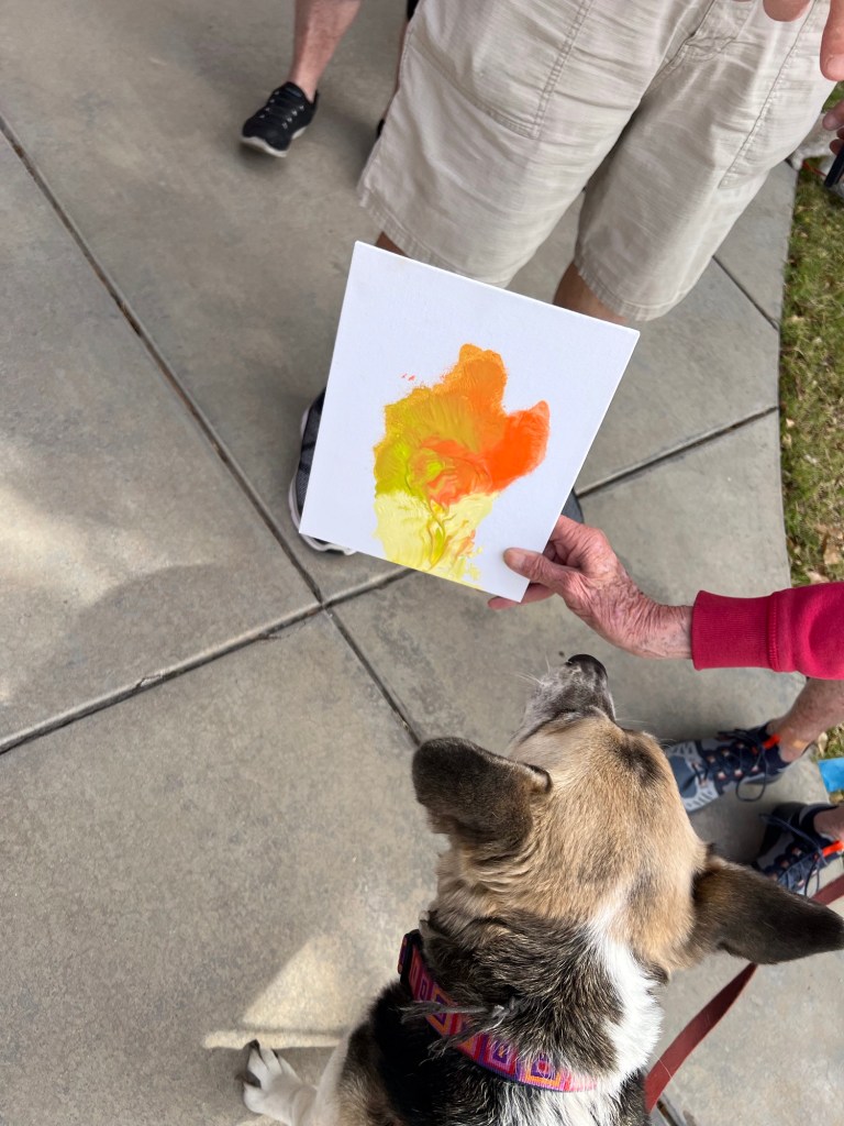
Soon other dogs, too, were busy with their art.
TractorSweetie Pie
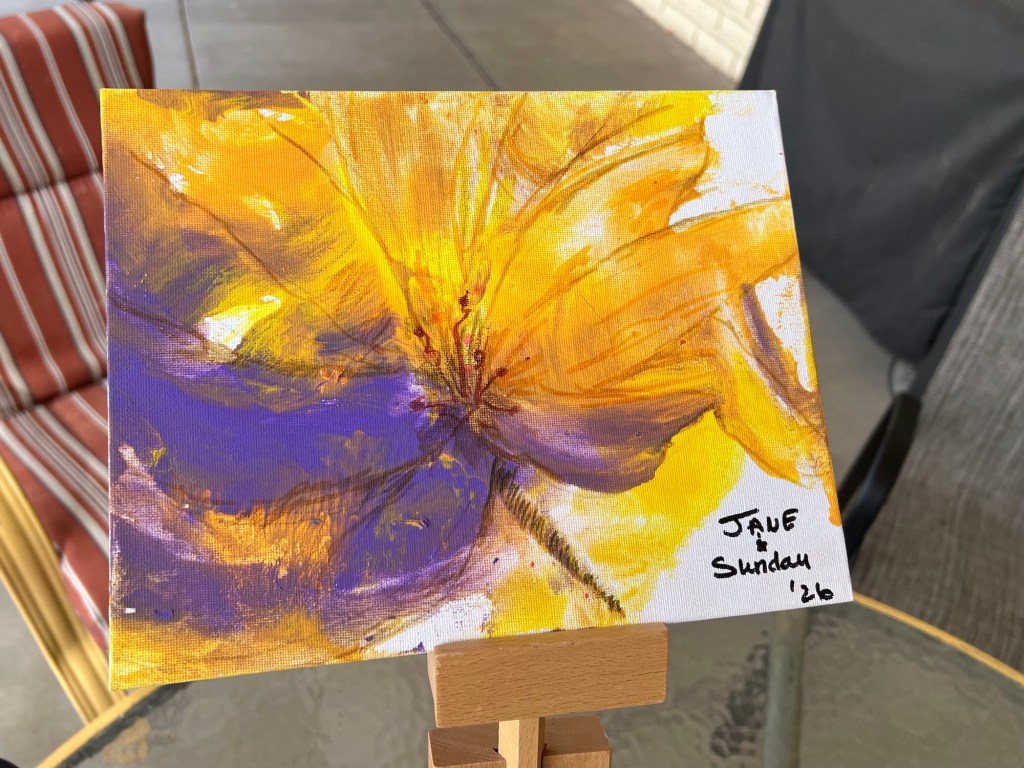
And then, voila! Finished artwork.
The artists studied their finished products.
A good time, and easy for anyone with a dog to try. Have fun!
By the way, you can enhance your dog’s piece, should dog allow that.
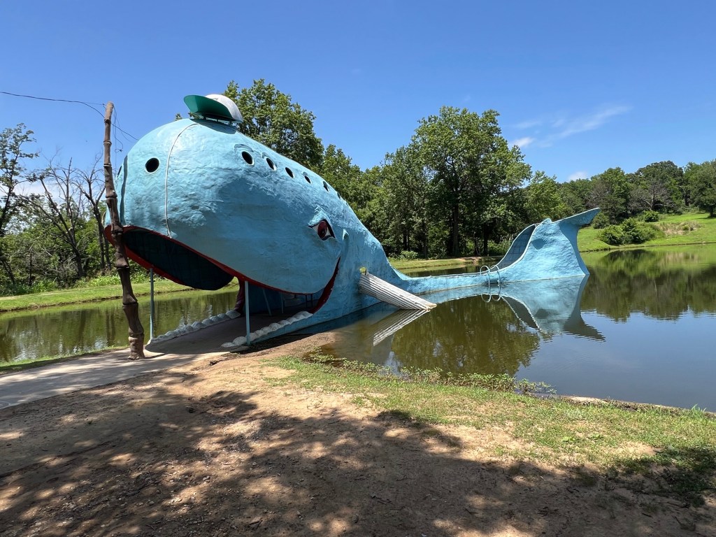
I’d just come home on Sunday, July 13th, from a seven-week road trip, camping in my car. I’d taken back roads to Louisville to see my family, and then we all went up to Michigan for a vacation. I drove north separately, leaving a few days earlier than the others, again taking back roads.
On my way to Louisville, I visited interesting places and took photos of oddities.
Sculpture of a rattlesnake tail, Rodeo, New MexicoThe Pink Elephant, Las Cruces, New Mexico
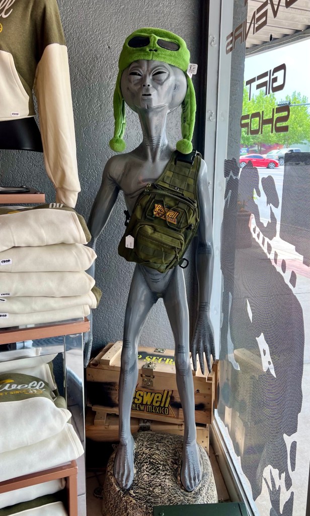
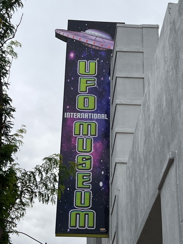
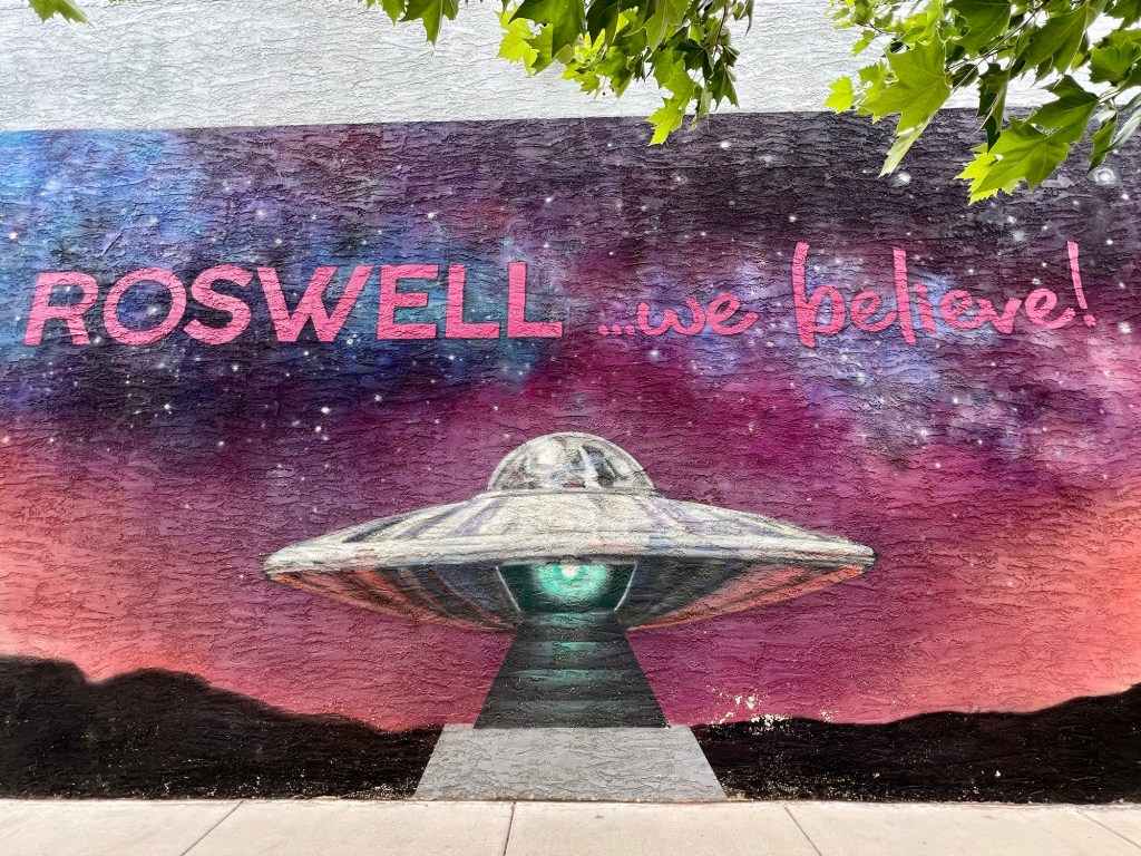
I also visited Roswell, New Mexico, home of the “Roswell Incident” in 1947.
Some say it was a UFO and there were extraterrestrials. The US Army says it was a high-altitude balloon. However, the army also announced that a disk was recovered.
Ever since, people have talked about alien invaders, and Roswell has run with the concept. The town has become a tourist mecca for those who love the idea of aliens and UFOs.
Even the restaurants celebrate UFOs
I had no idea my life was going to change in under two months.
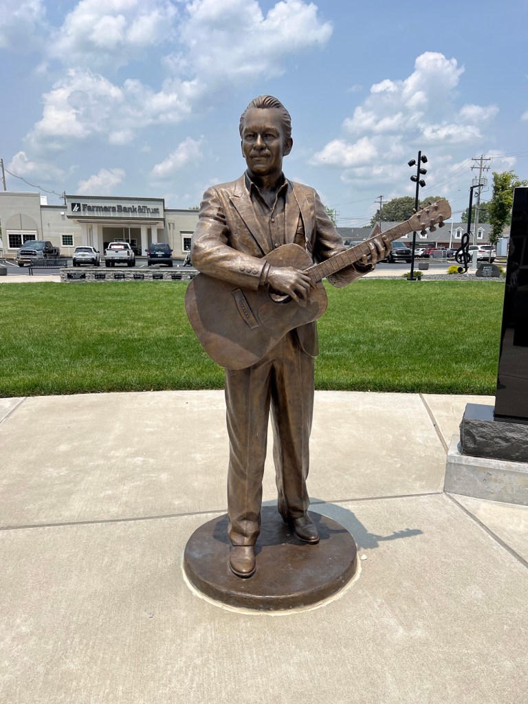
In Oklahoma, I took stretches of old Route 66 and also visited the hometown of famous folk musician Woody Guthrie.
Woody Guthrie statue, Okemah, Oklahoma
In Kentucky I saw statues of the Everly Brothers (John and Phil), a famous duo in the late 1950s and early 1960s. I saw a statue of John Prine, a folk musician I loved, sadly taken by Covid in 2020. I also spent time in John Prine Park (🎶 down by the Green River where Paradise lay 🎶) in Muhlenburg County.
Don and PhilA young John PrineAcross the Green River from Paradise, Kentucky
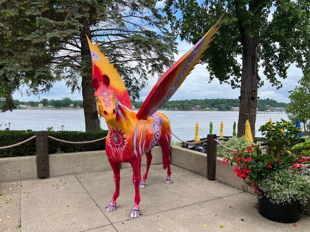
On to Louisville.
Pegasus along the Ohio River
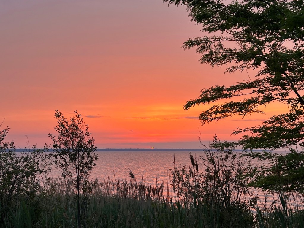
Then Michigan—more oddities and lots of beauty.
Overlooking Saginaw Bay, Lake Huron, in Michigan
Still no indication my life would change so significantly.
On the way home, more back roads, and some wonderful stretches of old Route 66.
Aston, Oklahoma Catoosa, Oklahoma
In New Mexico, I made two visits to dear friends and drove the famous musical highway, a part of Route 66 near Albuquerque. Mini sped bumps in the road were designed so drivers who roll down the road at exactly 45 miles an hour hear “America the Beautiful”. What fun!
I made it home Sunday and was too exhausted to unpack my car. Exhausted but unsuspecting. On Monday I was too lazy to haul things into the house.
Then Tuesday.
I go to a coffee group on Tuesday mornings. A couple has graciously opened their home two mornings a week to anyone who wants to come for coffee and conversation. I hadn’t been there in nearly eight weeks and was looking forward to seeing the group.
I was driving up a rural road, and for some reason, still unknown, my blood pressure suddenly crashed, and I blacked out.
But my car continued on up the road another quarter to half a mile. It stopped when it slammed into an electric pole.
I don’t know how long I was unconscious. I do know it took the ambulance 10 minutes to arrive after they were notified, but I don’t know how soon after the wreck someone called for help. I was just waking up to someone knocking on my window as the ambulance pulled up.
When the EMTs reached me and got me out of my car and into the ambulance, my blood pressure was 70/40 and they figured it had come up because I’d become conscious again. I’d only been conscious for about one minute.
Off to the ER I went. I had no idea how bad my car was nor how bad I was.
I called my sister and a few friends, and soon there were three visitors in my room. The nurse mentioned a few times that only two people were allowed, but none of the three friends would leave. Yay friends!
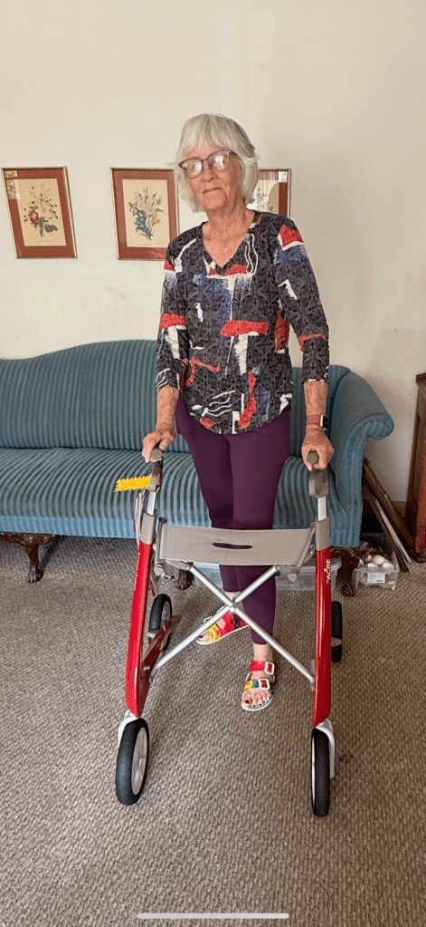
Bottom line: The doctors don’t know why my blood pressure crashed, so I‘ve decided to never drive again. I still have a license, but I refuse to put anyone at risk. Every day, I am incredibly depressed because I can’t drive. Can’t travel. Can’t car camp.
Another bottom line: I injured my head pretty badly, I guess, because I’m still wobbly and off-balance and can’t go any distance at all without a walker. Even in the house, I stumble and crash into walls. Every day, I am incredibly frustrated.
Yet another bottom line: My car was totaled. I’d hit that pole at between 45 and 50 miles an hour.
If I’d hit the pole about 6 inches closer to the center of the car, the engine would’ve landed in my lap and I wouldn’t be here today writing this. Every day, I am incredibly grateful.
Depressed. Frustrated. Grateful. Ever day.
I got new wheels.
I can’t live in a rural area with very poor bus service. There’s no bus in the evening and none on Sunday. It’s minimal on Saturday. It only comes to my small town every other loop on weekdays, so if I take the bus to the grocery store, I can’t come home for about 2 1/2 hours.
It’s now totally unworkable here for me. So I put my house up for sale.
It sold! Inspection is completed and the loan appraiser will be here in a week or so (we hope). I’ve already found my spot in Tucson and will stay with a close friend until my new-to-me house is ready.
I’m heartbroken. This area has has been my home base for fifty-two years, and this house has been my home for nearly twenty two. But I have to leave.
My house is old and worn and needs work. Since it is out of town and not in the desirable area of Bisbee, the house didn’t sell for much. I’m not able to afford another house or pay the outrageous rents here, so I can’t stay and wouldn’t anyway because of the transportation issues.
So I was off to Roswell. If I couldn’t find weird there, I likely wouldn’t find it anywhere.
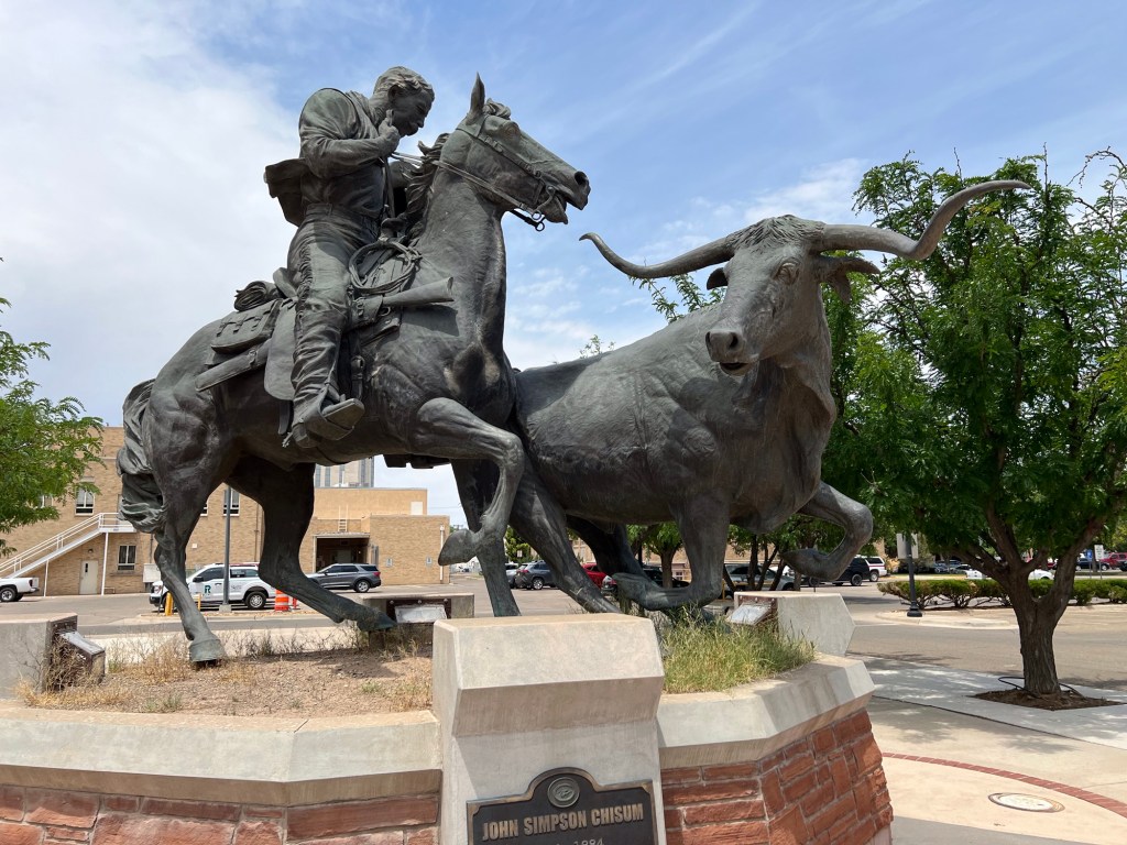
I pulled into town and found a shady place to park. The first weird thing I spotted wasn’t very weird though. It was sort of a rocket-like structure that had once been part of a slide. Nearby was a statue of John Simpson Chisum, “Cattle King of the Pecos”.
John Chusum
What follows is a smattering of photos I took in downtown Roswell.
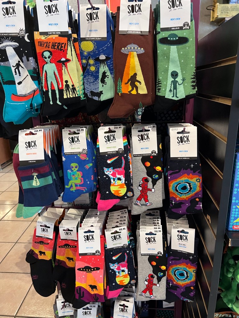
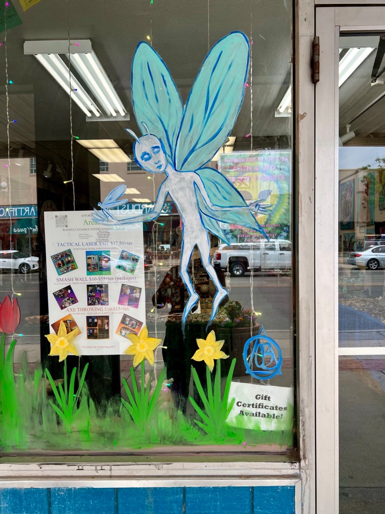
Lots of sock choices! But I didn’t get any.Alien fairies?I didn’t go in. Not enough stand/walking time left.My favorite. Even chickens will get beamed up!
Then on to Portales where I found a collection of windmill parts.
In Clovis, I found a statue acknowledging the Clovis People as the earliest ones on our continent, at least as of what we know today.
And then I settled for the night in Hereford, Texas.
I thought I had, anyway. Soon some jerk was honking his horn regularly. Then some 20-somethings came in and started drinking. I figured it wasn’t a good place for me for the night and ended up, unfortunately, at a Love’s. At least it was a safe place with clean bathrooms and the coffee was ready in the morning.
By 8:30, I was on the road. Soon I was cruising east on US Route 80. Route 80 is an historic highway, one of the first transcontinental roads in the country, once running from San Diego to Tybee Island, Georgia. Unfortunately, like historical Route 66, it’s been chopped up, with some parts merging with interstates and some parts simply disappearing.
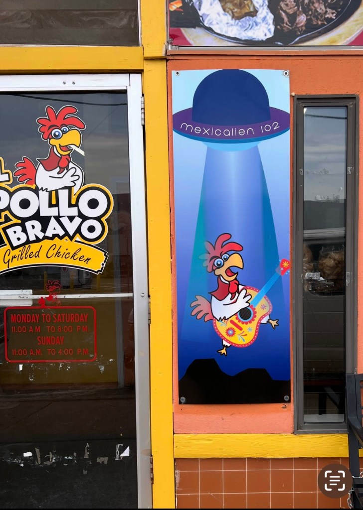
The first leg of my trip was the Weird Things portion. Admittedly, not all the sites I stopped at were weird, but at least they were unusual or special.
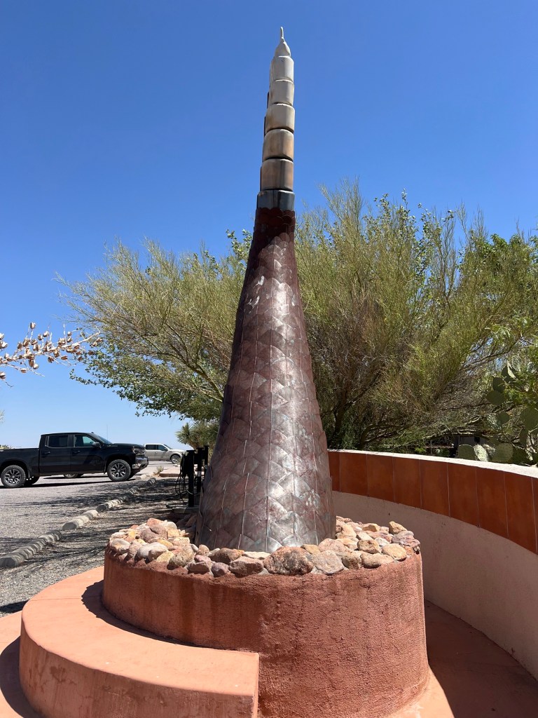
My first stop was in Rodeo, New Mexico, at the Chiricahua Desert Museum. If you’re ever in the area, it’s a great stop with one dollar coffee, a desert museum, and a special snake section to the museum.
What I wanted to see was outside. Just south of the building stood a 15 foot tall rattlesnake rattle fabricated from metal.
Then I went inside, grabbed a quick coffee, and continued north on Highway 80. My second stop was midway between the town of Rodeo and Interstate 10 on the east side of the road. That’s where a favorite tree of mine grows.
The entire Southwest is in serious drought. Driving through the valley, I saw so many dead trees and shrubs. But there, growing out of solid rock, was my tree. I have no idea how it survives. I’ve been watching it grow for around 40 years.
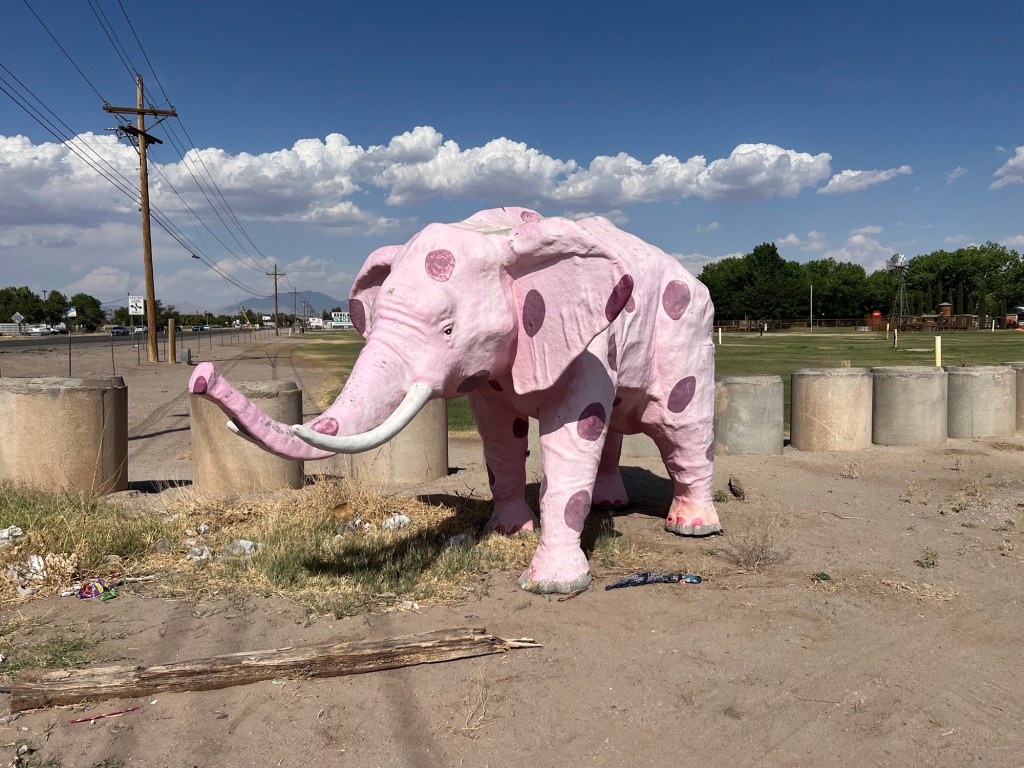
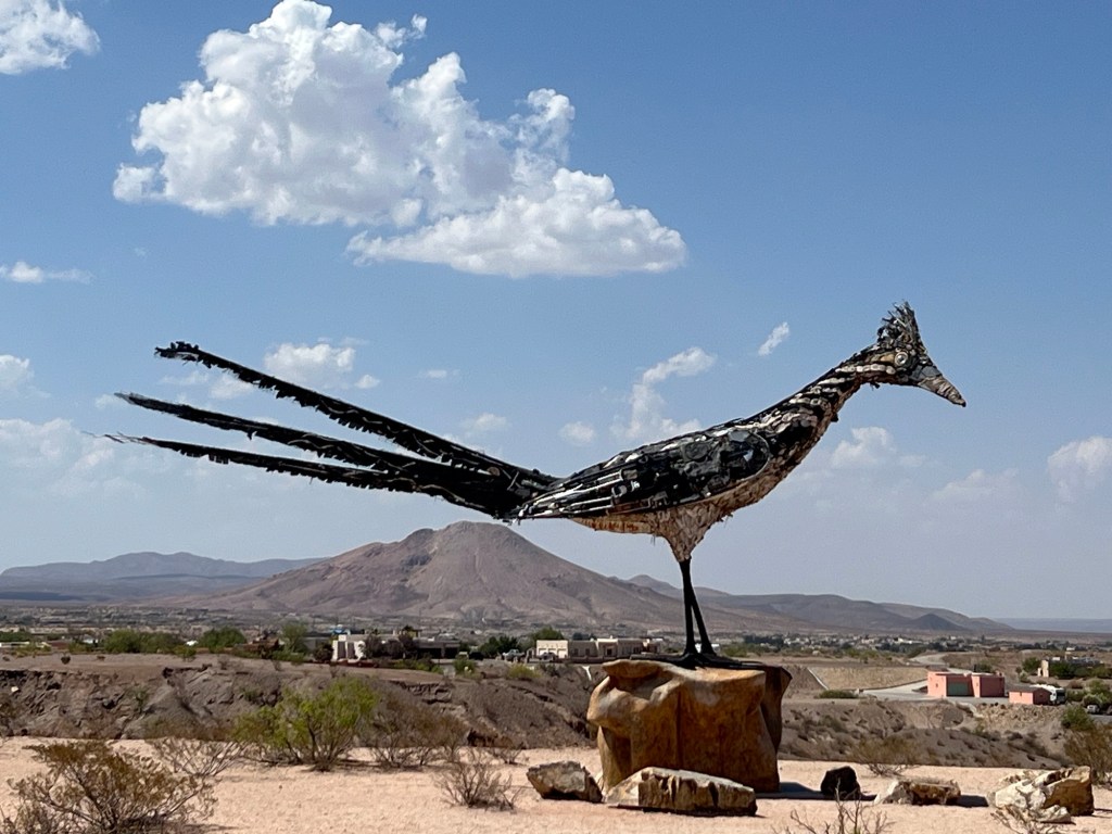
After a quick green chile cheeseburger in Deming, I continued to Las Cruces to see the Roadrunner statue made of scrap metal.
In Las Cruces, I also found the world’s largest chile, a pink elephant, and then in Veterans Park, a memorial commemorating the Bataan Death March. For those who don’t know about it, during World War II in the Philippines, cornered Allied troops surrendered. 78,000 men, US and Filipino, were forced to walk 65 miles to a Japanese prison camp. It’s estimated that around 10,000 of those men died during the march.
This is in front of the Big Chile Inn and Suites.
I continued on US Highway 70 to White Sands National Park. Long ago, I got my Senior Parks Pass there. Back then it was only five dollars. Probably the best five dollars I’ve ever spent. It’s gotten me into so many national parks for free and I’ve gotten discounted camping in all of them I’ve stayed in.
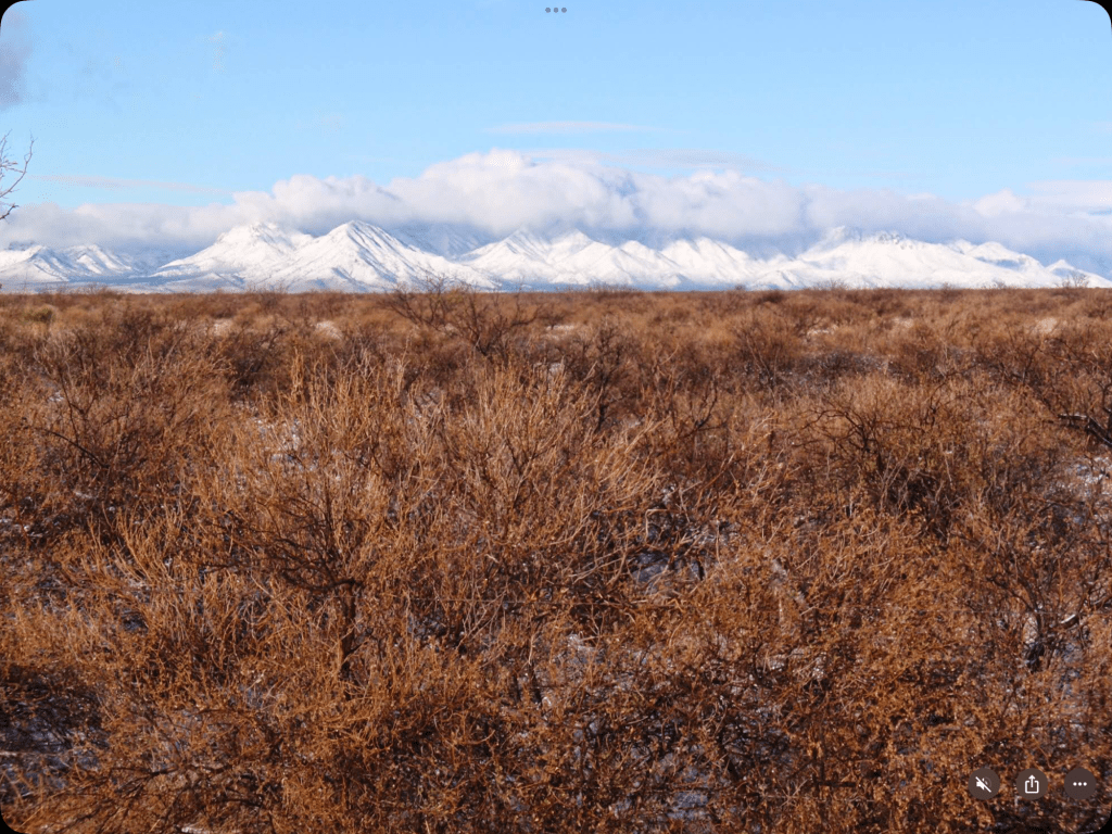
I settled for the night outside of Alamogordo in a wonderful free spot near the mountains.
The mountains to my eastIt was a good sunset spot!
In the morning, I decided to go up to Cloudcroft just because I’d never been there. On the way I saw an old barn, or maybe it was a garage. The temperature plummeted nearly 20° during this drive up the mountain. Alamogordo has an elevation of about 4300 feet, but Cloudcroft has an elevation over 8600 feet. After a brief visit, I headed back down on a different highway. Then I headed towards Roswell.
I wanted to show you a few shots of downtown Cloudcroft, but my phone has started disappearing photos. I took two in downtown Cloudcroft They were there several days ago, but now they are not. I’ve looked back and found about 20 photos that have disappeared off my phone.
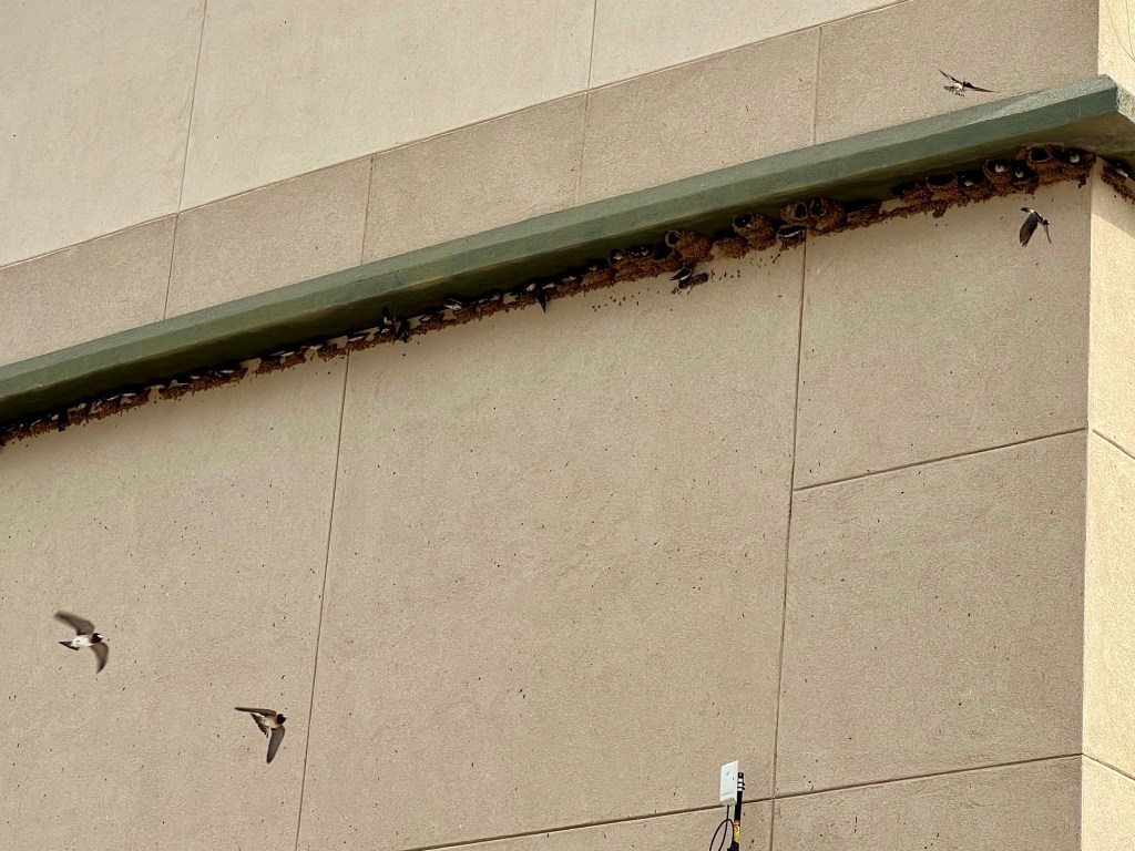
I’ll leave you with this. In Mescalero, I made a quick stop and was startled to find swallows nesting underneath a small overhang on the building. Enlarge the picture and you can see the ledge is lined with birds and nests.
I’ve been quite lax, not posting anything for well over a year.
The last time I blogged was in August of last year when I was visiting good friends in North Carolina. I wrote about our visit to Lake Lure and posted it on August 1, 2023. It was a highlight of my visit to Carol and Aurora.
Since that time, of course, Hurricane Helene hit, and it destroyed the Lake Lure Flowering Bridge and also did a fair amount of damage to Carol and Aurora’s house. Go back to my last blog post to see how lovely the bridge was. Today, it is completely gone.
I completed my six-month-and-one-day roam around the US in late September. I’d even managed a brief foray into New Brunswick and Québec, Canada. I traveled in what I refer to as my mini RV, my Toyota RAV converted into a camper.
Luna Azul, my mini RV, at one of the wonderful spots I found to camp.
When I returned home, I was used up. Shot. I became quite lazy. But somewhere in those months of laziness, I managed to finish up and publish two more children’s books.
My first book, Luisa the Green Sea Turtle/Luisa la Tortuga Verde Marina, came out about five years ago. It and the others are bilingual, English and Spanish. At the end of the book, Luisa laid a nest of eggs.
My second book came out this spring and is a follow-up to the first. It’s called Luisa’s Babies/Los Bebés de Luisa. In it, Luisa’s eggs hatch, and the babies make their way to the beach and head out to sea. H
Screenshot
Now I’ve begun a new series, a travel series for kids.
I need to speak of something else for a moment to explain the backstory for this book.
I live just outside of Bisbee, Arizona. Bisbee is a former mining town, turned hippie town, turned arts and tourist town, turned retirement and tourist town. I will let you guess where I came in.
Bisbee is a wonderful place of about 5000 people that manages to sustain two coffee roasters, two breweries, a community radio station, a year-round weekly farmers market, and an absolutely fabulous patisserie. People who have visited France say the pastries here are as good as or even better than those found in Paris. This little town even has a five star restaurant.
We have murals all over town, music every night of the week, and three to four out of five weekends there is some sort of festival or a special event. A few of the events include a mariachi festival, a rolling art car parade, and a vulture celebration. We draw many tourists from all over the US, and even some from around the world.
With that backstory, I’ll tell you about my new book. It’s called Gramma Takes Me to Bisbee/Nana Me Lleva a Bisbee.
Screenshot
This book tells the story of a little girl named Sofia whose grandmother takes her to visit Bisbee. In it there are a lot of pictures of the Bisbee area, painted by a wonderful local artist named Beca Reyes. Because it’s set in Bisbee, and because there are a lot of grandmothers here, it has been selling quite well.
This book begins a series with Gramma taking Sofia to all kinds of wonderful places. And the “hardship” is I will have to visit these places to write about them. It’s going to be such a hardship that I am chomping at the bit to start traveling!
So now you’re caught up with my life. I’d love it if you catch up with my books, too. They’re available on Amazon in paper format as well as e-book versions, and of course I have them for sale also.
On Amazon, just search for Emilie Vardaman and my three books will come up.
When I was visiting Carol and Aurora in North Carolina, they took me to a flowering bridge. I’d expected it to be like the one I visited in Shelburne Falls, Massachusetts.
I was wrong.
The bridge in Massachusetts is a footbridge. The one we visited in Lake Lure was a two-lane bridge that had been driven over for many years. When a new, nearby route was established, the community created this beautiful walking bridge on the old road.
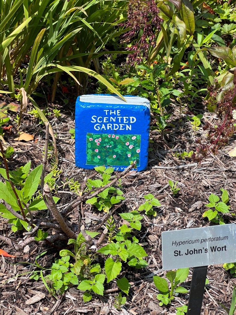
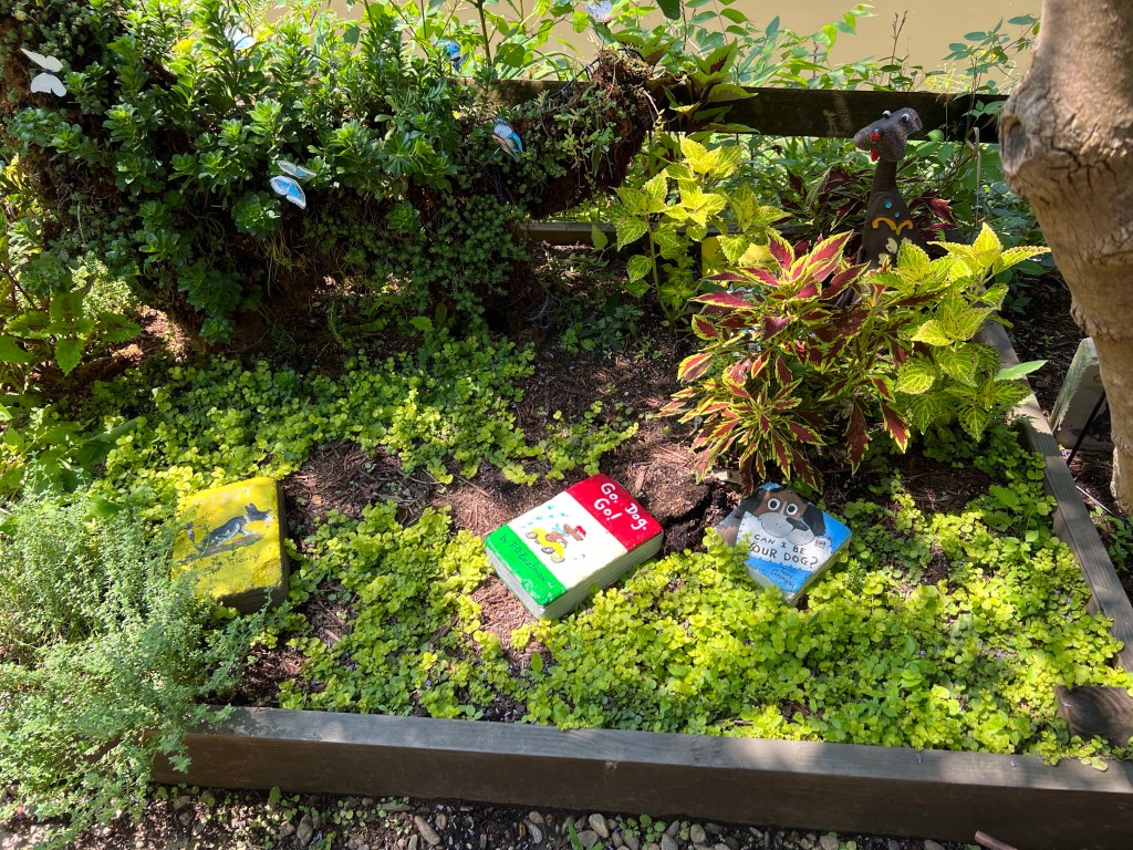
The bridge is divided into separate planting areas, each one distinctive and independent of the others. Blocks painted as books are throughout the garden, each title reflecting the type garden it sits in.
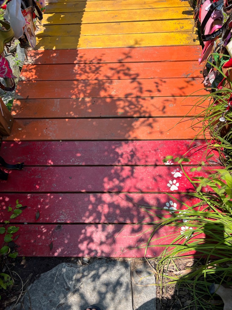
In the Dog Garden
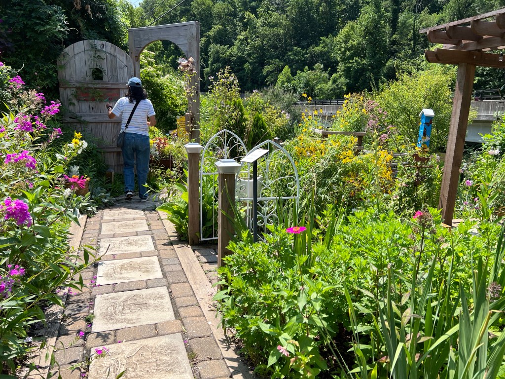
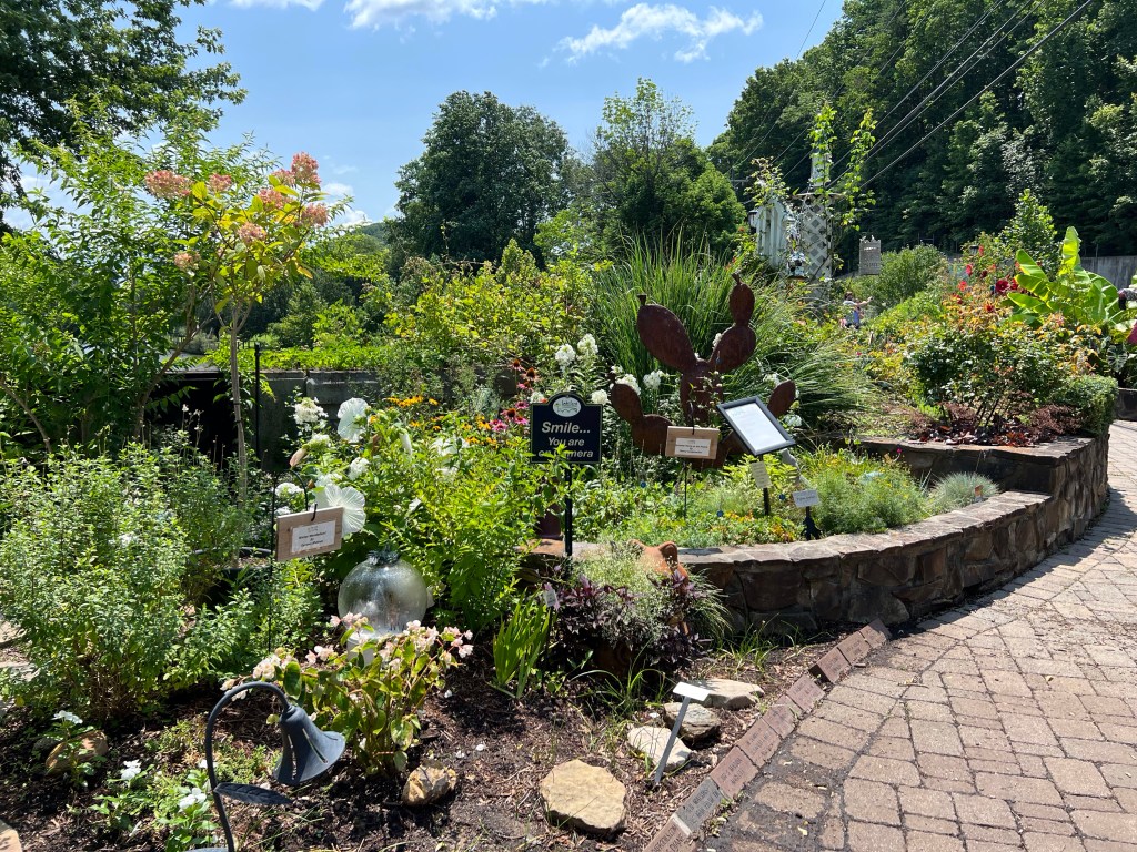
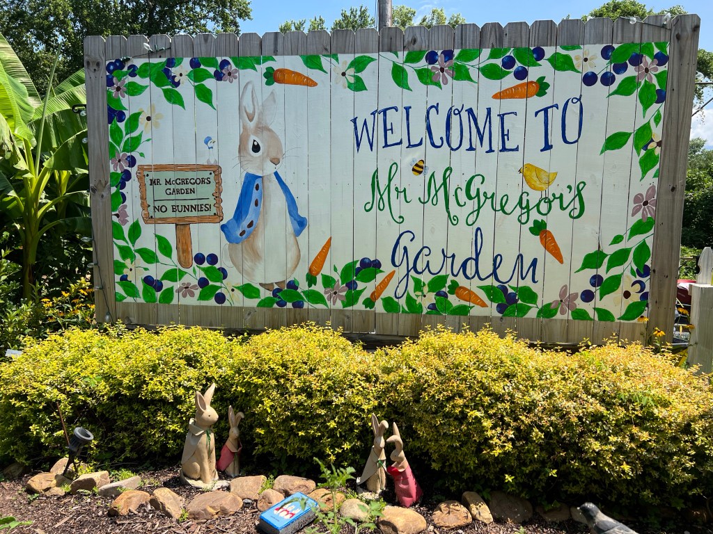
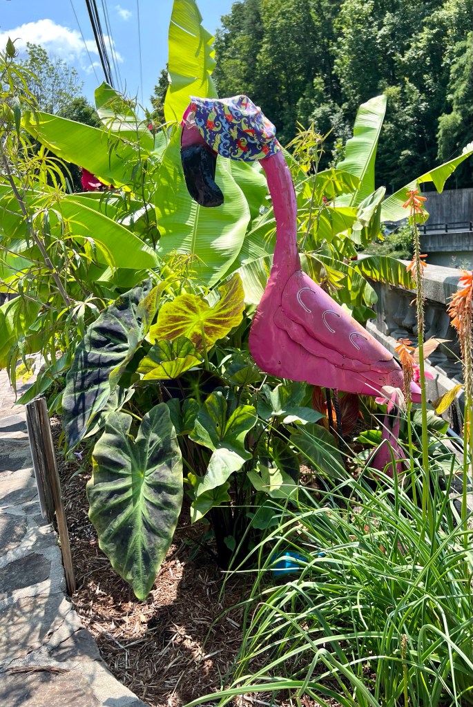
Here are random photos.
Plants are well labeledChildren’s GardenLots of fun, random art
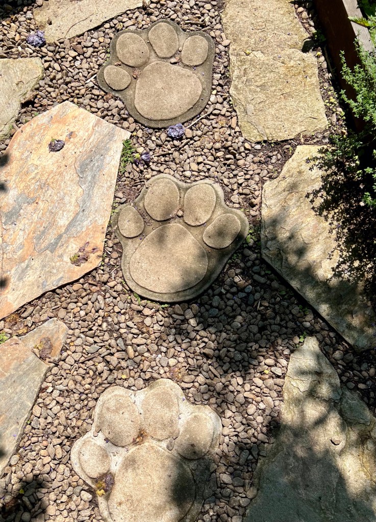
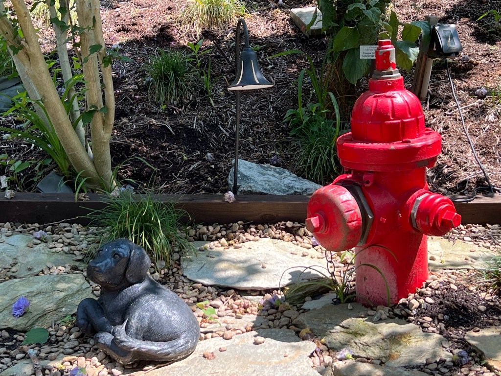
And the most moving part of the garden was that dedicated to the wonderful doggies we’ve lost. The section was called the the Dog Garden, and to get there, we walked across the Rainbow Bridge. Grab your tissues.
If I’d known about this special garden before I left home, I’d have brought Chloe’s collar.Paw prints at the start of the bridge.See the little doggie?Some have left their dog’s favorite toy.
I definitely spilled a number of tears while walking through this section.
After we’d visited the whole garden, I sat awhile and reviewed my photos.
More to come one of these days when I get to it. I’m too busy having fun!
It was in Louisiana that I drove on the interstate the first time.
It was the most direct route to Lake Charles, where I’d planned to stop for my first official beignet treat. Also, I wanted a big state map, and picking one up at the welcome center seemed a good way to get one. Bonus? Beautiful grounds, and a safe, secure place to spend a night.
I headed out in the morning before dawn to be at Stellar Beans Coffeehouse shortly after opening. It was a good stop in that I met a few locals and spent time in great conversation. But I was disappointed in the beignets. I’d looked forward to them so much, but they were a bit heavy and doughy.
Fountain in downtown Lake Charles
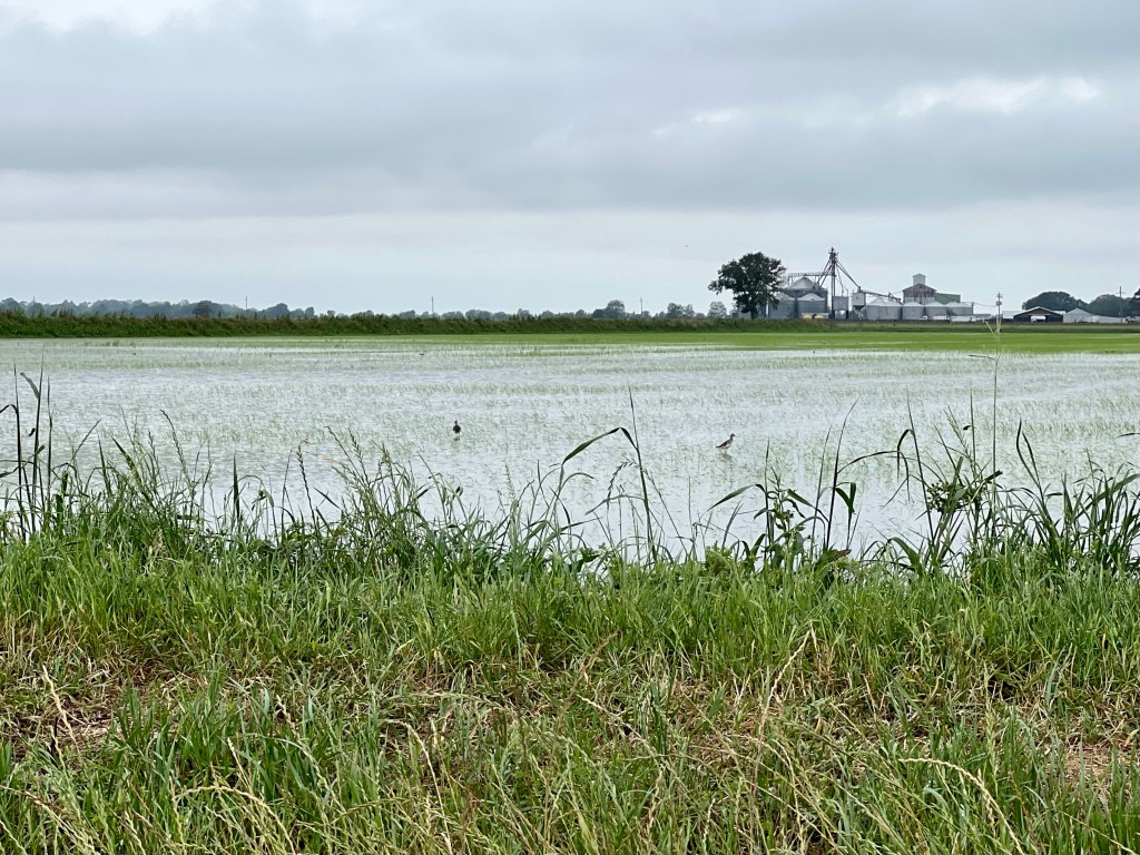
So on to Lafayette via back roads.
Rice paddy between Lake Charles and Lafayette
In Lafayette I’d have my first on-the-road housesit.
I got to my housesit right on time and was happily welcomed by the hosts. The cats weren’t exstatic, but they accepted me, and by the end of the sit, they were quite friendly. I also became friendly with the next door neighbor and donated one of my books to the Shelly Drive Little Free Library.
Cool weather and rain greeted me. Unfortunately, the cool weather stayed the whole time I was there.
While in Lafayette, I dropped down to Broussard to attend part of the Lao New Year Festival.
I’d spent the night just north of St. Augustine. I wanted to get past Jacksonville near the end of rush hour and thought I’d treat myself to good coffee once I’d made it through the freeway and highway mess. So I looked online for a coffeehouse just beyond the tangle of pavement.
There were several spots toward the north end of the city, but one sounded familiar: Bitty and Beau’s Coffee. Why in the world did I recognize the name of a coffeehouse nearly 2,000 miles from home?
I clicked on the link and remembered exactly why I knew it. It had been on the news numerous times, and for sure I was headed there!
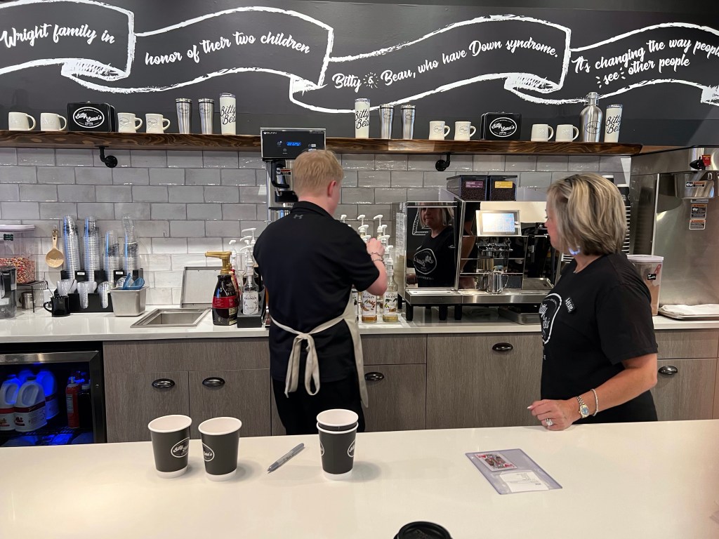
Bitty and Beau’s is a special kind of coffeehouse employing special needs people. As a former special ed teacher and someone with special needs people in the family, this place was right up my alley.
I pulled into a spot right in front of the coffeehouse and went inside to order. A young woman, Lexi, took my order and handed me a playing card, the nine of hearts. She said they’d call out that card when my latte was ready.
Lexi was friendly, polite, and full of smiles while she took my order. She said she loves working there and had been working there since it opend in November of 2022.
Another employee, Andrew, has also been there since the coffeehouse opened. He says likes marking prices on the goods for sale and he also likes that he gets a lot of steps in his day.
I spoke to Lissie Hurst, the owner and manager. Lissie got involved because she’s a former special ed teacher and has an autistic son. She was delighted when she learned she could get a Bitty and Beau’s francishe. She knew it would be a perfect place for her son to have a job.
Lissie makes sure Andrew chooses the correct flavor to add to a coffee drink.
Lissie told me Lexi remembers all the reguals. She can call them by name and even remembers the drinks they order, which is better than I could do.
Soon a third employee came in. Raymond had just visited his brother in Colorado and was proud that he’d flown alone for the first time. He happily showed Lexi and Andrew some photos he’d taken.
Andrew and Lexi check out Raymond’s photos.
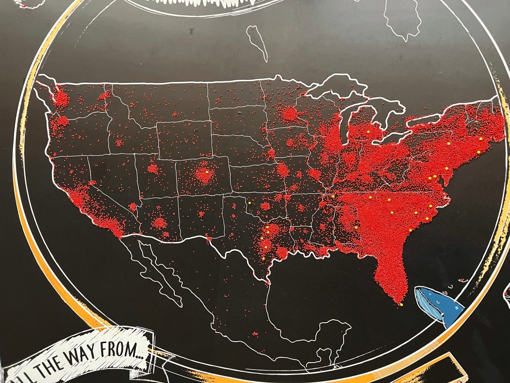
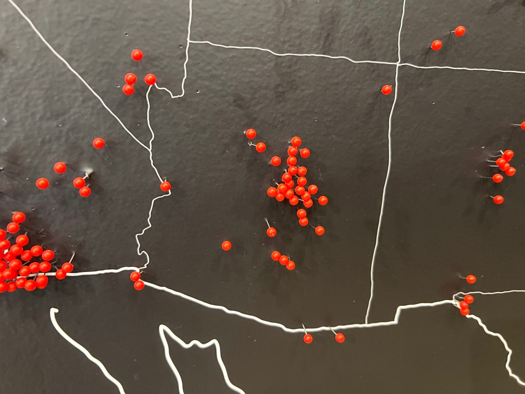
Before I left, I put a pin on the map to indicate someone from Naco, Arizona, had visited the shop. Pins show there have been visitors from every US state plus Canada, Mexico, and countries in Central and South America as well as Europe.
Yellow pins indicate locations of Bitty and Beau’s coffeehouses.
A pin for Naco!
After I’d finished my latte, which was very good, and finished chatting with the employees, I headed on north.
A week later in Savannah, I stopped at another Bitty and Beau’s. Jeff Sanders is the manager and has been with the company for just a month and a half. Emelda has been there since it opened in 2019 and says she’s the one who trained Jeff.
Jeff’s another former special ed teacher who got frustrated that his students aged out of high school and there were no services or jobs for them. He feels good about his move to manage the Savannah Bitty and Beau’s.
Max has also been at the coffeehouse since it opened, and he confided that he helped train Jeff too. He likes the job because, “It helps people like me.”
The store has fourteen employees including a shift supervisor who has a develpmentally delayed family member.
Jeff said employees here, like the ones in Jacksonville, remembered the names of the regulars as well as their favorite drinks. He said in addition to the regulars, a number of tourists happen to wander in, and hopefully, they leave slightly changed.
He was delighted to tell me that just three weeks previously, two employees had gotten married!
And here, I also added a pin to the map.
Bitty and Beau’s, “A Human Rights Movement Disguised as a Coffeeshop.”
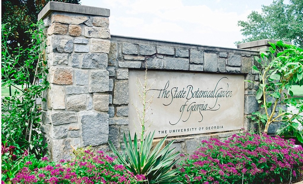
I wanted to roam a bit around Athens, Georgia, so I headed to Google looking for free things to do. One of the most highly reocmmended on the ‘to do’ list was a visit to the State Botanical Gardens.
Road to the Gardens
Free? Yes, free!
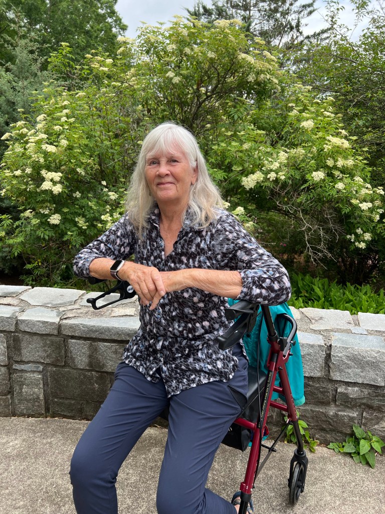
I headed there, took advantage of my handicapped parking placard, pulled my walker out of the car, and headed in. I also grabbed my rain jacket since fat gray clouds threatened rain.
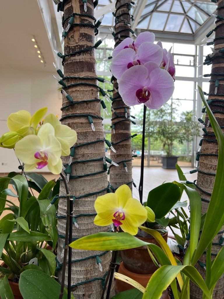
Free entry, but there was a $2 suggested donation. After dropping a $5 bill into the box, I stepped into the tropical garden greenhouse.
Bleeding Heart VineFishtail PalmOrchids, no labelsBradissium FlyawayBrazilian Candles
Then I headed to outdoor gradens but immediately fell into a conversation with a mother-daughter duo. The mom kindly offered to take my photo.
To the knot garden and herbal area.
Foxglove
Antique roses.
American Swamp Rose—delicious scent!Cherokee Rose, the state flower of Georgia
To another area.
Bachelor Button, a favorite of minePrickly Pear and Sotol—I wondered if I’d time traveled back to Arizona!Adam’s NeedleOne of many birdhouses in the gardensUnlabeled. Daylily?Unlabeled. Begonia?
And back through the greenhouse to leave.
StrapflowerCatatante Orchid
There was much I didn’t see because I simply can’t stand long enough. The walker helped a lot and extended my range, but there was so much more!
I got to my car, stashed my walker, tossed my purse, water bottle and rain jacket in the car, and climbed in. As I reached my arm out to close the door, the threatened rains began.