I left Ajo as the eastern sky was beginning to get light.
I made a stop at Roadrunner Java. It was the only place open at that hour and I’d read online that the coffee was good and donuts were excellent. That review was almost correct. The donut and coffee were both excellent. I highly recommend stopping if you’re ever in town, but go soon. The owner is not young and the business is for sale.
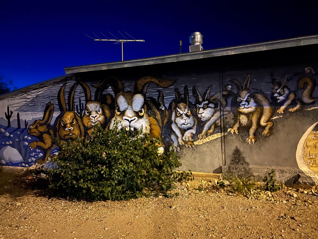
This mural’s on the side of Roadrunner Java. There’s just gotta be a story, but I didn’t look it up.
Down the road I went, passing the town of Why, still sleeping at just after 6 AM.
And I made my goal, Organ Pipe for sunrise sunrise.
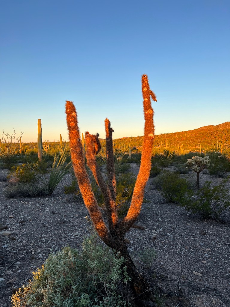
A cholla glistens in early morning light, beautiful even in death. Border half a mile ahead
I crossed the border easily though I got an alto (stop) light which meant my vehicle had to be inspected by the aduana, Mexican customs. I chuckled as the vehicle behind me, truck bed piled high with furniture and trailer equally piled, got a pase (green, no inspection) light. The aduana inspected my vehicle for approximately 30 seconds, and one agent asked where I was coming from. He was shocked and pleased when I said Naco. Then he smirked a bit and asked if I had any weapons. I pointed to my fist and said, “Only this.” He laughed and let me get going.
Soon I was south of town and skirting the western edge of a desolate plant and animal preserve called Reserva de la Biosfera El Pinacate y Gran Desierto de Altar.
I left home around 8:30, made a few stops and finally headed west from Tucson toward Ajo, Arizona, today a small community that was once a mining town.
My ultimate destination was Puerto Peñasco, located at the bottom of the map near the left. Right on the water.
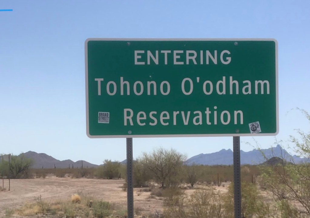
On the west side of Tucson, I picked up Arizona highway 86, soon entering Tohono O’odham land.
Highway 86 is a two-lane road that was in rough shape. Patches on top of patches on top of patches made for a bumpy ride. It was partly overcast, and for about half an hour I got drizzled on and even even heavily rained on.
Kitt Peak Observatory near Baboquivari Peak, the high point on this mountain, sacred to the O’odham people. The mountain is the center of Tohono O’odham cosmology, home of their creator, I’itoli. This mountain is named Quijotoa which means “mountain shaped like a carrying basket”.
I passed towns and turnoffs with names like Chiwuli Tak and Pisnemo, listening to radio station KOHN, Hewel Ñi’ok Radio, the voice of the Tohono O’odham Nation.
The station played a broad array of music: Mexican, oldies from the fifties (even Elvis), country, and the best—traditional and new O’odham. New O’odham is a style called chicken scratch. Chicken scratch music is recognizable for its moderate use of saxophone, some drums, and lots of accordion.
There were also quite a few community announcements, most in the native language, so I couldn’t understand a thing. In all, it was very enjoyable.
I saw several signs commemorating or protesting the disappearance of Native women.
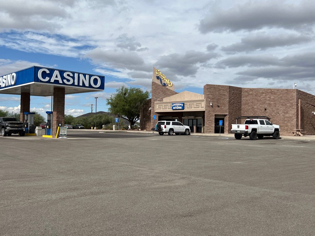
And right before I left the reservation, a casino.
About 20 minutes later I was in the town of Ajo. I got a meal at the only open restaurant and then wandered town for a while.
Curley School, once an elementary school and today a wonderful space remodeled for artists. It has both apartments and studio spaces.
The plan had been to continue on to Organ Pipe Cactus National Monument and camp there, but by the time I wandered, it was close to sunset. I was exhausted and didn’t feel like driving, arriving in the dark, and searching for a place to camp. If, in fact, there were any spots even available.
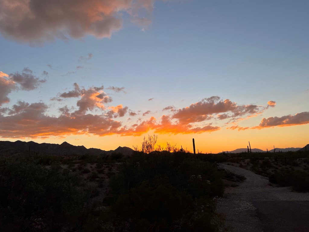
So I watched the sunset and checked into a motel.
And it’s a good thing I stayed in a motel. The overnight temperatures at Organ Pipe dipped into the 40s, and I really wasn’t prepared for much below 55 (which had been the original forecast).
New plan: up early and be amid the giant cactus for sunrise.
My friend Pam lives in Tucson and has a little casita in the village of Mata Ortiz, Chihuahua, México. Mata Ortiz is a village of about 2000 people with typical small town shops—mostly food and other necessities.
Yes, there’s a shorter route, but this one is great.
But about seventy years ago, villagers began using clay in the area to form pottery, copying old pieces they’d found in fields surrounding the town. By the 1990s when I first visited, the community was becoming known for fine ceramics, and potters were beginning to show their work in galleries throughout the US, then Mexico, and eventually, throughout the world. The pots, not always traditional designs these days, carry prices up to $3000.
Pam and I left my house around 8 am on a Monday morning heading east on US Highway 80. East then northeast into New Mexico and to the tiny town of Rodeo, today with a population of fewer than fifty people.
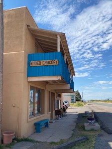
Years back, I’d always stop at the Rodeo store and restaurant. I’ve purchased food there and had some great meals in the little cafe.
Pam and I decided to stop for a quick visit, maybe pick up some food to take on the trip. We found only a few snacks available—very few—and the restaurant owner/cook/waitress/cashier was having a cup of coffee with a friend. There were no other customers.
We chatted with them briefly and I told the owner how much I’d always loved the US Highway 80 map mural on the south wall of the cafe. Pam and I then headed on our way having found nothing at all to purchase.
Soon we were headed east on New Mexico 9 going through Animas (about 125 people) and Playas, (around 50 people), a town once built and owned by Phelps Dodge Mining Corporation. Then to Hachita (also around 50 people), Hermanas (no longer exists), and finally Columbus, with a population of about 1400.
As we drove from Hachita to Hermanas, we looked for any signs designating the area where Phelps Dodge Mining Corporation, the then Bisbee (AZ) mining company, had dumped a thousand or so miners in 1917. Read the book Bisbee ’17 for the history of the 1917 Deportation, or watch the 2017 filmof the same name (though not a takeoff on the book) to learn about that tumultuous and cruel time in history.
In any event, we found no clues to where the miners had been abandoned and could not even spot any remains of the town of Hermanas other than a cattle pen and a water tower.
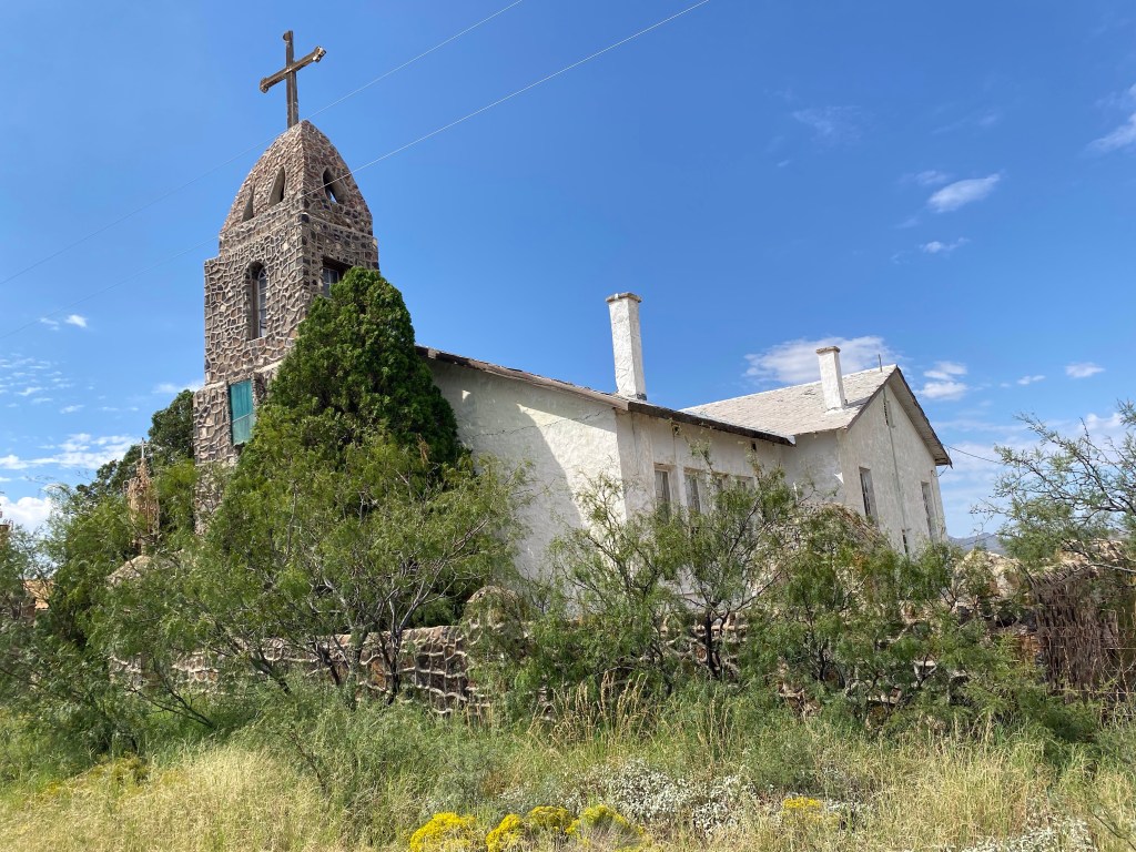
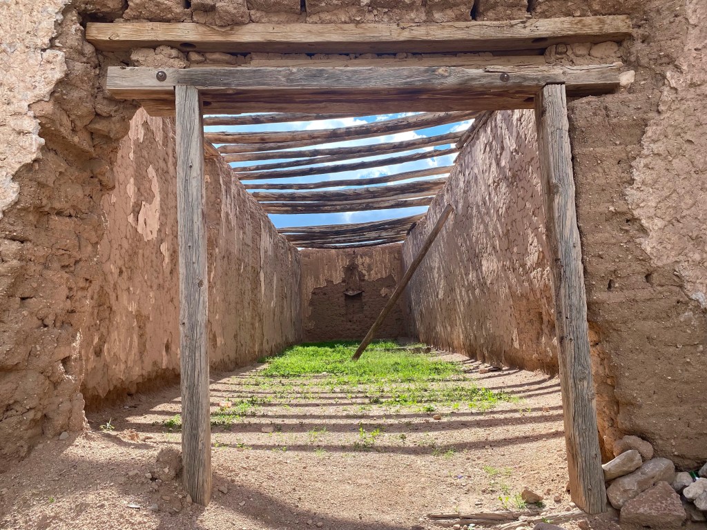
Long-abandoned St. Catherine of Siena Catholic Mission Church in Hachita
We turned south in Columbus and headed for the border.
Crossing into Palomas, Chihuahua, we stopped for lunch a block south of the border at the famous Pink Store.
And then we drove southwest, stopping in Janos to see the ruins of the the Franciscan Mission built in the early 1700s, as well as the ruins of Capilla Capestrenses de Guadalupe.
Franciscan missionCapilla Capastrenses de Guadalupe
Through Nuevas Casas Grandes, then Casas Grandes which was settled in the 1660s, past the Mormon community of Colonia Juarez, and finally to Mata Ortiz and Pam’s house.
We wandered Mata Ortiz, enjoying the views and visiting friends.
A closed grocery store
We made one trip back to the city of Nuevas Casas Grandes for pesos, and another trip back for a great lunch at a mariscos (seafood) restaurant.
And of course, we saw a lot of pottery. And bought some.
Jera with his effigy pot—zoom in to get a close look at his amazing work!Jera is holding one of his handmade brushes.Hera’s wife Norma painting one of her fine pieces.The piece I bought.
We visited the ruins of Paquimé, a once large city founded, experts believe, around 1050.
We went to Colonia Juarez and saw the Mormon Temple. I also bought the best empanadas I’ve had in my life, and believe me, I’ve had many.
Friday we packed up and headed home, again crossing the border at Palomas, but this time we stopped for green chile cheeseburgers in Columbus at the Borderland Cafe—worth going out of your way for if you’re driving I-10 through New Mexico. It’s only about half an hour south of Deming. Then, rather than heading back to the interstate, you can head east or west along Highway 9 and enjoy the rural scenery.
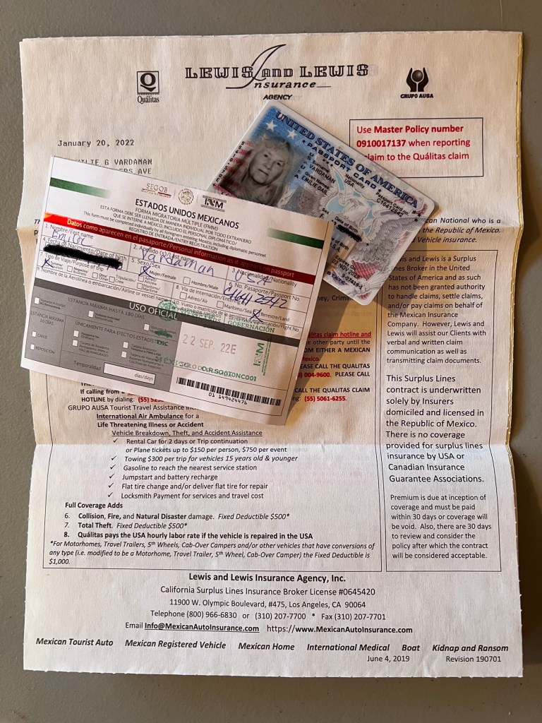
I’d say visit Mata Ortiz, but you need a passport, an FMM (Mexican travel permit) Mexican auto insurance, and a permiso (Mexican temporary import permit—a fee plus at least a $3-500 deposit) for your vehicle. Don’t drive down without all of that!
As a border resident, I always have my passport on me and I buy Mexican auto insurance yearly. I get a six-month FMM twice a year and drive only where no vehicle permiso is necessary.