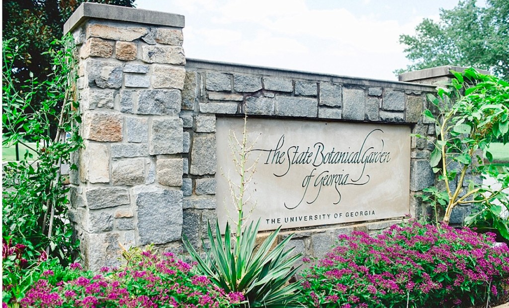
I wanted to roam a bit around Athens, Georgia, so I headed to Google looking for free things to do. One of the most highly reocmmended on the ‘to do’ list was a visit to the State Botanical Gardens.
Road to the Gardens
Free? Yes, free!
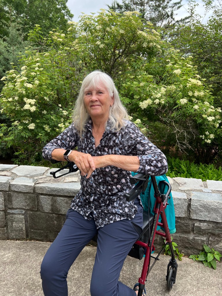
I headed there, took advantage of my handicapped parking placard, pulled my walker out of the car, and headed in. I also grabbed my rain jacket since fat gray clouds threatened rain.
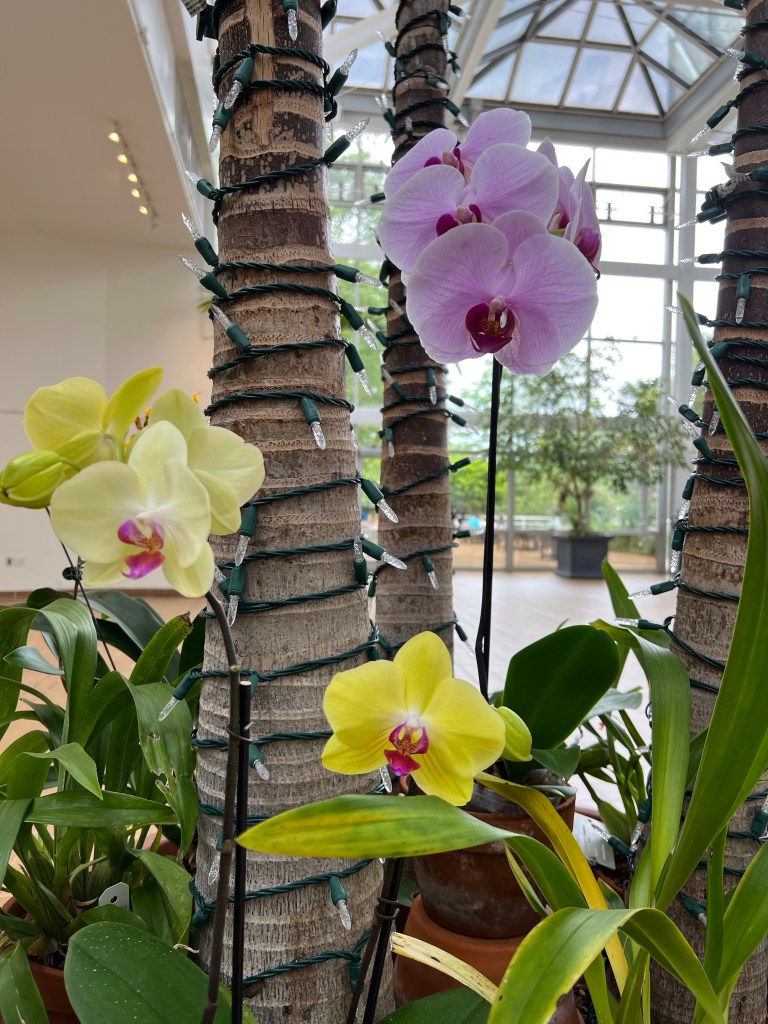
Free entry, but there was a $2 suggested donation. After dropping a $5 bill into the box, I stepped into the tropical garden greenhouse.
Bleeding Heart VineFishtail PalmOrchids, no labelsBradissium FlyawayBrazilian Candles
Then I headed to outdoor gradens but immediately fell into a conversation with a mother-daughter duo. The mom kindly offered to take my photo.
To the knot garden and herbal area.
Foxglove
Antique roses.
American Swamp Rose—delicious scent!Cherokee Rose, the state flower of Georgia
To another area.
Bachelor Button, a favorite of minePrickly Pear and Sotol—I wondered if I’d time traveled back to Arizona!Adam’s NeedleOne of many birdhouses in the gardensUnlabeled. Daylily?Unlabeled. Begonia?
And back through the greenhouse to leave.
StrapflowerCatatante Orchid
There was much I didn’t see because I simply can’t stand long enough. The walker helped a lot and extended my range, but there was so much more!
I got to my car, stashed my walker, tossed my purse, water bottle and rain jacket in the car, and climbed in. As I reached my arm out to close the door, the threatened rains began.
I left off when I arrived in Sanderson, Texas. I’m going to just hit some highlights of the next ten days.
I spent the night and got a bit lost in Sonora, Texas, which is hard to do, then romed on up to Leander to visit a friend I hadn’t seen in nearly sixty years. SIXTY! The trip took me through the Hill Country of Texas which was in bluebonnet season.
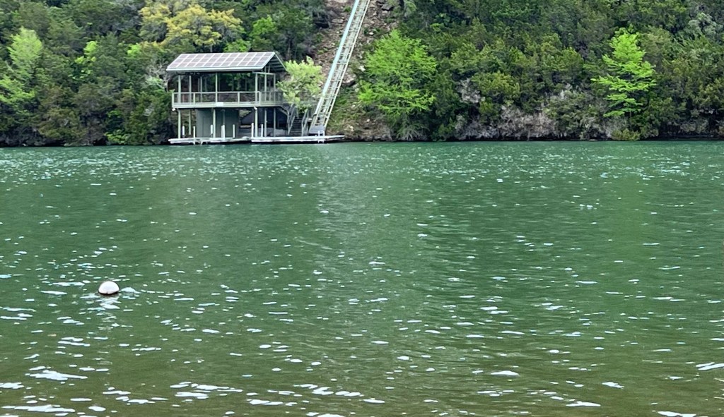
Then down to Austin where I visited a friend from the mid seventies in Bisbee. I stayed there a few days and enjoyed a lovely visit and great views of Lake Travis.
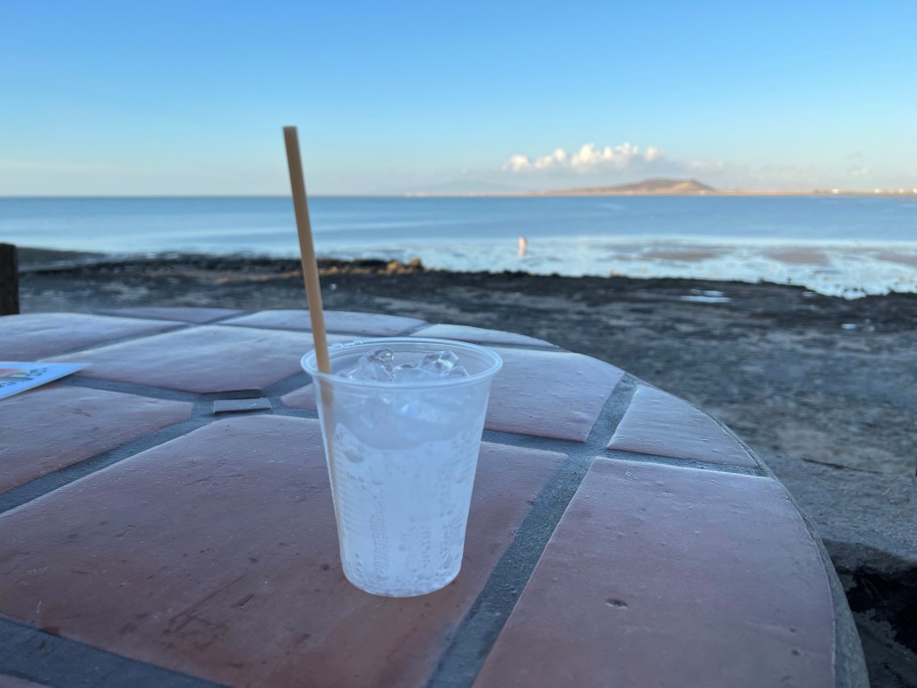
Then down to the coast. The Gulf.
First to Corpus Cristi where I spent my first night (and only night so far) in a Walmart parking lot. Then to and across Mustang Island and on the ferry to Port Aransas. More coastal driving and a visit to the Aransas National Wildlife Refuge where I SAW A WHOOPING CRANE!!!
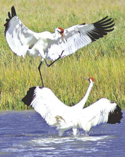
I didn’t get a photo, unfortunately.
I’d climbed a lot of stairs to a lovely lookout when the biggest egret in the world flew into the trees. I then realized no egret was that large, and besides, it had black wingtips. This bird was huge!!! I was mystified until I went down the stairs and saw a sign about nesting whooping cranes. That’s what I’d seen! The photo below is a stock photo.
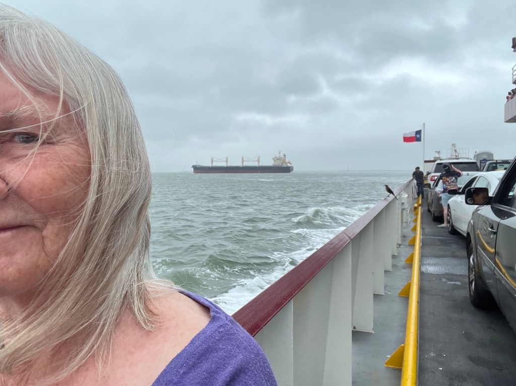
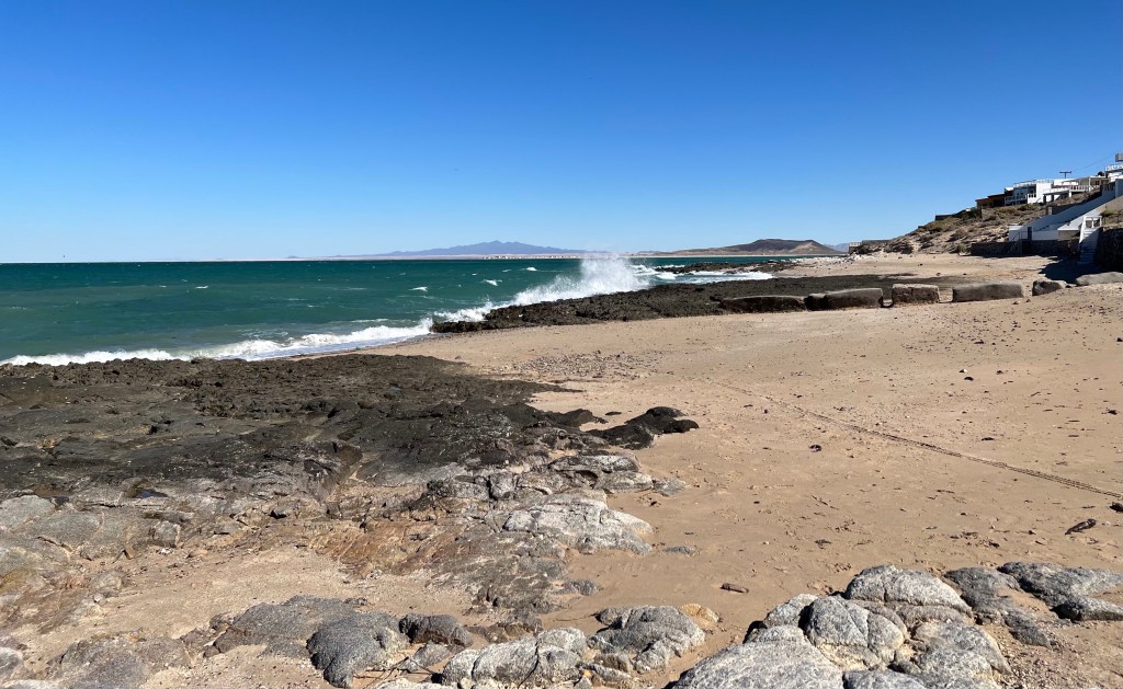
Across Galveston Island and the ferry to the Bolivar Peninsula.
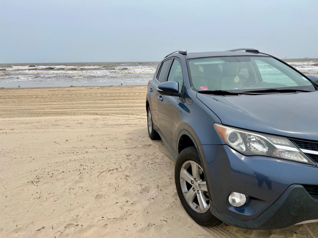
Once on the peninsula, I bought a $10 beach permit. It allowed a full week of parking and sleeping on the beach, but my one night there, though beautiful, wasn’t really good. Way too windy.
Before it got windy.
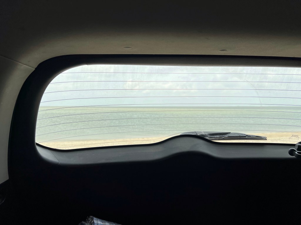
Luna Azul, my RAV, was rocking and rolling all night. Plus it drizzled and blowing sand stuck to every square inch of my poor car. She was no longer azul (blue). Thankfully, rain over the next day or so rinsed her off.
I spent the next night in a sweet little park outside a small town, again a place on the water—but no blowing sand!
And north.
Anahuac National Wildlife Refuge
I visited Port Arthur. The entrance was awful—all refineries.
But I spent some good time in the Museum of the Gulf Coast which is an excellent small museum. Highly recommended!
In addition to information on history and culture, the museum’s second floor was devoted to the musicians and music of the area.
The main reason I stopped was Port Arthur was the home of Janis Joplin.
Replica of Janis’s car
The best part of the display was a video board that allowed viewers to search musicians and music by decade.
And I listed to some of her music.
In Port Arthur, I also found a Buddhist Temple …
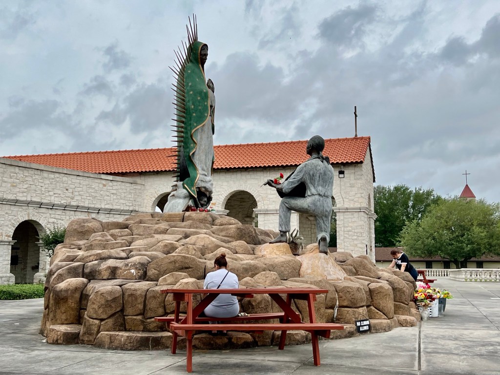
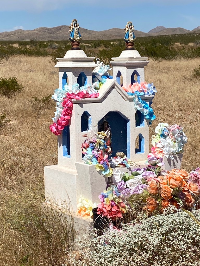
and a beautiful Virgin of Guadalupe.
From there I headed, unfortunately, to I-10 which was just about the only way to get to Lake Charles where I wanted to spend the night.
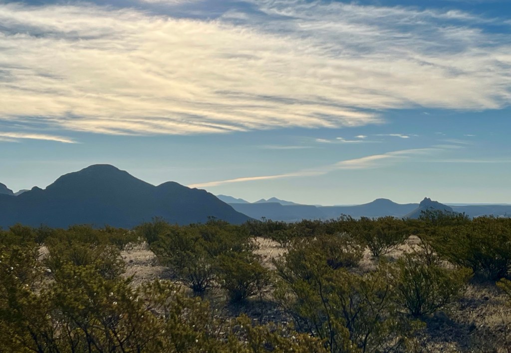
I left the Marfa Lights viewing area just at dawn and headed south on Texas 67 toward the border town of Presidio. 67 is a simple country road with windmills scattered on the bases of hillsides. The scenery is beautiful—rolling hills of golds and greens, a lovely twisty road, and mountains as a backdrop in every direction. But not enough pulloffs for viewing and photos.
Two road repair areas held me up briefly, but in all, it was a loverly drive.
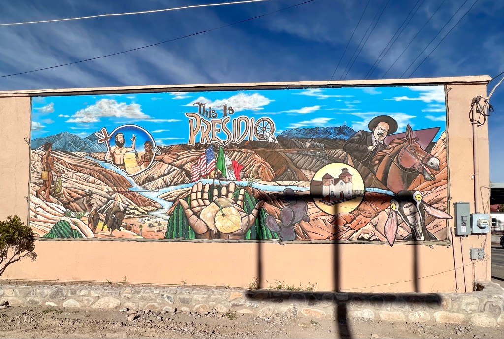
For some reason, in my mind Presidio was a little semi-ghost town, maybe a population of a few hundred. I envisioned collapsed roofs and falling-down, crumbled adobe structures.
Imagine my surprise when I found a small bustling town of about 3300 people. I learned there was a coffeehouse in the downtown area and, of course, headed right there.
Town was busy, but the lone coffeehouse was closed. A woman on the street said it was always closed. There went my only chance at a good cup of coffee.
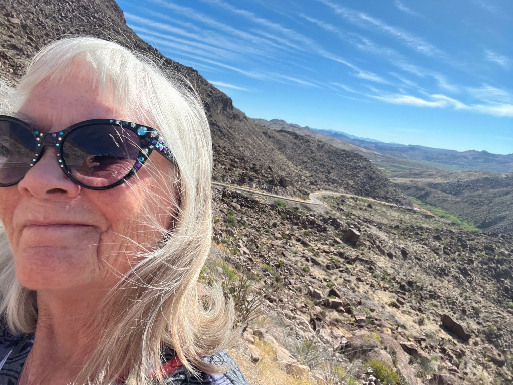
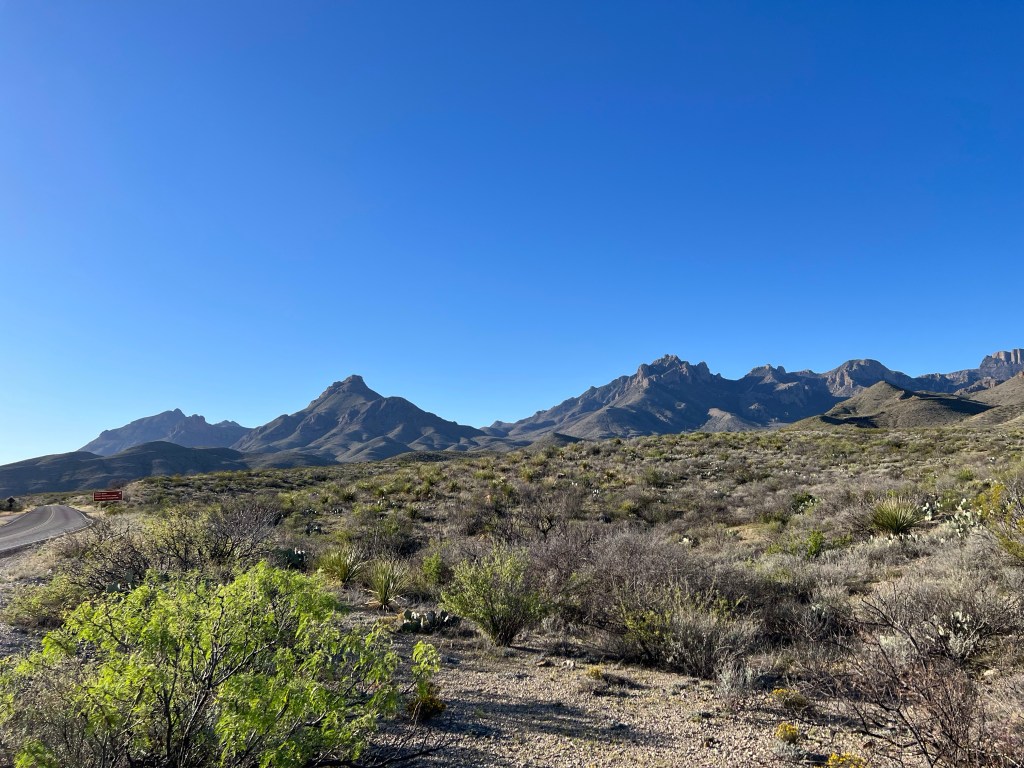
On to Texas 170, the road to Terlingua, a road often called the most scenic in Texas. That claim gets no argument from me.
The views before, after, and in the middle of each curve begged me to shift my eyes from the road. And there must have been at least two hundred curves or twists in the sixty-two mile drive. Google told me it would take about an hour and half. Closer to two and a half for me.
Even the straightaways, which were few and often lasted only about a quarter of a mile, were stunning. But as on other routes, not enough pulloffs, and the those that existed weren’t near the view I’d wanted to capture. Pullovers! I want more pullovers!
Sadly, the several road repair stops never offered much of a view.
The journey took me quite close to the Río Grande, sometimes coming withing about ten feet of the river.
I took it slowly, stopping just to gaze around when I’d (finally) find a pullover. I saw a number of camping areas along the way, some close to the road and others further away. No services, just a place to stop and spend a few days hiking and taking in the beauty.
In a few hours, I reached the town of Lajitas. Once a booming town and location of a major border crossing, when area mines closed, Lajutas dwindled to just four residents by the early 1970s.
That’s when a Houston corporation bought it, restored what buildings it could, and created a golf resort.
Yes, it’s true. In the middle of wild rugged mountains, a small valley on the Río Grande is now a golf resort with a private airport.
The irony of it all is not lost on me. My guess is the resort is filled with people who won’t go to “scary” Mexico, in general support a border wall, and under almost any other circumstances, would never go to a small border town. But they fly in to Lajitas, golf, and spend the winter in a beautiful area with daytime temperatures in the seventies.
And like the rest of this route, there is no border wall. A wall would destroy the wild beauty. As one who lives just a few blocks from a thirty-foot wall, I can’t tell you the delight I found in driving so many border miles of unspoiled, intense beauty.
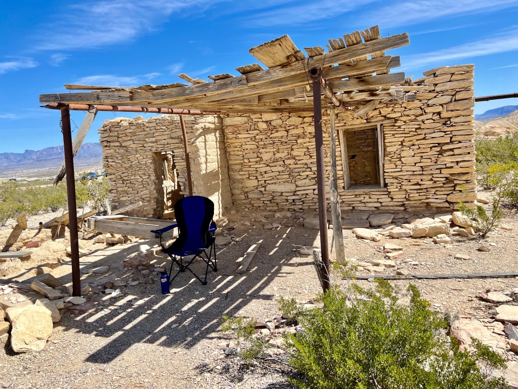
I reached Terlingua near 1:00 and splurged on lunch at DB’s Rustic Inn BBQ. I then wandered town and found a $2 shower. Wow! I settled myself in the shade of an old porch in the ruins of the Terlingua ghost town to read and write a bit.
I camped in a quiet spot, had some great coffee at Espresso y Poco Mas, and headed for Big Bend.
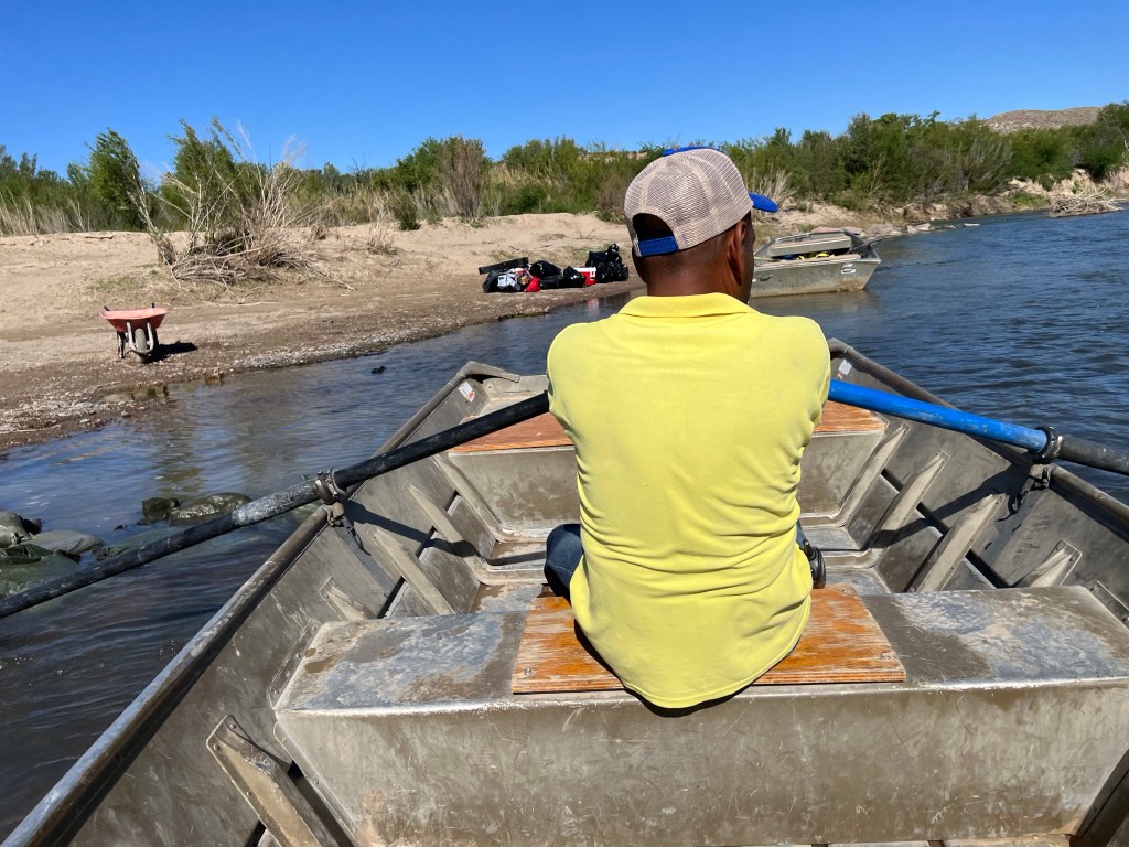
My senior pass I bought years ago got me into the park free. I didn’t wander but headed right for Boquillas Crossing.
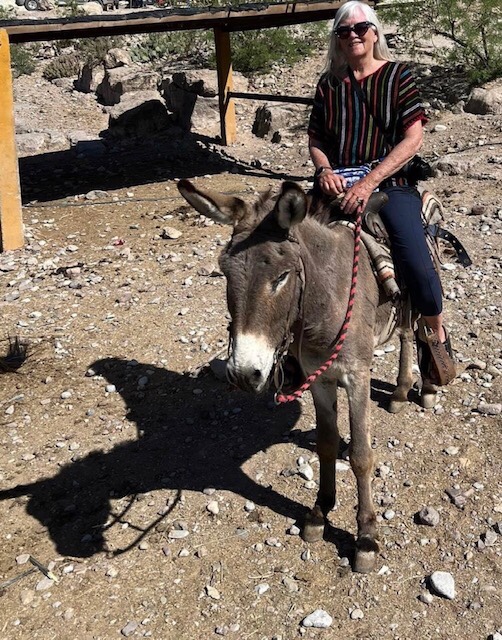
Yay!! Crossing to Mexico by rowboat had been the impetus for this entire trip. I got to Boquillas Crossing and entered the Customs building where a Park Service employee verified that I had a passport. Then, down the path to the river.
To Mexico, where I then rode a burro into town!
I had a nice lunch and returned to the US where I had to go into the Customs building again. A Park Service employee took my passport and held it up to a computer screen where its image was sent to a human somewhere else. The Park Service man returned my card and I approached the screen. A bored, disembodied voice asked if I had anything to declare. When I responded that I didn’t, he sent me on my way.
What a bizarre re-entry to the US!
From there, I searched for a (free) place to spend the night, but everything was either taken or w-a-y down a bumpy dirt road. Spring break. What did I expect?
So I headed out of Big Bend, my mission to cross the Río Grande accomplished, and headed to Sanderson for a visit with another woman who has roamed the country. She landed on my property at the beginning of the Covid shutdown and was basically stuck there for a few months. But at least she had a full van she could stand up in! I’m in my RAV.
An aside: As I sat in the shade in Terlingua Ghost Town and wrote, a couple walked by. The woman waved. Just then her husband got a call and wandered the other direction to talk. The woman and I chatted awhile, exchanging bits of info.
We found we were on a similar route. I then mentioned I was from Bisbee. “Bisbee! We were there a few weeks ago for the Vulture Festival!”
I told her I’d been there also. We laughed and kept chatting. She said they were headed to Big Bend next and planned to take the little rowboat across the Río Grande the next day. I laughed again and told her I had plans to do the same thing.
And guess who I ran into in Boquillas the next day! By the time we’d talked in Boquillas, I had an invitation to their home in northern New York. And then we found we were both headed to Texas Hill Country! And we laughed again realizing they live just a few blocks from the northern border while I live a few blocks from the southern.
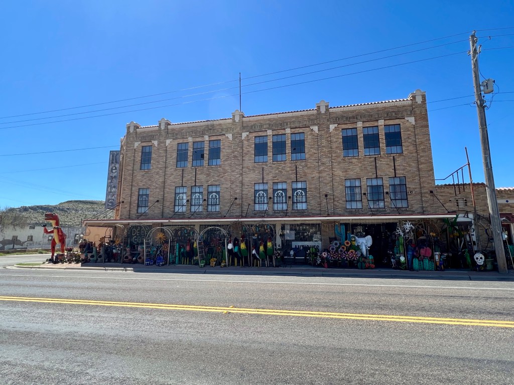
To finish, here’s the hardware store in Sanderson.
I didn’t reach Alpine and Marfa until my third day of travel even though I could have easily made it in under eight hours. This trip is much about leisure, so much leisure that the one-hour trip between Van Horn and Marfa took me nearly three hours.
I left the Van Horn area at dawn and cruised slowy down Texas Highway 90 to Marfa.
Whoever is promoting Marfa has done a fine job, because the first references to were about thirty-five miles north of the town. That’s where I found Prada Marfa, a sculpture created in 2005. There are even some Prada shoes and purses inside the little building.
Then another twenty or so miles down the road, I found the next Marfa sculpture.
The diorama came complete with music seeming to emanate almost from the car.
Then about seven miles before town, there was a big “Welcome to Marfa” sign.
And finally the town, about 1800 people if you ask Google, or about 1500 if you ask the locals.
But I continued to Alpine, another twenty-five miles east.
I wanted to see Alpine because I’d been there once before, maybe twelve or fifteen years ago, on a train trip from Arizona to New Orleans. What I remembered about the town was the train stopping and Border Patrol agents having everyone get off while they searched the train.
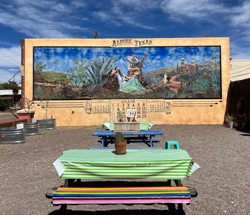
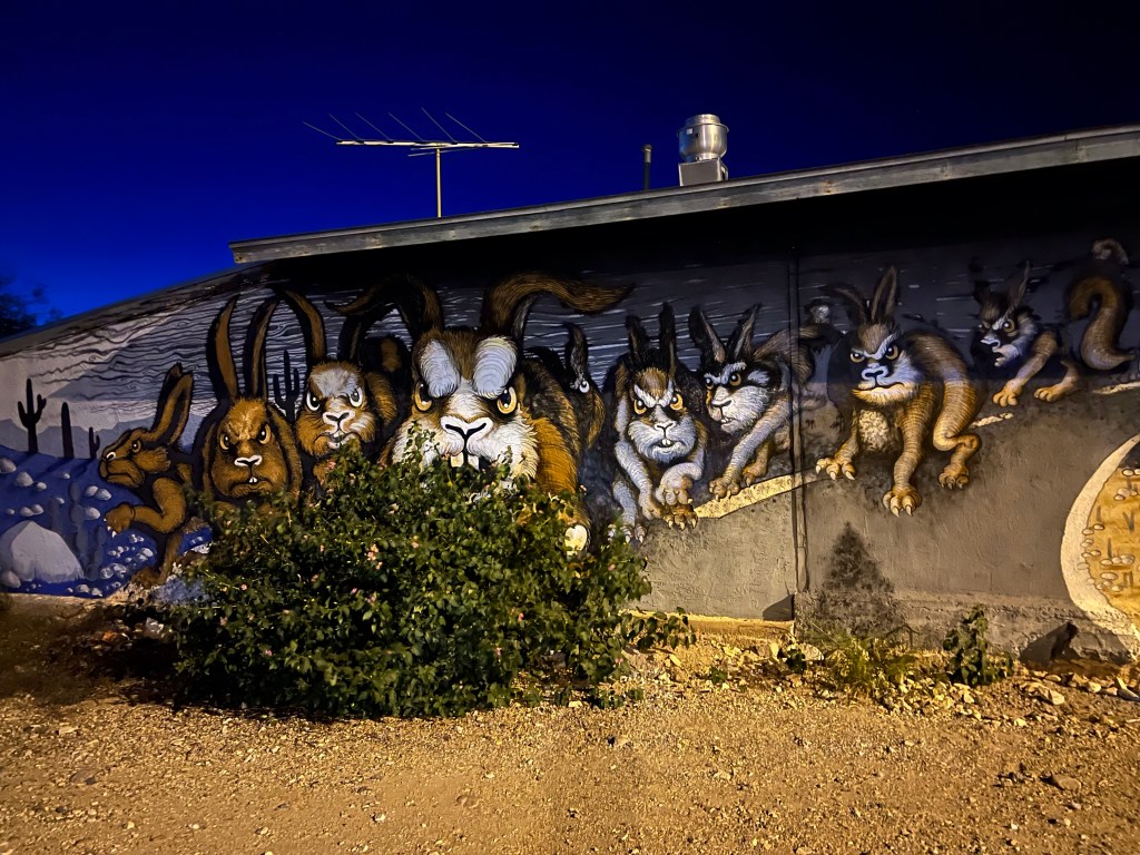
Alpine is a sweet little town filled with artist’s studios, cafes, and murals and more murals. It has a population of fewer than 6000 people, but there are probably close to fifty murals! The last count was forty-four, but the woman at the welcome center said she knew more had been added since the mural map had been made.
Map in hand, I roamed town a bit looking at murals.
MURALS
And other art.
After wandering and seeing the art, I headed back to Marfa.
My first stop was Wrong, an art gallery and store. I’d met the owners in Kino in January and wanted to stop in. Well worth the stop! Jewelry, a lunar calendar, artwork, and much, much more. If you’re ever in Marfa, visit there and spend money.
There are some beautiful historical buildings in town, too, including the county courthouse. I elevatored up three floors and then walked up the last two levels.
There’s a beautiful old hotel, the Hotel Paisano (originally El Paisano Hotel) designed by Trost and Trost. (Bisbee, by the way, has a Trost house.) The hotel opened in 1930. It’s famous for headquartering the cast and crew of the 1956 movie Giant and is on the National Register of Historic Places.
Part of what drew me to Marfa was the Marfa Lights, lights that are sometimes seen at dusk and ocassionally later at night, about nine miles east of the town.
I went there to watch and hope, and to spend the night. About thirty other people showed up, but unfortunately, you can’t prove the Marfa Lights by me. I did however, see a fine sunset.
After a quiet night, I headed south to Presidio and then northeast to Terlingua, which you’ll read about in my next post.
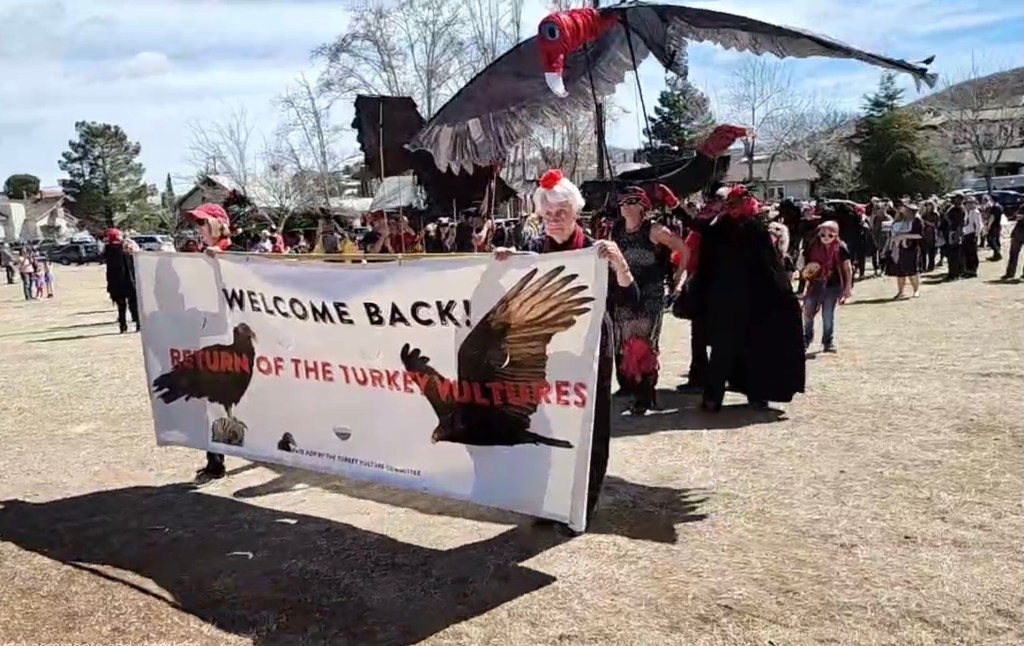
Bisbee loves its vultures. Bisbee also loves parades.
My friend Christina Nealson took this photo. She lives in Arivaca, Arizona, where the community is having its first vulture festival this weekend! Check out Christina’s blog at http://christinanealson.com.
So what does Bisbee do when turkey vultures migrate back here for the summer? We have a vulture parade!
This parade has been happening for many years, at least 13 but maybe more. It used to be held in Old Bisbee, but for the last three years it has been in Vista Park during the regular Saturday Market.
Enjoy!
A vulture announces the beginning of the parade.
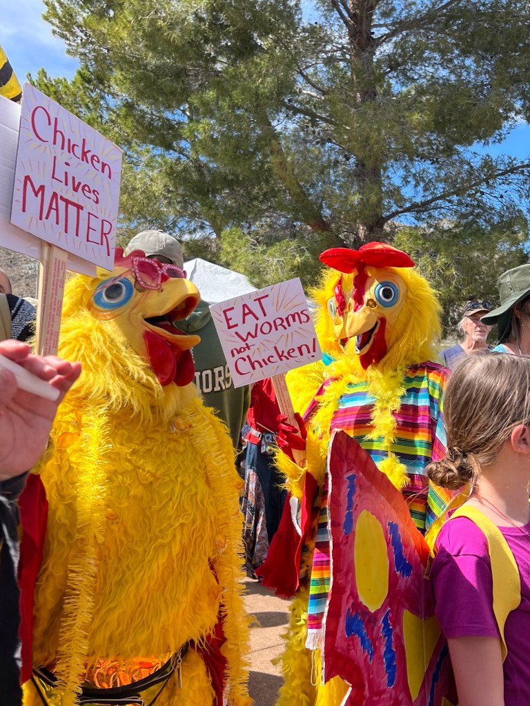
And it’s about more than just vultures.The parade enters the park.A vulture feasts while hatchlings (the children in white, in the background) look on.And of course the famous Bisbee Chickens showed up because, well, it’s Bisbee after all. After the parade, only the hatchlings’ shells remain.
I cannot capture the California Central Coast in words. I can’t even capture it in photos. I can share only little tiny pieces: waves, flowers, and sunsets. Sea lions and otters. Food. Oh, the food!
Majestic. Awe-inspiring. Comical and whimsical. Views that captured me so completely I couldn’t move. Traffic that terrified me enough that I had to hand over the keys. I live in a town of 800 and was unprepared for LA freeways.
Elle and I drove straight through to California on day one and stayed two nights in a northern suburb of LA, heading into the city on day two. I didn’t drive, of course. Elle and her mother wanted to hit the garment district, shopping for fabrics and checking out fashions. I chose to do what I do well: visit a coffeehouse. I chose one that specialized in French pastries.
At Paris Baguette, downtown LA.
We also got caught in traffic.
When the others finished shopping, we ate some fine, fine food at a little hole-in-the wall. We had sandwiches on fresh, crusty baguette. I had tuna salad, and it was the best tuna salad—and maybe the best sandwich—I’ve ever had, the secret recipe handed down to the cook from his Cuban mother.
The following day Elle and I headed north, stopping at a coffeehouse in Santa Barbara and visiting Old Santa Barbara Mission, built in 1786. Our visit to the coffeehouse had my sister dub our visit the California Coffeehouse and Pastry Tour. She was not wrong. We hit a coffeehouse every morning and a few afternoons, often supplementing our caffeine with baked goods.
At Daily Grind, Santa Barbara.Mission Santa Barbara
In Santa Barbara I also saw my favorite hedge and gate.
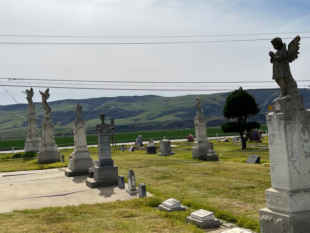
Slowly, slowly up the coast, visiting Guadalupe and its cemetery.
If you look closely, you can see workers in the field beyond the cemetery.
In Pismo Beach we stopped to see monarch butterflies but could see them only from a distance. Next, late lunch on the pier.
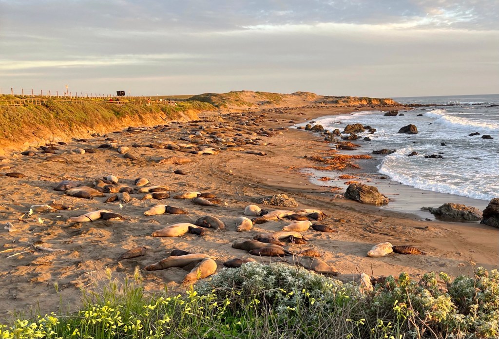
Further north to have some beach time near San Luis Obispo. Then on to San Simeon where we saw the Hearst Castle from afar and elephant seals from a lookout point. We spent the night in San Simeon.
That’s the Hearst Castle left of center.Elephant Seal Beach
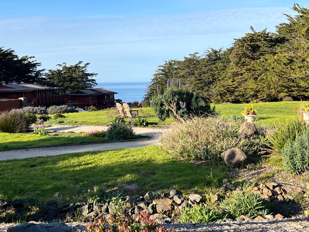
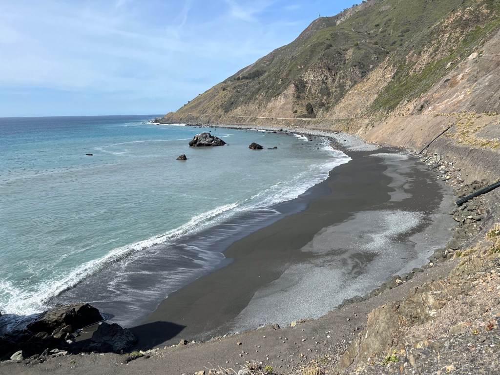
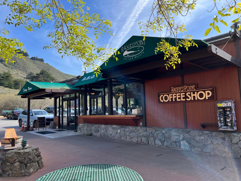
The next day, day four, we headed north again, stopping in Ragged Beach for, yes, coffee. And a killer breakfast with a fabulous view from the patio.
Had to stop to watch the waves on the way to Ragged Beach.Breakfast view
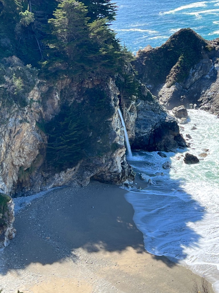
On up to Gorda which is the southern end of Big Sur country.
About five miles further on at Sand Dollar Beach, the road was closed due to the major slides that happened during the rains last month.
More beach time, a visit with friends, then back south and east to Highway 101 where we headed north to Salinas then west to Monterey for the next three nights.
Stopped at Ragged Beach on the way back south to refuel.
Day five. A lovely coffeehouse in Monterey, then south.
We splurged and paid to take 17-Mile Drive along the coast. Views, views, and more views!
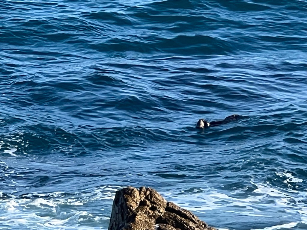
That’s an otter!The iconic Lone Cypress on 17-Mile Drive
We had breakfast at the famous lodge at Pebble Beach where we split a breakfast of eggs, potatoes and and Kobe beef—the best, most tender beef I’ve had in my life.
And coffee.
Further south through the village of a Big Sur and finally to the the northern road closure.
Back slowly north to Monterey and our motel.
One of the many bridges between Monterey and Big Sur
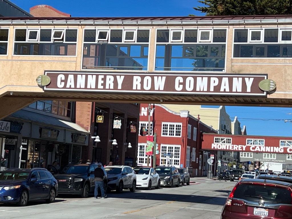
On day six we stayed around Monterey and Carmel, visiting Cannery Row and other local sights, battling mobs of tourists for parking and walking space and viewpoints.
The words read as such: “Cannery Row in Monterey in California is a poem, a stink, a grating noise, a quality of light, a tone, a habit, a nostalgia, a dream. Cannery Row is the gathered and scattered, tin and iron and rust and splintered wood, chipped pavement and weedy lots and junk heaps, sardine canneries of corrugated iron, honky tonks, restaurants and whore houses, and little crowded groceries, and laboratories and flophouses….”
Day seven we had a heavy breakfast on a pier and a visit with a group of sea lions. A group is a herd, a harem, a rookery, or a bob. I rather like rookery.
Sign in the restaurant
Then down 101, west to coastal Highway 1, with more beautiful scenery and then traffic jams as we neared Los Angeles
After a final night outside of LA, we drove through morning rush hour, which was about as awful as you can imagine. Then across the desert, into clouds, drizzle, and into Tucson’s afternoon rush hour. It was a long, nearly thirteen-hour day before we got home.
The beauty was spectacular. I was completely enchanted by the waves, their constant crashing as they slowly erode the cliffs. About five or six times daily I’d exclaim, “The waves! My god, look at those waves!”
I must return for a more leisurely trip. More time with sea lions and sunsets and waves. Especially the waves.
I visited the first time in 1971 when it was small town of about 7,000 along side a Tohono O’Odham village. I camped on the outskirts and never even saw the town. I returned in 1985 when it had swelled to 10,000—one comfortable hotel and a few restaurants. I loved it.
In 1993, I was horrified by the population explosion. There must have been 25 or 26,000 people there. I told my then-husband it was ruined and I’d never return.
But when my friend Frank was house sitting there and got permission for me to come visit, well … well, it was Mexico after all. Even with a winter-time population nearing 80,000, it would be nice to see Frank and I figured I’d enjoy the sea and food.
So I went, deciding ahead I’d have to pretend it was someplace I’d never been. And because it was completely unrecognizable, in a sense that was true. I’d never been to this Puerto Peñasco before.
Let me tell you who Frank is. We met about six years ago when he was couchsurfing his way across the southern US, headed back to his home near Seattle. He found my offer of a place to stay via the website, couchsurfing.com. It was free then, but today it’s a subscription site, though affordable. If you want to travel affordably, sign up—it’s great!
Frank has been leaving the cold, rainy northwest for Arizona sunshine every winter since and has stayed with me many time. This time, I’d be visiting him.
I crossed the US/Mexico border before 8:00 am and arrived in Cholla Bay (also Choya Bay, the gringo spelling) before 10. Frank helped me get my things inside, showed me the rooftop deck, and we immediately went out for a late breakfast.
View from the roof
Great huevos rancheros at Xochitl’s Cafe though the salsa was gringo-ized and not very spicy.
In the ten days I was there, Frank and I sampled a lot of restaurants, saw daily sunrises and sunsets, visited bakeries, and toured around a bit. All this in addition to shopping for groceries, wandering the malecón, and lounging on the roof.
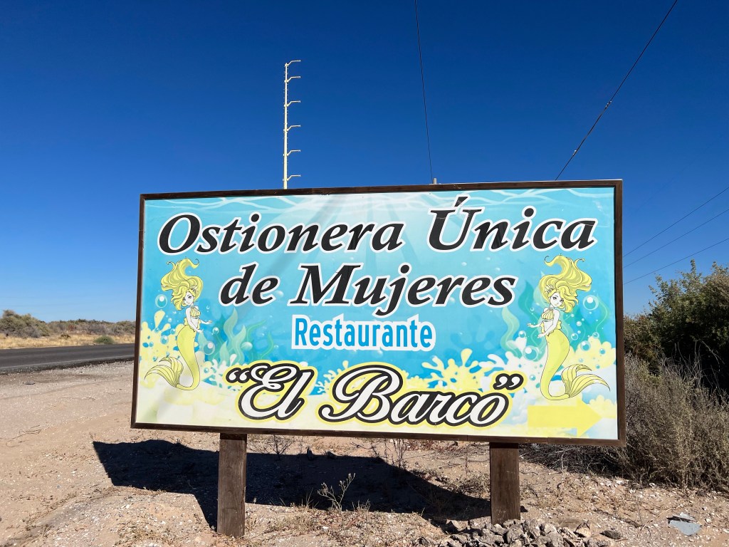
One day we visited El Barco, the women’s oyster co-op. El Barco is the only female owned and operated oyster farm in Puerto Peñasco, and they also have a restaurant with a view.
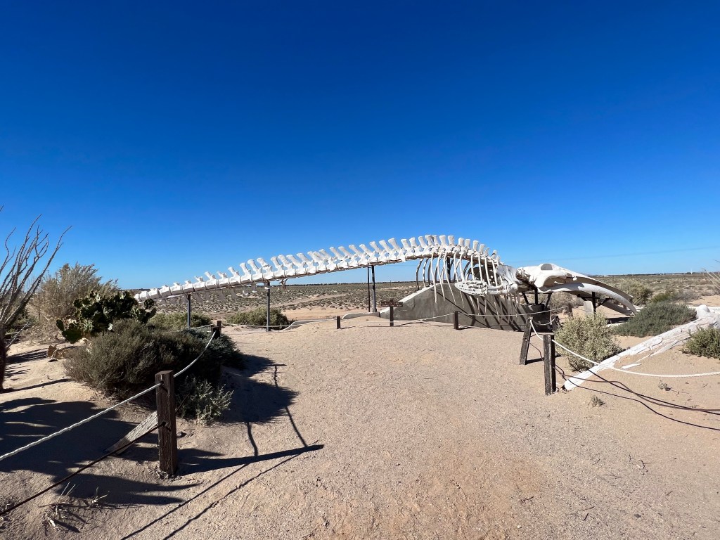
We roamed CEDO, the Intercultural Center for the Study of Deserts and Oceans, where we saw the skeleton of a fin whale. The bones were found in the area in 1983 and were eventually moved and reassembled at the CEDO site.
We visited two bakeries, my favorite La Tapatía, where breads and rolls were still baked the old fashioned way.
Frank took me to the malecón and I went back once on my own. A malecón similar to a boardwalk in that it fronts the ocean or sea. It’s often made of stone. It or the area around it usually has stalls with vendors selling food, local handicrafts and arts, tickets to boat rides, blankets, clothing, and more.
Tribute to the shrimpers and the shrimp on the malecón.Malecón
There are lots of boats in Puerto Peñasco.
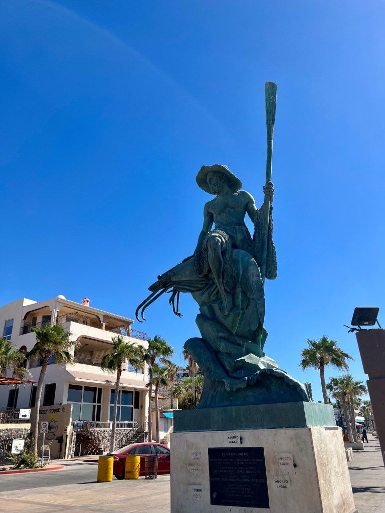
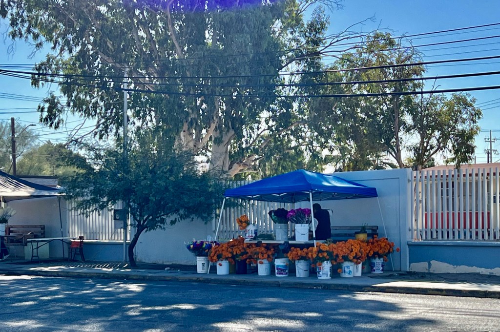
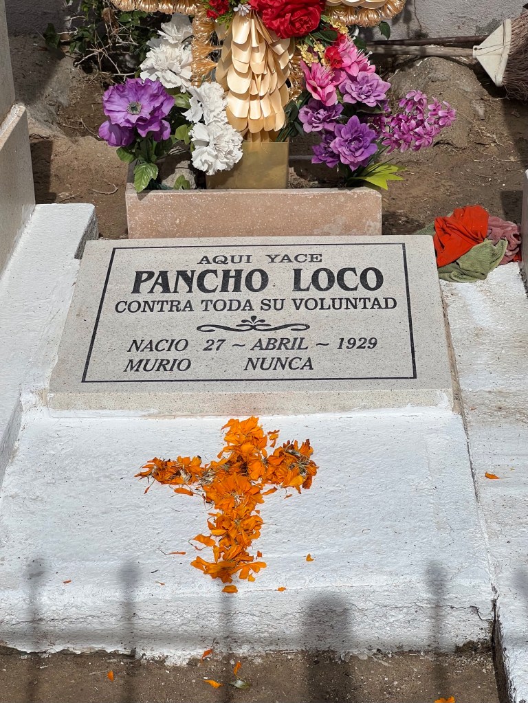
I was fortunate to be in town for Día de los Muertos, Day of the Dead. Vendors sell marigolds for people to place on the graves of their loved ones. The belief is marigolds attract the souls of the departed, so graves are decorated with them as are altars created specially for the holiday.
Selling marigoldsMangold petals used to form a cross
One area of town had a display of altars.
This altar was made for murdered women.
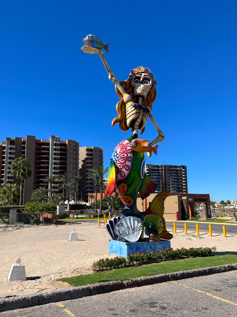
Catrinas were everywhere. Catrinas are skeleton dolls, artwork, and even sculptures representing the dead for Día de los Muertos.
CATRINA
Each morning, sunrise lured me to the rooftop.
Most days ended with sunset on the beach.
My ten days in Puerto Peñasco showed me it’s not good to write off a place because it isn’t the way it used to be. Peñasco is a vibrant small city. I’d found it wonderful in 1971 and 1975. If I hadn’t felt so irritated by its growth, I’d have seen it was probably wonderful also in 1993. I sure thought it was on this visit.
I left Ajo as the eastern sky was beginning to get light.
I made a stop at Roadrunner Java. It was the only place open at that hour and I’d read online that the coffee was good and donuts were excellent. That review was almost correct. The donut and coffee were both excellent. I highly recommend stopping if you’re ever in town, but go soon. The owner is not young and the business is for sale.
This mural’s on the side of Roadrunner Java. There’s just gotta be a story, but I didn’t look it up.
Down the road I went, passing the town of Why, still sleeping at just after 6 AM.
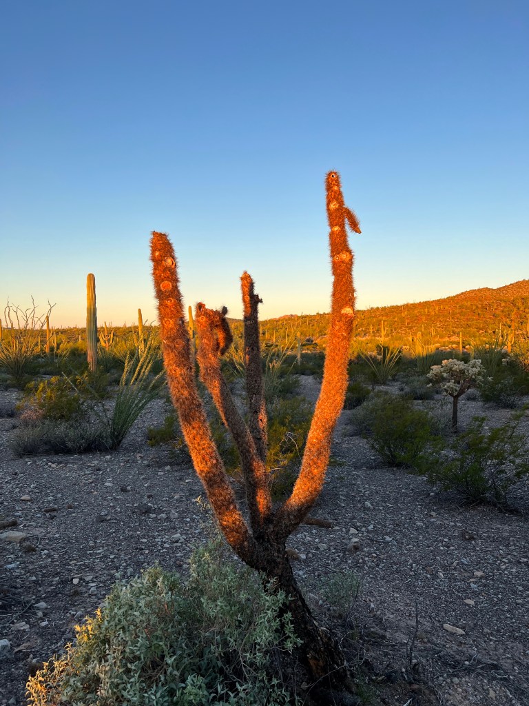
And I made my goal, Organ Pipe for sunrise sunrise.
A cholla glistens in early morning light, beautiful even in death. Border half a mile ahead
I crossed the border easily though I got an alto (stop) light which meant my vehicle had to be inspected by the aduana, Mexican customs. I chuckled as the vehicle behind me, truck bed piled high with furniture and trailer equally piled, got a pase (green, no inspection) light. The aduana inspected my vehicle for approximately 30 seconds, and one agent asked where I was coming from. He was shocked and pleased when I said Naco. Then he smirked a bit and asked if I had any weapons. I pointed to my fist and said, “Only this.” He laughed and let me get going.
Soon I was south of town and skirting the western edge of a desolate plant and animal preserve called Reserva de la Biosfera El Pinacate y Gran Desierto de Altar.
I left home around 8:30, made a few stops and finally headed west from Tucson toward Ajo, Arizona, today a small community that was once a mining town.
My ultimate destination was Puerto Peñasco, located at the bottom of the map near the left. Right on the water.
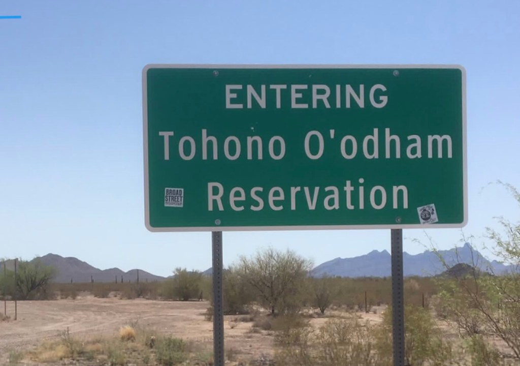
On the west side of Tucson, I picked up Arizona highway 86, soon entering Tohono O’odham land.
Highway 86 is a two-lane road that was in rough shape. Patches on top of patches on top of patches made for a bumpy ride. It was partly overcast, and for about half an hour I got drizzled on and even even heavily rained on.
Kitt Peak Observatory near Baboquivari Peak, the high point on this mountain, sacred to the O’odham people. The mountain is the center of Tohono O’odham cosmology, home of their creator, I’itoli. This mountain is named Quijotoa which means “mountain shaped like a carrying basket”.
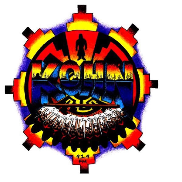
I passed towns and turnoffs with names like Chiwuli Tak and Pisnemo, listening to radio station KOHN, Hewel Ñi’ok Radio, the voice of the Tohono O’odham Nation.
The station played a broad array of music: Mexican, oldies from the fifties (even Elvis), country, and the best—traditional and new O’odham. New O’odham is a style called chicken scratch. Chicken scratch music is recognizable for its moderate use of saxophone, some drums, and lots of accordion.
There were also quite a few community announcements, most in the native language, so I couldn’t understand a thing. In all, it was very enjoyable.
I saw several signs commemorating or protesting the disappearance of Native women.
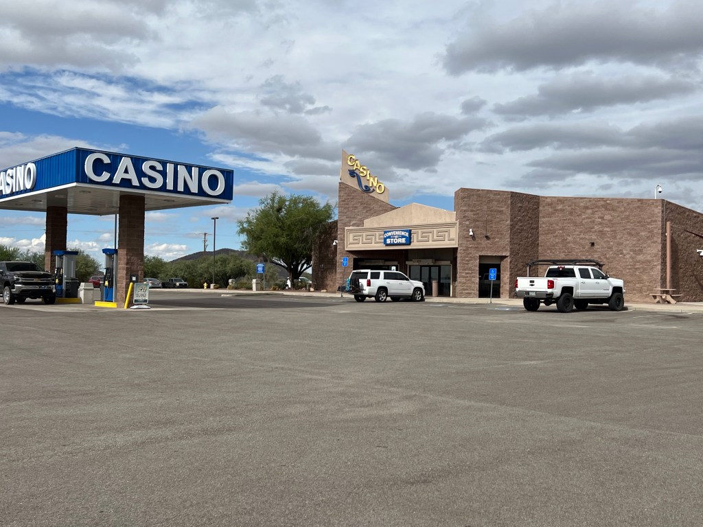
And right before I left the reservation, a casino.
About 20 minutes later I was in the town of Ajo. I got a meal at the only open restaurant and then wandered town for a while.
Curley School, once an elementary school and today a wonderful space remodeled for artists. It has both apartments and studio spaces.
The plan had been to continue on to Organ Pipe Cactus National Monument and camp there, but by the time I wandered, it was close to sunset. I was exhausted and didn’t feel like driving, arriving in the dark, and searching for a place to camp. If, in fact, there were any spots even available.
So I watched the sunset and checked into a motel.
And it’s a good thing I stayed in a motel. The overnight temperatures at Organ Pipe dipped into the 40s, and I really wasn’t prepared for much below 55 (which had been the original forecast).
New plan: up early and be amid the giant cactus for sunrise.
My friend Pam lives in Tucson and has a little casita in the village of Mata Ortiz, Chihuahua, México. Mata Ortiz is a village of about 2000 people with typical small town shops—mostly food and other necessities.
Yes, there’s a shorter route, but this one is great.
But about seventy years ago, villagers began using clay in the area to form pottery, copying old pieces they’d found in fields surrounding the town. By the 1990s when I first visited, the community was becoming known for fine ceramics, and potters were beginning to show their work in galleries throughout the US, then Mexico, and eventually, throughout the world. The pots, not always traditional designs these days, carry prices up to $3000.
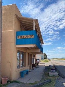
Pam and I left my house around 8 am on a Monday morning heading east on US Highway 80. East then northeast into New Mexico and to the tiny town of Rodeo, today with a population of fewer than fifty people.
Years back, I’d always stop at the Rodeo store and restaurant. I’ve purchased food there and had some great meals in the little cafe.
Pam and I decided to stop for a quick visit, maybe pick up some food to take on the trip. We found only a few snacks available—very few—and the restaurant owner/cook/waitress/cashier was having a cup of coffee with a friend. There were no other customers.
We chatted with them briefly and I told the owner how much I’d always loved the US Highway 80 map mural on the south wall of the cafe. Pam and I then headed on our way having found nothing at all to purchase.
Soon we were headed east on New Mexico 9 going through Animas (about 125 people) and Playas, (around 50 people), a town once built and owned by Phelps Dodge Mining Corporation. Then to Hachita (also around 50 people), Hermanas (no longer exists), and finally Columbus, with a population of about 1400.
As we drove from Hachita to Hermanas, we looked for any signs designating the area where Phelps Dodge Mining Corporation, the then Bisbee (AZ) mining company, had dumped a thousand or so miners in 1917. Read the book Bisbee ’17 for the history of the 1917 Deportation, or watch the 2017 filmof the same name (though not a takeoff on the book) to learn about that tumultuous and cruel time in history.
In any event, we found no clues to where the miners had been abandoned and could not even spot any remains of the town of Hermanas other than a cattle pen and a water tower.
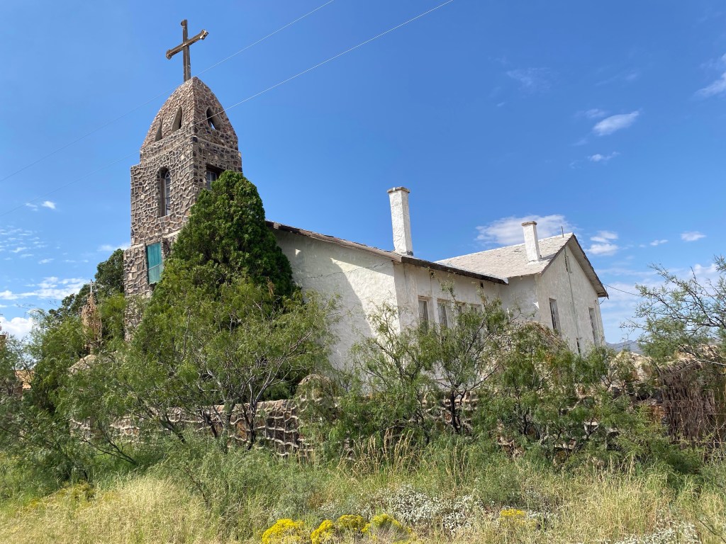
Long-abandoned St. Catherine of Siena Catholic Mission Church in Hachita
We turned south in Columbus and headed for the border.
Crossing into Palomas, Chihuahua, we stopped for lunch a block south of the border at the famous Pink Store.
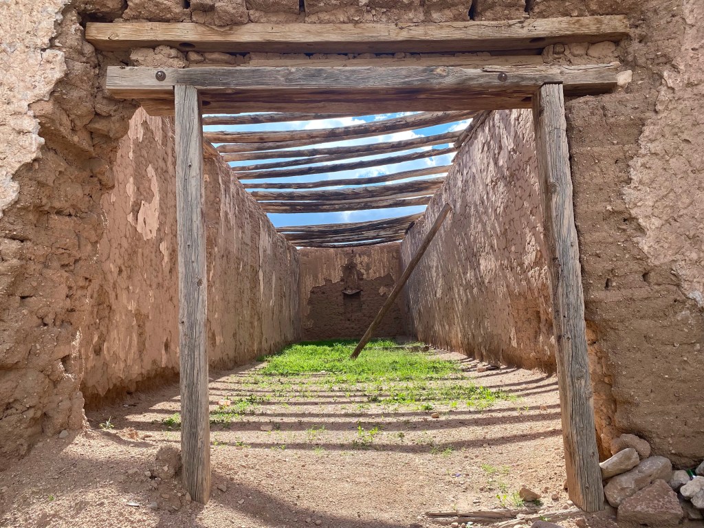
And then we drove southwest, stopping in Janos to see the ruins of the the Franciscan Mission built in the early 1700s, as well as the ruins of Capilla Capestrenses de Guadalupe.
Franciscan missionCapilla Capastrenses de Guadalupe
Through Nuevas Casas Grandes, then Casas Grandes which was settled in the 1660s, past the Mormon community of Colonia Juarez, and finally to Mata Ortiz and Pam’s house.
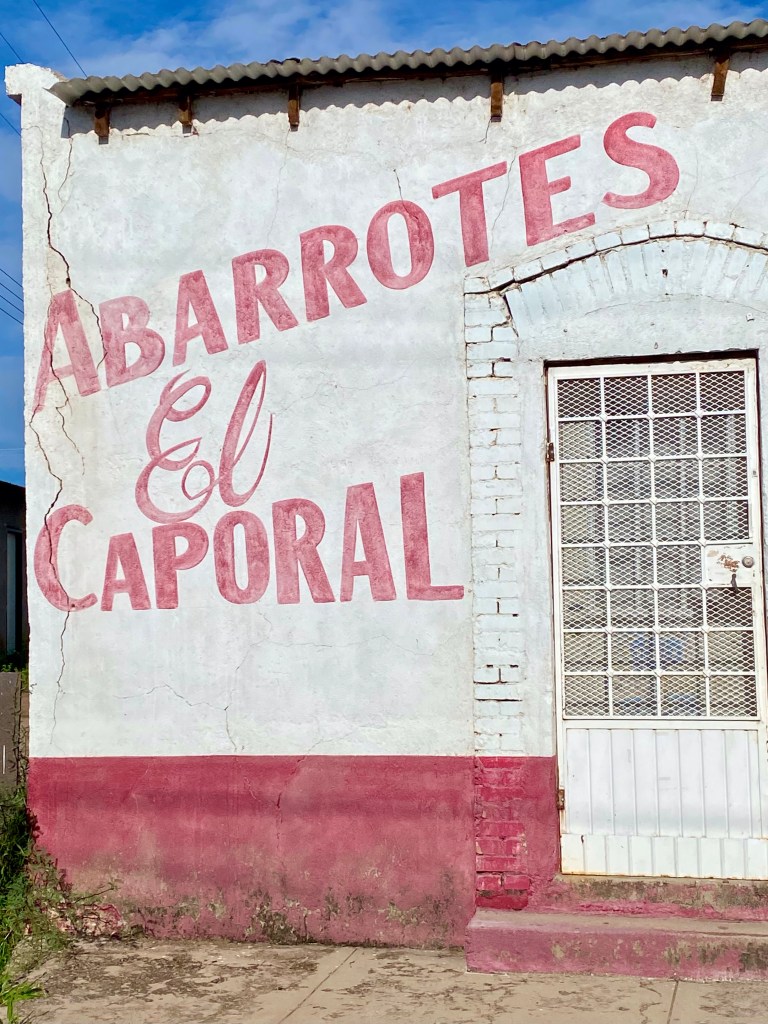
We wandered Mata Ortiz, enjoying the views and visiting friends.
A closed grocery store
We made one trip back to the city of Nuevas Casas Grandes for pesos, and another trip back for a great lunch at a mariscos (seafood) restaurant.
And of course, we saw a lot of pottery. And bought some.
Jera with his effigy pot—zoom in to get a close look at his amazing work!Jera is holding one of his handmade brushes.Hera’s wife Norma painting one of her fine pieces.The piece I bought.
We visited the ruins of Paquimé, a once large city founded, experts believe, around 1050.
We went to Colonia Juarez and saw the Mormon Temple. I also bought the best empanadas I’ve had in my life, and believe me, I’ve had many.
Friday we packed up and headed home, again crossing the border at Palomas, but this time we stopped for green chile cheeseburgers in Columbus at the Borderland Cafe—worth going out of your way for if you’re driving I-10 through New Mexico. It’s only about half an hour south of Deming. Then, rather than heading back to the interstate, you can head east or west along Highway 9 and enjoy the rural scenery.
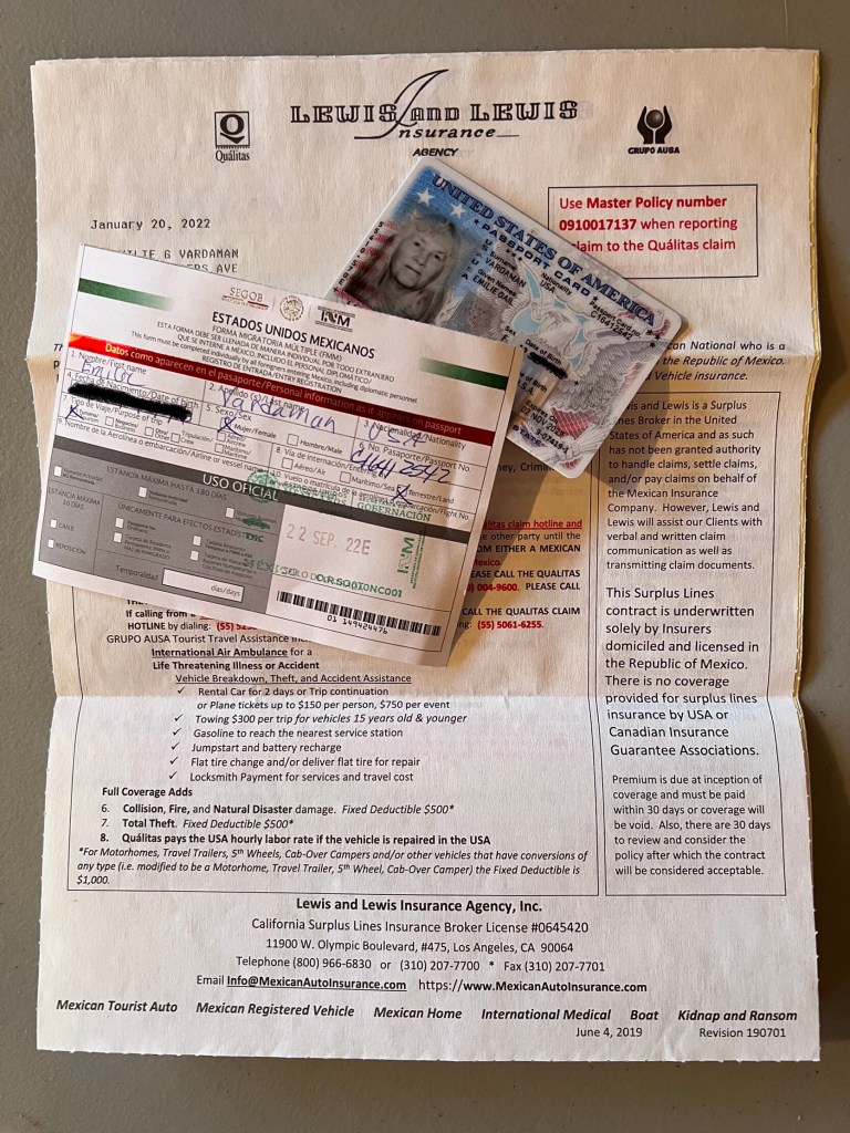
I’d say visit Mata Ortiz, but you need a passport, an FMM (Mexican travel permit) Mexican auto insurance, and a permiso (Mexican temporary import permit—a fee plus at least a $3-500 deposit) for your vehicle. Don’t drive down without all of that!
As a border resident, I always have my passport on me and I buy Mexican auto insurance yearly. I get a six-month FMM twice a year and drive only where no vehicle permiso is necessary.